United States 1845-03-1845-12
Autor/Urheber:
Made by User:Golbez.
Attribution:
Das Bild ist mit 'Attribution Required' markiert, aber es wurden keine Informationen über die Attribution bereitgestellt. Vermutlich wurde bei Verwendung des MediaWiki-Templates für die CC-BY Lizenzen der Parameter für die Attribution weggelassen. Autoren und Urheber finden für die korrekte Verwendung der Templates hier ein Beispiel.
Shortlink:
Quelle:
Größe:
1000 x 677 Pixel (106276 Bytes)
Beschreibung:
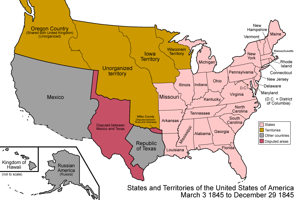
Map of the states and territories of the United States as it was from March 1845 to December 1845. On March 3 1845, Florida Territory was admitted as the state of Florida. On December 29 1845, the Republic of Texas and all of its claimed lands were admitted as the state of Texas.
Kommentar zur Lizenz:
Own work, attribution required (Multi-license with GFDL and Creative Commons CC-BY 2.5)
Lizenz:
Credit:
Eigenes Werk.See Charles O. Paullin and John K. Wright's Atlas of the Historical Geography of the United States (1932) for PD maps which support these.
Bild teilen:


_(cropped).jpg)


