Tropical cyclone carina (2006)
Autor/Urheber:
NASA image created by Jesse Allen, Earth Observatory, using data obtained courtesy of the MODIS Rapid Response team.
Shortlink:
Quelle:
.jpg?uselang=de)
Größe:
6000 x 6000 Pixel (5542407 Bytes)
Beschreibung:
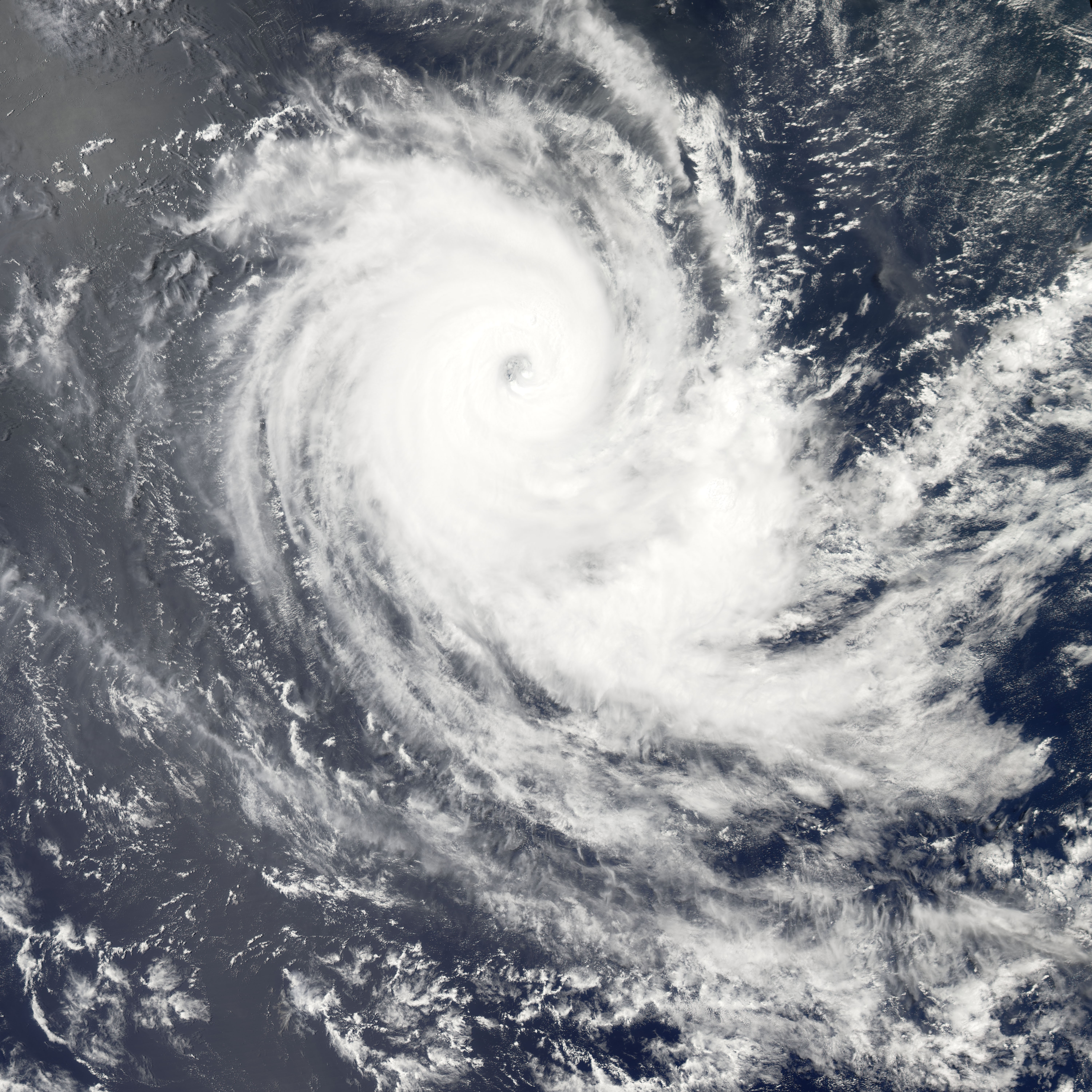
Tropical Cyclone Carina appears as a tightly wound spiral in the Indian Ocean in this satellite view of the storm, obtained by the Moderate Resolution Imaging Spectroradiometer (MODIS) instrument on NASA’s Aqua satellite on February 27, 2006. Carina had become an organized storm system four days earlier, and built rapidly into a powerful cyclone. By the time MODIS obtained this observation of Carina, peak winds were blowing at 175 kilometers per hour (110 miles per hour). However, the tropical cyclone was moving into the southern Indian Ocean well away from the nearest land, even the very remote Cocos Islands several hundred kilometers east.
Kommentar zur Lizenz:
| Diese Datei ist gemeinfrei (public domain), da sie von der NASA erstellt worden ist. Die NASA-Urheberrechtsrichtlinie besagt, dass „NASA-Material nicht durch Urheberrecht geschützt ist, wenn es nicht anders angegeben ist“. (NASA-Urheberrechtsrichtlinie-Seite oder JPL Image Use Policy). |
|
|
 |
Warnung:
|
Lizenz:
Public domain
Bild teilen:


Relevante Artikel
ErdbeobachtungUnter Erdbeobachtung versteht man in der Luft- und Raumfahrt die Beobachtung der Erdoberfläche und/oder der Erdatmosphäre aus großer Höhe. Die Beobachtung schließt dabei auch technische Verfahren zur Informationsgewinnung ein. .. weiterlesen