Taupo.Volcanic.Zone.North.Island.NZ
Autor/Urheber:
- BayofPlentyA2002296.jpg: Jacques Descloitres, MODIS Rapid Response Team, NASA/GSFC
- derivative work: Chris.urs-o (talk)
Shortlink:
Quelle:
Größe:
616 x 864 Pixel (106476 Bytes)
Beschreibung:
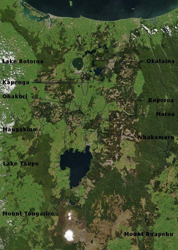
Bay of Plenty, North Island, New Zealand, from the Bay of Plenty coast to Mounts Tongariro, Ngauruhoe, and Ruapehu (at bottom of picture). Also shows Lake Taupo and the Rotorua Lakes. This scene was acquired by the Moderate Resolution Imaging Spectroradiometer (MODIS), flying aboard NASA’s Terra satellite, on October 23, 2002
Lizenz:
Public domain
Credit:
Bild teilen:


Relevante Bilder


Relevante Artikel
Taupō Volcanic ZoneDie Taupō Volcanic Zone ist ein aktives Vulkangebiet auf der Nordinsel Neuseelands. Sie ist nach dem Vulkan Taupō benannt, der mit seiner gefluteten Caldera, dem Lake Taupō, der größte Vulkan dieser Zone ist. .. weiterlesen