Tambora volcano
Autor/Urheber:
NASA Landsat7 image (worldwind.arc.nasa.gov)
Shortlink:
Quelle:
Größe:
640 x 436 Pixel (68770 Bytes)
Beschreibung:
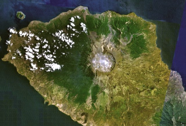
Tambora volcano on Indonesia's Sumbawa Island was the site of the world's largest historical eruption in April 1815. This NASA Landsat mosaic shows the 6-km-wide caldera truncating the 2850-m-high summit of the massive volcano. Pyroclastic flows during the 1815 eruption reached the sea on all sides of the 60-km-wide volcanic peninsula, and the ejection of large amounts of tephra caused world-wide temperature declines in 1815 and 1816.
Lizenz:
Public domain
Bild teilen:


Relevante Bilder


Relevante Artikel
Liste von Vulkanen in IndonesienDies ist eine Liste von Vulkanen in Indonesien, die während des Quartärs mindestens einmal aktiv waren. .. weiterlesen