Tahaa and Raiatea topographic map - with communes et communes associées
Autor/Urheber:
Shortlink:
Quelle:
Größe:
714 x 1143 Pixel (341244 Bytes)
Beschreibung:
Lizenz:
Public domain
Credit:
Œuvre personnelle.
Données :
- Carte de base : NASA Shuttle Radar Topography Mission (SRTM3 v.2) (domaine public)
- Cartes de localisation : globe fait à partir de la carte Polynesia-triangle.png (modifiée) crée par Reisio sous license PD
- Autres références utilisées pour la toponymie : carte spéciale de l'IGN Tahiti — Archipel de la Société
Logiciels utilisés :
- Données de la NASA éditées avec le logiciel GRASS GIS
- Vectorisées avec Inkscape
- Retouches avec Gimp
- Tutoriel de création cartographique de Sting (merci à lui)
Autres informations :
- Projection cartographique UTM
- Système géodésique WGS84
- Relief ombré (image composite d'éclairages du N-O, O et N).
Relevante Bilder
Relevante Artikel
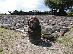
TaputapuateaTaputapuatea ist eine der drei Gemeinden auf der Insel Raiatea (Gesellschaftsinseln) in Französisch-Polynesien. Die Gemeindegemarkung hat einen Anteil am Tefatua, der mit 1017 m. ü. M. den höchsten Punkt Taputapuateas ergibt. Eine weitere Erhebung ist der Oropiro auf 824 m. ü. M. im Süden der Insel. .. weiterlesen


