South West England counties
Autor/Urheber:
Nilfanion, created using Ordnance Survey data
- English_ceremonial_counties_2010.svg: Nilfanion
- derivative work: Dr Greg and The Equalizer (updated for 2019)
Attribution:
Das Bild ist mit 'Attribution Required' markiert, aber es wurden keine Informationen über die Attribution bereitgestellt. Vermutlich wurde bei Verwendung des MediaWiki-Templates für die CC-BY Lizenzen der Parameter für die Attribution weggelassen. Autoren und Urheber finden für die korrekte Verwendung der Templates hier ein Beispiel.
Shortlink:
Quelle:
Größe:
1281 x 936 Pixel (264276 Bytes)
Beschreibung:
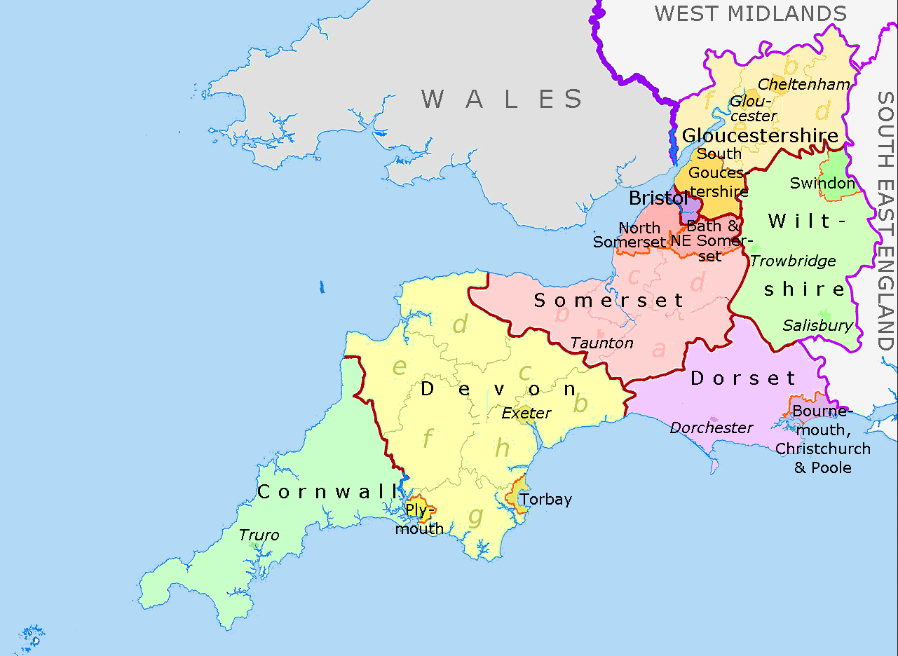
Map of the South West England region, showing its counties and administrative districts. The county colours are the same as those in File:English metropolitan and non-metropolitan counties 2009.svg.
Equirectangular map projection on WGS 84 datum, with N/S stretched 160% Geographic limits:
- West: 6.5W
- East: 1.4W
- North: 52.2N
- South: 49.7N
Lizenz:
Credit:
File:SouthWest-local-government-2019.jpg Diese Datei wurde von diesen Werken abgeleitet:

Bild teilen:


Relevante Bilder

Dr Greg and Nilfanion. Contains Ordnance Survey data © Crown copyright and database right 2011, CC BY-SA 3.0

Dr Greg and Nilfanion. Contains Ordnance Survey data © Crown copyright and database right 2011, CC BY-SA 3.0

Dr Greg and Nilfanion. Contains Ordnance Survey data © Crown copyright and database right 2011, CC BY-SA 3.0

Dr Greg and Nilfanion. Contains Ordnance Survey data © Crown copyright and database right 2011, CC BY-SA 3.0


Dr Greg and Nilfanion. Contains Ordnance Survey data © Crown copyright and database right 2011, CC BY-SA 3.0

Dr Greg and Nilfanion. Contains Ordnance Survey data © Crown copyright and database right 2011, CC BY-SA 3.0


(c) Yarnton, St. Bartholomew's Church: The nave with its unusual chancel arch and c15th painting by Michael Garlick, CC BY-SA 2.0

(c) Richard Croft, CC BY-SA 2.0


(c) nick macneill, CC BY-SA 2.0
rev.jpg)
(c) Philip Pankhurst, CC BY-SA 2.0


.jpg)


.jpg)
(c) Chris Downer, CC BY-SA 2.0


%2c_St_Michael_and_All_Angel%27s_church_interior_(31621340446).jpg)

_council_areas.png)

(c) Ruth Sharville, CC BY-SA 2.0

(c) John Salmon, CC BY-SA 2.0
.jpg)
(c) Derek Harper, CC BY-SA 2.0

(c) trolvag, CC BY-SA 3.0

.jpg)

(c) Church of the Blessed Virgin Mary and St Leodegarius, Ashby St Ledgers by David Purchase, CC BY-SA 2.0


(c) St John the Baptist, Wittersham - interior looking south-east by David Kemp, CC BY-SA 2.0

(c) Langford, St. Matthew's Church: c12th nave with Anglo Saxon tower arch by Michael Garlick, CC BY-SA 2.0


Relevante Artikel
Liste der Hallenkirchen im Vereinigten Königreich▶ Liste(n) der Hallenkirchen – Übersicht .. weiterlesen