PlaCerda1859b
Autor/Urheber:
Shortlink:
Quelle:
Größe:
7591 x 5325 Pixel (7636215 Bytes)
Beschreibung:
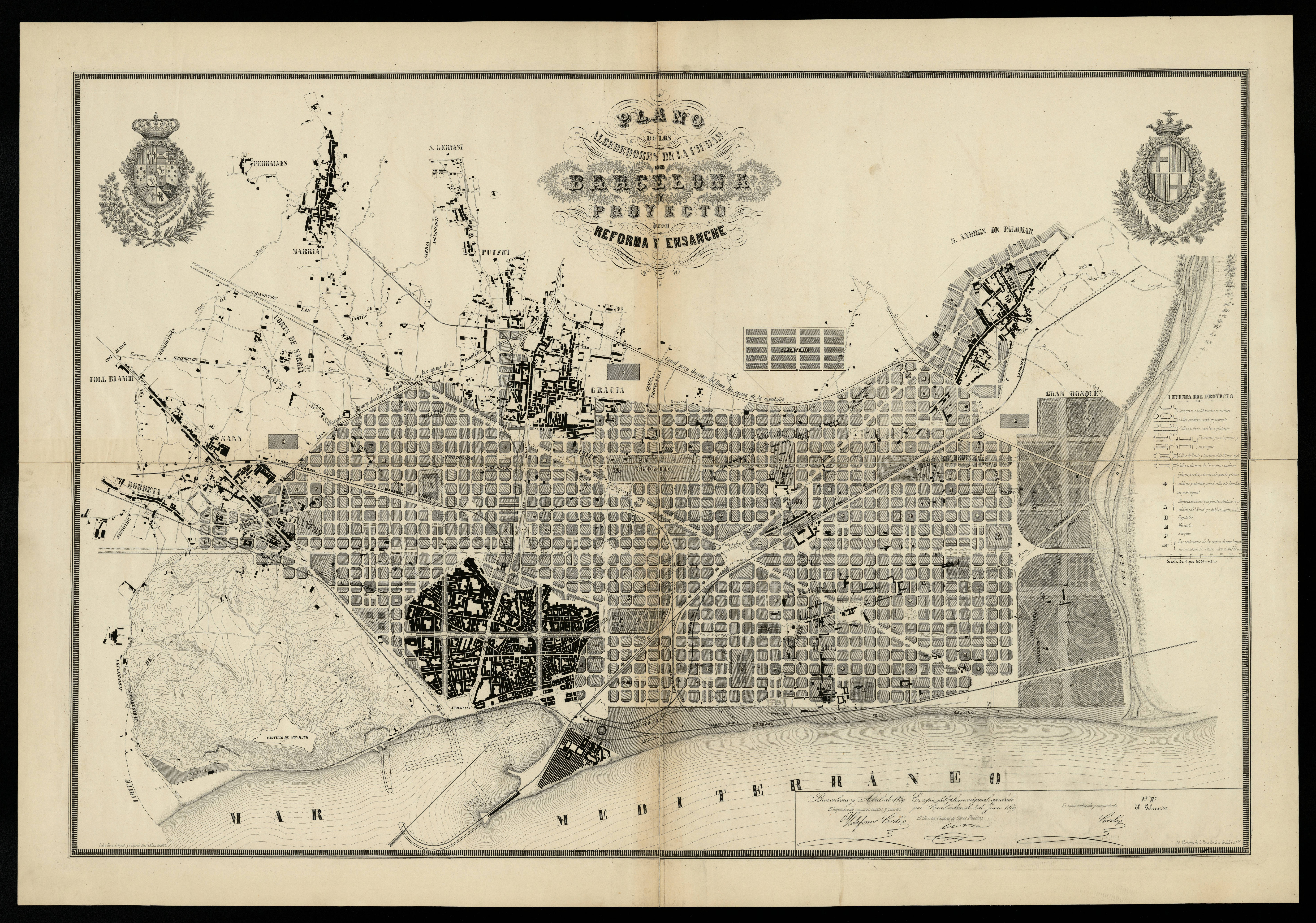
Enlargement map of Barcelona. Map of the neighborhoods of the city of Barcelona and project for its improvements and enlargement, 1859.
Lizenz:
Public domain
Credit:
Museu d'Historia de la Ciutat, Barcelona.
Bild teilen:


Relevante Bilder


.jpg)
(c) mibuchat, CC BY-SA 2.0

.jpg)

(c) Geri340, CC BY-SA 3.0

(c) Diego Delso, CC BY-SA 4.0
.jpg)


.jpg)


.jpg)


(c) Maurice Luyten, CC BY 4.0


(c) Cricu, CC BY-SA 3.0

Relevante Artikel
Strukturalismus (Architektur)Der Strukturalismus ist eine Mitte des 20. Jahrhunderts aufgekommene Strömung in Architektur und Städtebau. Er ist eine Reaktion auf den CIAM-Funktionalismus (Rationalismus). .. weiterlesen