PIA16154 fig1-Mars Curiosity Rover - Road To Glenelg

This mosaic from the Mast Camera on NASA's Curiosity rover shows the view looking toward the "Glenelg" area, where three different terrain types come together. All three types are observed from orbit with the High-Resolution Imaging Science Experiment (HiRISE) camera on NASA's Mars Reconnaissance Orbiter. By driving there, Curiosity will be able to explore them.
One of the three terrain types is light-toned with well-developed layering, which likely records deposits of sedimentary materials. There are also black bands that run through the area and might constitute additional layers that alternate with the light-toned layers. The black bands are not easily seen from orbit and are on the order of about 3.3-feet (1-meter) thick. Both of these layer types are important science targets.
This mosaic is composed of seven images. The Mastcam 34-millimeter camera took a series of four images; embedded within that series is a second set of three images taken with the Mastcam 100-millimeter camera.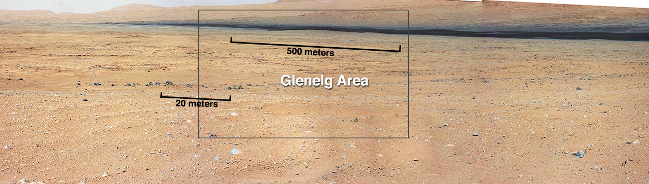


Relevante Bilder


.jpg)


.jpg)


.jpg)

Relevante Artikel
Mars Science LaboratoryMars Science Laboratory ist eine NASA-Mission im Rahmen des Flagship-Programms, die den Mars hinsichtlich seiner aktuellen und vergangenen Eignung als Biosphäre erforscht. Hierzu wurde auf der Oberfläche ein weitgehend autonomer Rover mit dem Namen Curiosity abgesetzt, der mit zehn Instrumenten zur Untersuchung von Gestein, Atmosphäre und Strahlung ausgerüstet ist. Zu deren Analyse kommen neben einer großen Zahl unterschiedlicher Spektrografen auch Kameras und meteorologische Instrumente zum Einsatz, welche die Messdaten für die Auswertung zur Erde schicken. Mit einer Masse von 900 kg und der Größe eines kompakten Kleinwagens war Curiosity bis zur Landung von Perseverance im Februar 2021 das schwerste von Menschen geschaffene Objekt auf der Marsoberfläche und löste die Viking-Tochtersonden mit je knapp 600 kg ab. .. weiterlesen