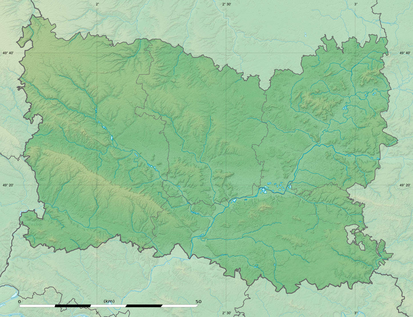
Oise department relief location map
Shortlink:
Quelle:
Größe:
1446 x 1111 Pixel (357713 Bytes)
Beschreibung:
Blank physical map of the department of Oise, France, as in December 2014, for geo-location purpose, with distinct boundaries for regions, departments and arrondissements.
Kommentar zur Lizenz:
| Attribution and Share-Alike required |
|---|
| Any use of this map can be made as long as you credit me (Eric Gaba – Wikimedia Commons user: Sting) as the author and distribute the copies and derivative works under the same license(s) that the one(s) stated below. A message with a reply address would also be greatly appreciated. |
Lizenz:
Credit:
Eigenes Werk
- Sources of data:
- NASA Shuttle Radar Topography Mission (SRTM1 v2 and SWBD) (public domain);
- BD Carthage 2013 (open license) created by the IGN and available on Sandre's site;
- NASA Shuttle Radar Topography Mission (SRTM1 v2 and SWBD) (public domain);
- References for the boundaries:
Bild teilen:


Relevante Bilder


(c) Bundesarchiv, Bild 121-2027 / Unbekannt / CC-BY-SA 3.0


.svg)


.jpg)
Relevante Artikel
Lichtung von CompiègneDie Lichtung von Compiègne, auch Lichtung bei Compiègne, Lichtung von Rethondes oder Lichtung des Waffenstillstandes genannt, im Wald von Compiègne nahe dem ehemaligen Bahnhof des Dorfes Rethondes bei Compiègne in Nord-Frankreich ist dadurch bedeutsam, dass hier zwei Mal, im Ersten Weltkrieg und im Zweiten Weltkrieg – jedoch mit umgekehrten Vorzeichen, ein Waffenstillstand zwischen der Französischen Republik und dem Deutschen Reich ausgehandelt wurde. Die Verhandlungen fanden jeweils in einem Eisenbahnwagen, dem später wegen seiner symbolischen Bedeutung berühmten Wagen von Compiègne, statt. .. weiterlesen