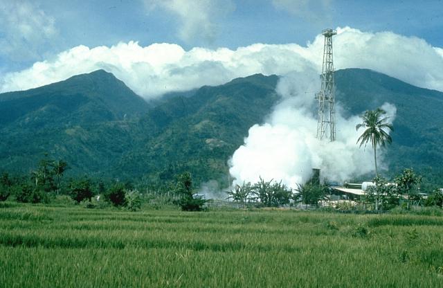
Mount Malinao
Autor/Urheber:
Chris Newhall (U.S. Geological Survey)
Shortlink:
Quelle:
Größe:
640 x 416 Pixel (43800 Bytes)
Beschreibung:
Mount Malinao is a forested stratovolcano with a summit crater that is breached to the east. The Tiwi geothermal field, seen here with the volcano in the background, is located on the east flanks of Malinao. The geothermal field is located near Luzon's largest fumarole field, which includes siliceous sinter deposits at Naglabong.
Lizenz:
Public domain
Bild teilen:


Relevante Bilder


_1945.jpg)


Relevante Artikel
Malinao (Vulkan)Der Malinao, auch Buhi oder Takit, ist ein 1548 m hoher Stratovulkan auf den Philippinen. Er liegt an der Grenze der Provinzen Albay und Camarines Sur, in der Region Bicol, auf der Insel Luzon in der Nähe der Vulkane Mayon und Masaraga. .. weiterlesen
Liste von Vulkanen auf den PhilippinenDies ist eine Liste von Vulkanen auf den Philippinen, die während des Quartärs mindestens einmal aktiv waren. .. weiterlesen