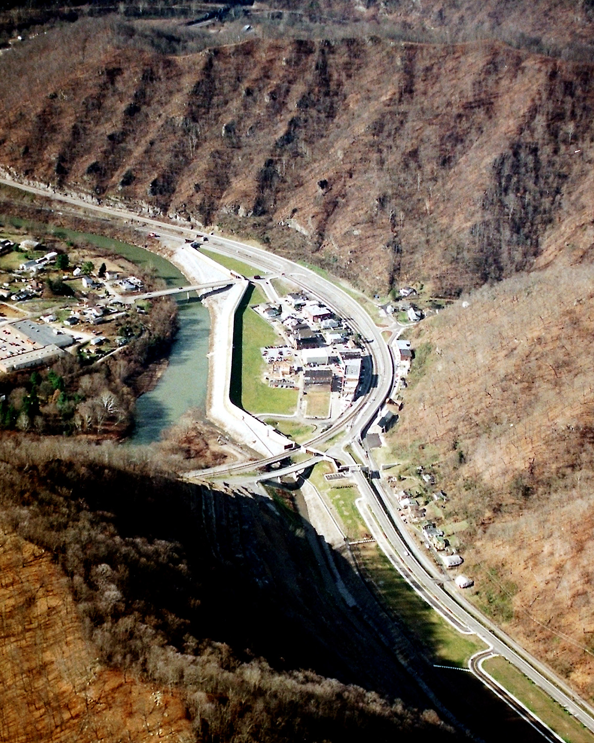
Matewan West Virginia aerial view
Autor/Urheber:
U.S. Army Corps of Engineers, photographer not specified or unknown
Shortlink:
Quelle:
Größe:
1199 x 1500 Pixel (728814 Bytes)
Beschreibung:
Matewan, West Virginia, USA, along the Tug Fork River. The town is protected by a large floodwall constructed by the U.S. Army Corps of Engineers. The river is the border between West Virginia and Kentucky; Kentucky is on the left and West Virginia is on the right.
Kommentar zur Lizenz:
This image or file is a work of a U.S. Army Corps of Engineers soldier or employee, taken or made as part of that person's official duties. As a work of the U.S. federal government, the image is in the public domain.
Lizenz:
Public domain
Credit:
U.S. Army Corps of Engineers Digital Visual Library
Image page
Image description page
Digital Visual Library home page
Image page
Image description page
Digital Visual Library home page
Bild teilen:


Relevante Bilder


Relevante Artikel
Tug ForkDer Tug Fork ist der 248 Kilometer lange rechte Quellfluss des Big Sandy River im Südwesten der US-amerikanischen Bundesstaaten Virginia und West Virginia und im Osten von Kentucky. .. weiterlesen