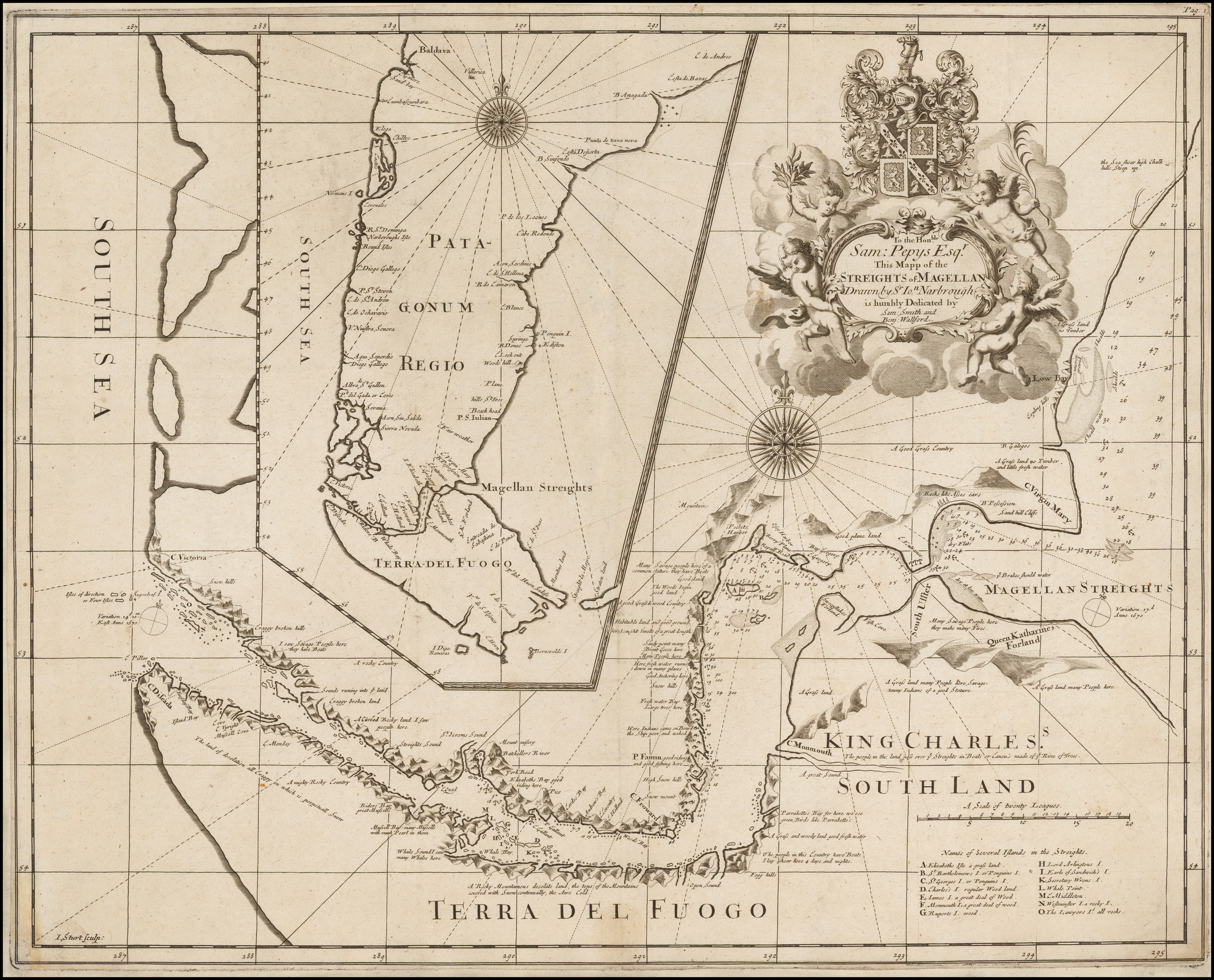
Map of the Streights of Magellan Drawn by Sr. John Narborough 1694

Autor/Urheber:
Map of the Streights of Magellan Drawn by Sr. John Narborough 1694
Shortlink:
Quelle:
Größe:
2478 x 2000 Pixel (5572732 Bytes)
Beschreibung:
To the Honble. Sam: Pepys Esqr. This Mapp of the Streights of Magellan Drawn by Sr. Ion. Narbrough is humbly Dedicated by Sam Smith and Benj: Wallford. Este mapa es el n°5 que Mateo Martinic menciona en su Informe: 5.— Map of the Streights of Magellan. Drawn by S< lo" Narbrough. Dibujado por I. Sturt. Dedicado al Hon. Sam. Pepys y editado por Sam Smith y Benj. Wallford. Medidas 51x41,5
centímetros. Incluido en la obra "An Account of Several Late Voyages & Discoveries", etc., publicada en Londres por Smith y Wallford, en 1694. En es:Mateo Martinic, David M. Moore, Las exploraciones inglesas en el estrecho de Magallanes 1670-1671. El mapa manuscrito de John Narborough, es:Anales del Instituto de la Patagonia, Punta Arenas, Chile, vol. 13, 1982.
Lizenz:
Public domain
Credit:
Bild teilen:


Relevante Bilder

Relevante Artikel
John NarboroughSir John Narborough war englischer Marinebefehlshaber im 17. Jahrhundert, der sich vor allem während der englisch-niederländischen Seekriege und im Kampf gegen nordafrikanische Piraten hervortat. Er stammte aus einer alten englischen Familie aus Norfolk. .. weiterlesen