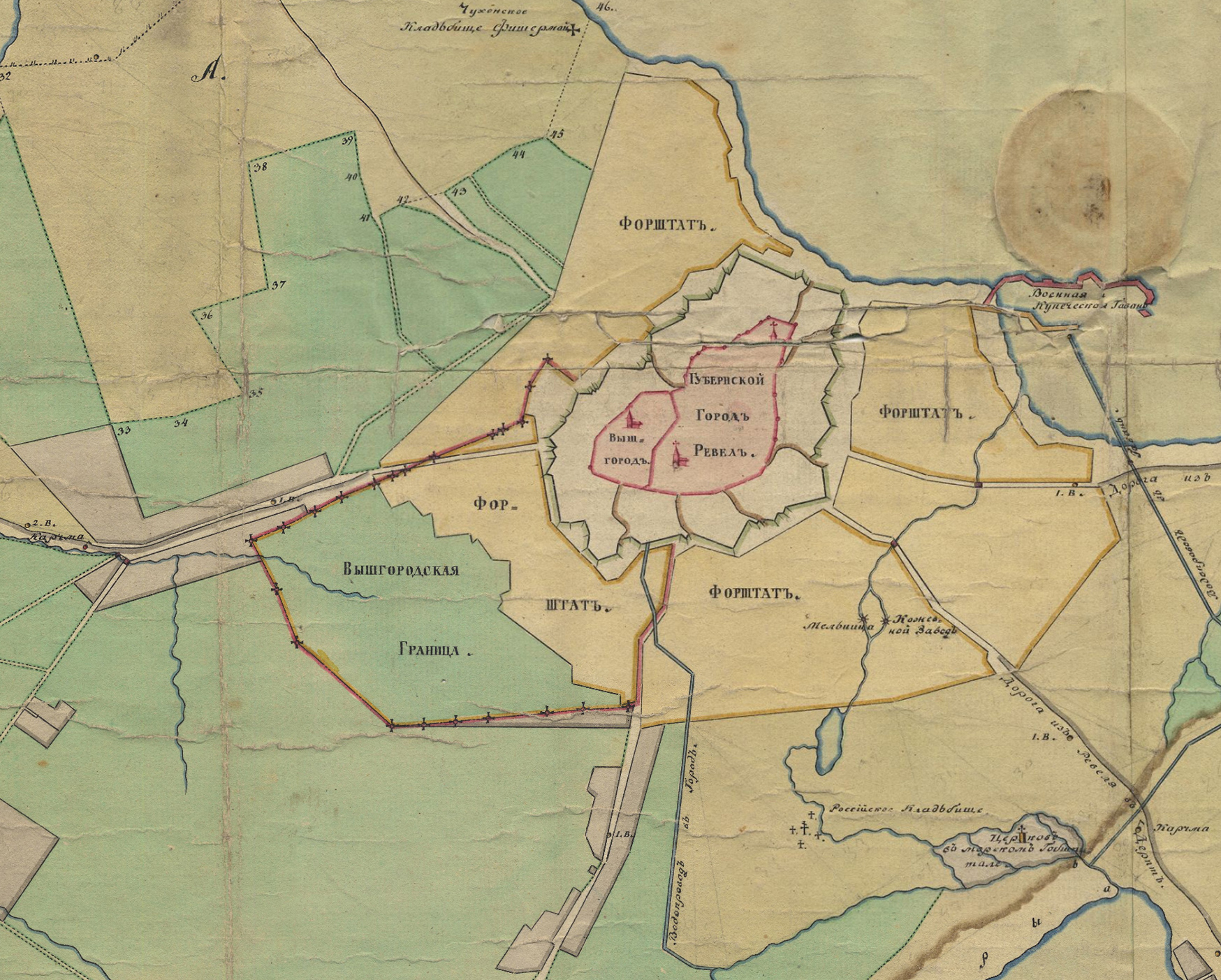
Map of Tallinn, 1810
Autor/Urheber:
Autor/-in unbekannt
Shortlink:
Quelle:
Größe:
1748 x 1403 Pixel (1779793 Bytes)
Beschreibung:
Extract from a 1810 map of Tallinn, showing the borders of Toompea and the rest of town.
Toompea (Вышгородъ) on the left, Tallinn (Lower Town - Губернской Городъ Ревелъ) on the right. Border of the territory of Toompea is shown with a red line (Вышгородцкая Граница).
Lizenz:
Public domain
Credit:
Collection of plans and maps of Tallinn City Archives: [1]
Bild teilen:


Relevante Bilder
%2c_Tallin%2c_Estonia%2c_2012-08-05%2c_DD_11.JPG)
(c) Diego Delso, CC BY-SA 3.0

(c) Diego Delso, CC BY-SA 3.0

(c) Diego Delso, CC BY-SA 3.0

(c) Diego Delso, CC BY-SA 3.0
_Aeropuerto_Tallinn%2c_Estonia%2c_2012-08-05%2c_DD_06.jpg)
(c) Diego Delso, CC BY-SA 3.0

(c) Diego Delso, CC BY-SA 3.0

(c) Diego Delso, CC BY-SA 3.0

.svg)


(c) Karte: NordNordWest, Lizenz: Creative Commons by-sa-3.0 de
.svg)


.svg)


Relevante Artikel
TallinnTallinn ist die Hauptstadt sowie das wirtschaftliche und kulturelle Zentrum Estlands und mit rund 430.000 Einwohnern auch die weitaus größte Stadt des Landes, somit die estnische Primatstadt. Sie liegt am Finnischen Meerbusen der Ostsee, etwa 80 Kilometer südlich von Helsinki. .. weiterlesen