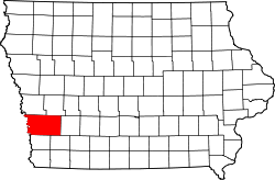
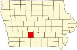
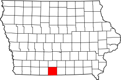
Map of Iowa highlighting Montgomery County
Autor/Urheber:
Shortlink:
Quelle:
Größe:
1783 x 1168 Pixel (31383 Bytes)
Beschreibung:
This is a locator map showing Montgomery County in Iowa. For more information, see Commons:United States county locator maps.
Lizenz:
Public domain
Credit:
The maps use data from nationalatlas.gov, specifically countyp020.tar.gz on the Raw Data Download page. The maps also use state outline data from statesp020.tar.gz. The Florida maps use hydrogm020.tar.gz to display Lake Okeechobee.
Relevante Bilder
Relevante Artikel
Montgomery County (Iowa)Das Montgomery County ist ein County im US-Bundesstaat Iowa. Bei der Volkszählung im Jahr 2020 hatte das County 10.330 Einwohner und eine Bevölkerungsdichte von 9,4 Einwohnern pro Quadratkilometer. Der Verwaltungssitz ist Red Oak. .. weiterlesen
Red Oak (Iowa)Red Oak ist eine Stadt im Montgomery County, Iowa, Vereinigte Staaten. Bei der Volkszählung von 2000 wurde eine Bevölkerungszahl von 6.197 registriert. Sie ist der County Seat (Kreisstadt) von Montgomery County. .. weiterlesen

