Macedonia relief Sar location map
Autor/Urheber:
Attribution:
Das Bild ist mit 'Attribution Required' markiert, aber es wurden keine Informationen über die Attribution bereitgestellt. Vermutlich wurde bei Verwendung des MediaWiki-Templates für die CC-BY Lizenzen der Parameter für die Attribution weggelassen. Autoren und Urheber finden für die korrekte Verwendung der Templates hier ein Beispiel.
Shortlink:
Quelle:
Größe:
1368 x 1133 Pixel (549401 Bytes)
Beschreibung:
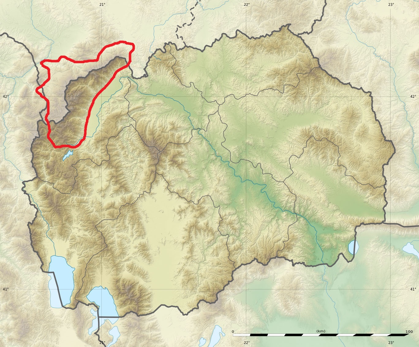
Physical map of the Šar Mountains in the Republic of Macedonia.
Kommentar zur Lizenz:
| Attribution and Share-Alike required |
|---|
| Any use of this map can be made as long as you credit me (Eric Gaba – Wikimedia Commons user: Sting) and Wikimedia Commons user: NordNordWest as the authors and distribute the copies and derivative works under the same license(s) that the one(s) stated below. A message with a reply address would also be greatly appreciated. |
Lizenz:
Credit:
- Background relief map (relief and rivers): own work by uploader
- Sources of data: SRTM3v2.1 and NGDC World Data Bank II
- Sources of data: SRTM3v2.1 and NGDC World Data Bank II
- All other data (lakes and boundaries) taken from File:Macedonia_location_map.svg created by NordNordWest under GFDL/CC-BY-SA-3.0
- Sources: United States National Imagery and Mapping Agency data
Bild teilen:


Relevante Bilder


Relevante Artikel
Šar PlaninaDie Šar Planina ist ein Gebirgszug, der sich zwischen dem Kosovo und Nordmazedonien erstreckt, der Titov Vrv ist mit 2747 m. i. J. der höchste Punkt. .. weiterlesen