Lambay Island - Reachrainn - geograph.org.uk - 1350641
Autor/Urheber:
Shortlink:
Quelle:
Größe:
640 x 427 Pixel (45408 Bytes)
Beschreibung:
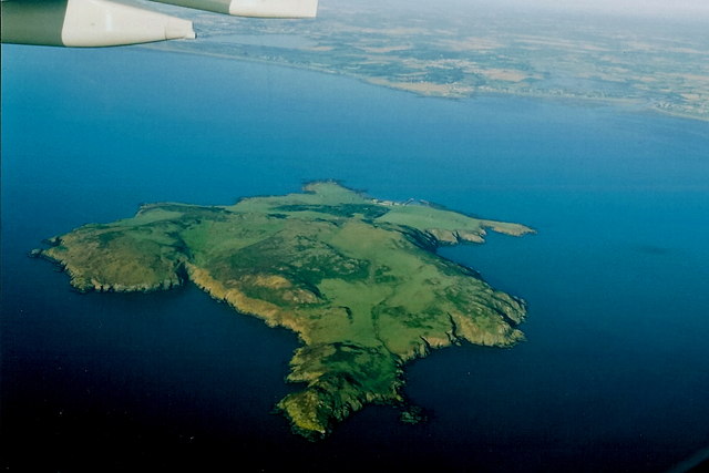
Lambay Island (Irish: Reachrainn) seen from an Aer Lingus Airbus A330 preparing to land at Dublin Airport in Ireland. The yellow headland at Portrane Desmesne called Quay juts out from the coast in the background, with the small town of Portrane in the bay to the right (north) of it.
Lizenz:
Credit:
From geograph.org.uk
Bild teilen:


Relevante Bilder


Relevante Artikel
Lambay IslandLambay Island ist eine bis zu 126 m hohe, auf drei Seiten von Klippen umgebene Insel. Sie liegt nordöstlich von Dublin, sechs Kilometer vor dem Ortsteil Portraine des Küstenortes Donabate im County Fingal in der Irischen See. Sie ist mit 241 Hektar die größte ostirische Insel. Der irische Name Reachra wurde von den Normannen durch den altnordischen Lambay (deutsch „Schafsinsel“) ersetzt, da hier Schafe vom Festland vom Frühling bis zum Sommer weideten. .. weiterlesen