LINE21
Autor/Urheber:
Tapatio in der Wikipedia auf Englisch
Shortlink:
Quelle:
Größe:
1000 x 690 Pixel (104839 Bytes)
Beschreibung:
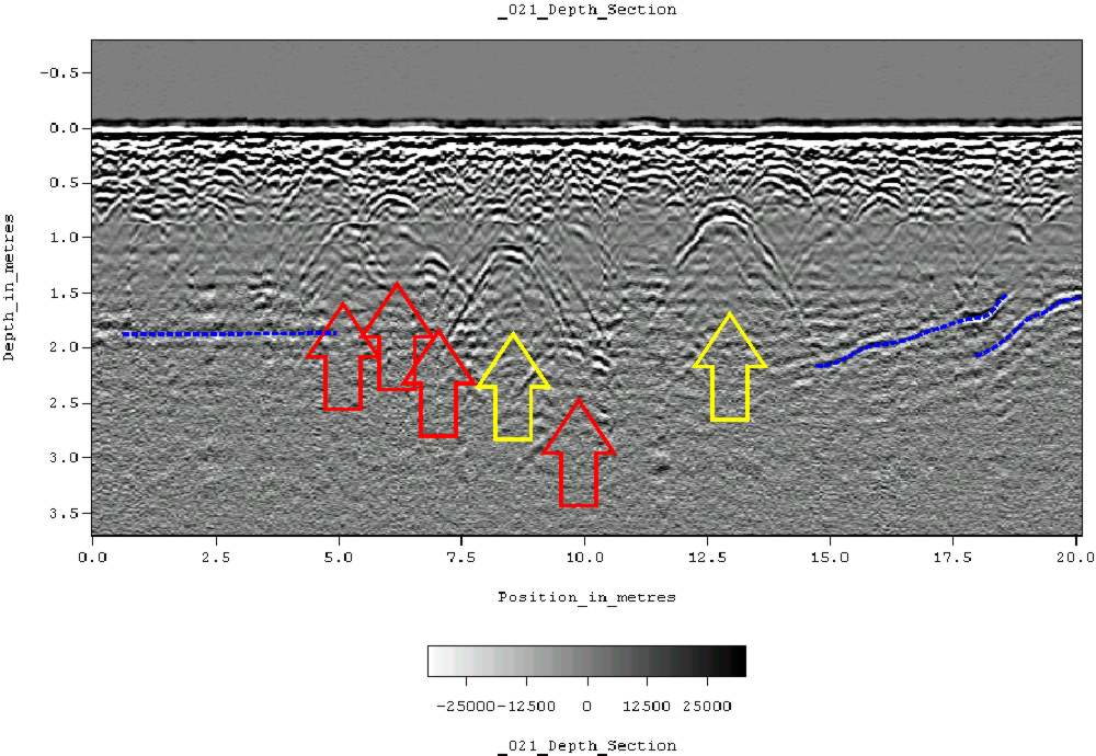
Ground-penetrating radar depth section (profile) collected on an historic cemetery in Alabama, USA. Yellow arrows indicate very distinct reflections, probably associated with human burials. "hyperbolic" reflections, appearing as an inverted U, are typically associated with discrete objects. Less distinct hyperbolic reflections are indicated by red arrows. dashed blue lines indicate horizontal and sloping reflectors, probably bedrock. The many smaller reflections near the surface are likely to be caused by tree roots. Because of the nature of the site, subsurface testing was not conducted, but these interpretations are supported by surface indications (grave markers and depressions) and with line-to-line patterning within the GPR data.
Lizenz:
Public domain
Credit:
Übertragen aus en.wikipedia nach Commons.
Bild teilen:


Relevante Bilder


Relevante Artikel
BodenradarEin Bodenradar, auch Georadar, engl. Ground Penetrating Radar (GPR) oder Radio Echo Sounding (RES), erlaubt eine zerstörungsfreie Charakterisierung des Untergrundes mit hochfrequenten elektromagnetischen Wellen. In der Geophysik dient es im Wesentlichen zur Untersuchung der oberen Schichten der Erdkruste. In militärischen Anwendungen wird es zum Aufspüren von Landminen eingesetzt. .. weiterlesen