Kyles of Bute - geograph.org.uk - 616059
(c) Richard Webb, CC BY-SA 2.0
Autor/Urheber:
Shortlink:
Quelle:
Größe:
640 x 480 Pixel (50970 Bytes)
Beschreibung:
Kyles of Bute An almost aerial view of some fjord scenery. Loch Ruel or Riddon comes in from the left, joining the Kyles of Bute. The Burnt Islands and a resting ferry can be seen in mid stream. Bute appears to be a moorland island here, the fertile part of the island is out of sight to the south.
Lizenz:
Credit:
From geograph.org.uk
Relevante Bilder

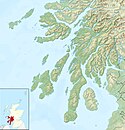
Contains Ordnance Survey data © Crown copyright and database right, CC BY-SA 3.0
Relevante Artikel
Burnt IslandsDie Burnt Islands sind drei unbewohnte Inseln in der Meeresstraße Kyles of Bute. Administrativ gehören sie zur schottischen Unitary Authority Argyll and Bute. Angeblich befindet sich dort eine Begräbnisstätte aus der Zeit der Wikingerbesetzung. .. weiterlesen
