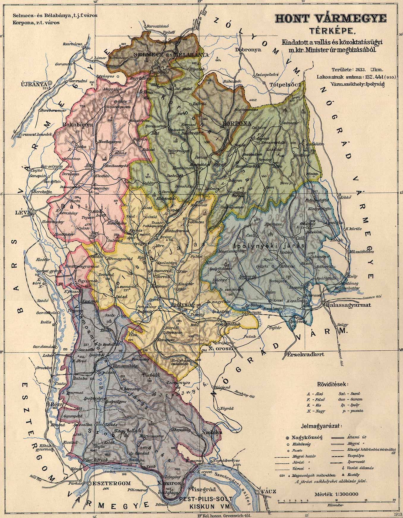
Hont county administrative map
Autor/Urheber:
Autor/-in unbekannt
Shortlink:
Quelle:
Größe:
1356 x 1740 Pixel (547043 Bytes)
Beschreibung:
Administrative map of the county of Hont in the Kingdom of Hungary from 1913. Borders of Vámosmikola district, organized in 1907, were added in the last minute with limited accuracy.
Lizenz:
Public domain
Bild teilen:


Relevante Bilder

.png)
.svg)

Relevante Artikel
Komitat HontKomitat Hont war eine Verwaltungseinheit im Nordwesten des Königreichs Ungarn. Verwaltungssitz war zuletzt Ipolyság. .. weiterlesen