Herne Hill Junction
Autor/Urheber:
Attribution:
Das Bild ist mit 'Attribution Required' markiert, aber es wurden keine Informationen über die Attribution bereitgestellt. Vermutlich wurde bei Verwendung des MediaWiki-Templates für die CC-BY Lizenzen der Parameter für die Attribution weggelassen. Autoren und Urheber finden für die korrekte Verwendung der Templates hier ein Beispiel.
Shortlink:
Quelle:
Größe:
3968 x 2232 Pixel (5553926 Bytes)
Beschreibung:
Six roads meet at Herne Hill Junction, the area’s main thoroughfare. The vehicles to the left are on Dulwich Road; behind the white van is the pedestrianised southern end of Railton Road; under the railway bridge, the junction between Milkwood Road, Herne Hill (both to the left) and Half Moon Lane (to the right) is visible; and the vehicles to the right are travelling south on Norwood Road. The route along Herne Hill, under the railway bridge (part of Half Moon Lane) and Norwood Road is part of the A215 road.
The pedestrian crossing on the extreme left of this image leads from the traffic island (referred to in planning documents as Island Green, which was the name of this area when it was surrounded by two tributaries of the Effra pre-1820) into Brockwell Park. The traffic island and park entrance were redesigned from 2008-10 to ease congestion and make the crossing safer for pedestrians.
Lizenz:
Relevante Bilder


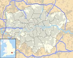
Contains Ordnance Survey data © Crown copyright and database right, CC BY-SA 3.0
Relevante Artikel
Herne HillHerne Hill ist ein Stadtteil der Londoner Bezirke Southwark und Lambeth. Er liegt südöstlich von Brixton. Seine nördliche Spitze grenzt an Denmark Hill, während Loughborough Junction westlich und Dulwich östlich liegt. .. weiterlesen
