DMIR Map
Autor/Urheber:
Elkman in der Wikipedia auf Englisch
Shortlink:
Quelle:
Größe:
1082 x 872 Pixel (16919 Bytes)
Beschreibung:
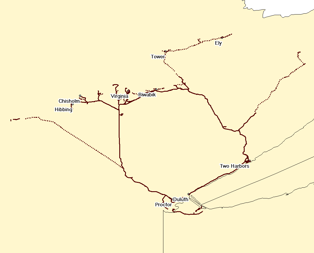
Map of the en:Duluth, Missabe and Iron Range Railway. Solid lines are tracks still in use; dotted lines are abandoned. The section from Two Harbors to Duluth is effectively operated by the en:North Shore Scenic Railroad although the en:DMIR (now en:CN) retain the exclusive right (unexercised) to operate freight traffic.
Lizenz:
Credit:
Übertragen aus en.wikipedia nach Commons.
Bild teilen:


Relevante Bilder
.jpg)


%2c_1883.jpg)


.jpg)


.jpg)
Relevante Artikel
Duluth, Missabe and Iron Range RailwayDie Duluth, Missabe and Iron Range Railway (DMIR), war eine Eisenbahngesellschaft im Norden der US-Bundesstaaten Minnesota und Wisconsin. Die Bahn transportierte Eisenerz und später auch Takonit zu den Häfen von Duluth und Two Harbors am Lake Superior. Die Bahngesellschaft wurde am 10. Mai 2004 von der Canadian National Railway (CN) aufgekauft. .. weiterlesen