Bridgeport covered bridge Nevada County CA
Autor/Urheber:
Michael Nevins, U.S. Army Corps of Engineers
Shortlink:
Quelle:
Größe:
987 x 1500 Pixel (640839 Bytes)
Beschreibung:
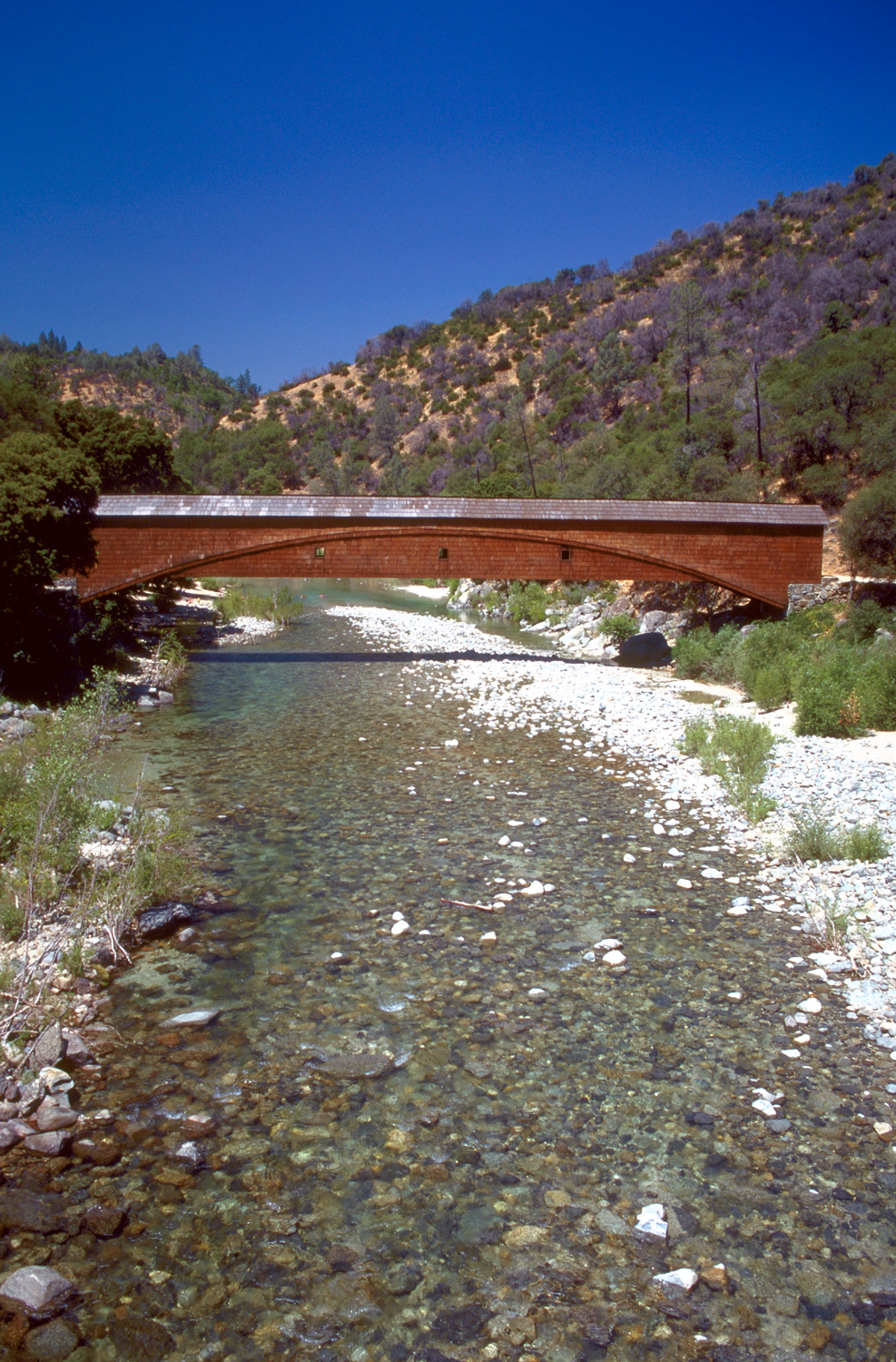
The Bridgeport Covered Bridge on the South Fork Yuba River in South Yuba River State Park in Nevada County, California, USA. The bridge here was originally constructed in 1862 and was part of the Virginia Turnpike Company Toll Road that served the northern mines and traffic to and from Virginia City and the Comstock Lode in Nevada. The bridge is 230 feet (70 m) long.
Kommentar zur Lizenz:
This image or file is a work of a U.S. Army Corps of Engineers soldier or employee, taken or made as part of that person's official duties. As a work of the U.S. federal government, the image is in the public domain.
Lizenz:
Public domain
Credit:
U.S. Army Corps of Engineers Digital Visual Library
Image page
Image description page
Digital Visual Library home page
Image page
Image description page
Digital Visual Library home page
Bild teilen:


Relevante Bilder


Relevante Artikel
Yuba RiverDer Yuba River ist ein Fluss in Kalifornien. Er ist ein bedeutender Zufluss zum Feather River, der seinerseits in den Sacramento River fließt. .. weiterlesen