Bayou des Allemands
Autor/Urheber:
Lane Lefort, U.S. Army Corps of Engineers
Shortlink:
Quelle:
Größe:
1500 x 1000 Pixel (341047 Bytes)
Beschreibung:
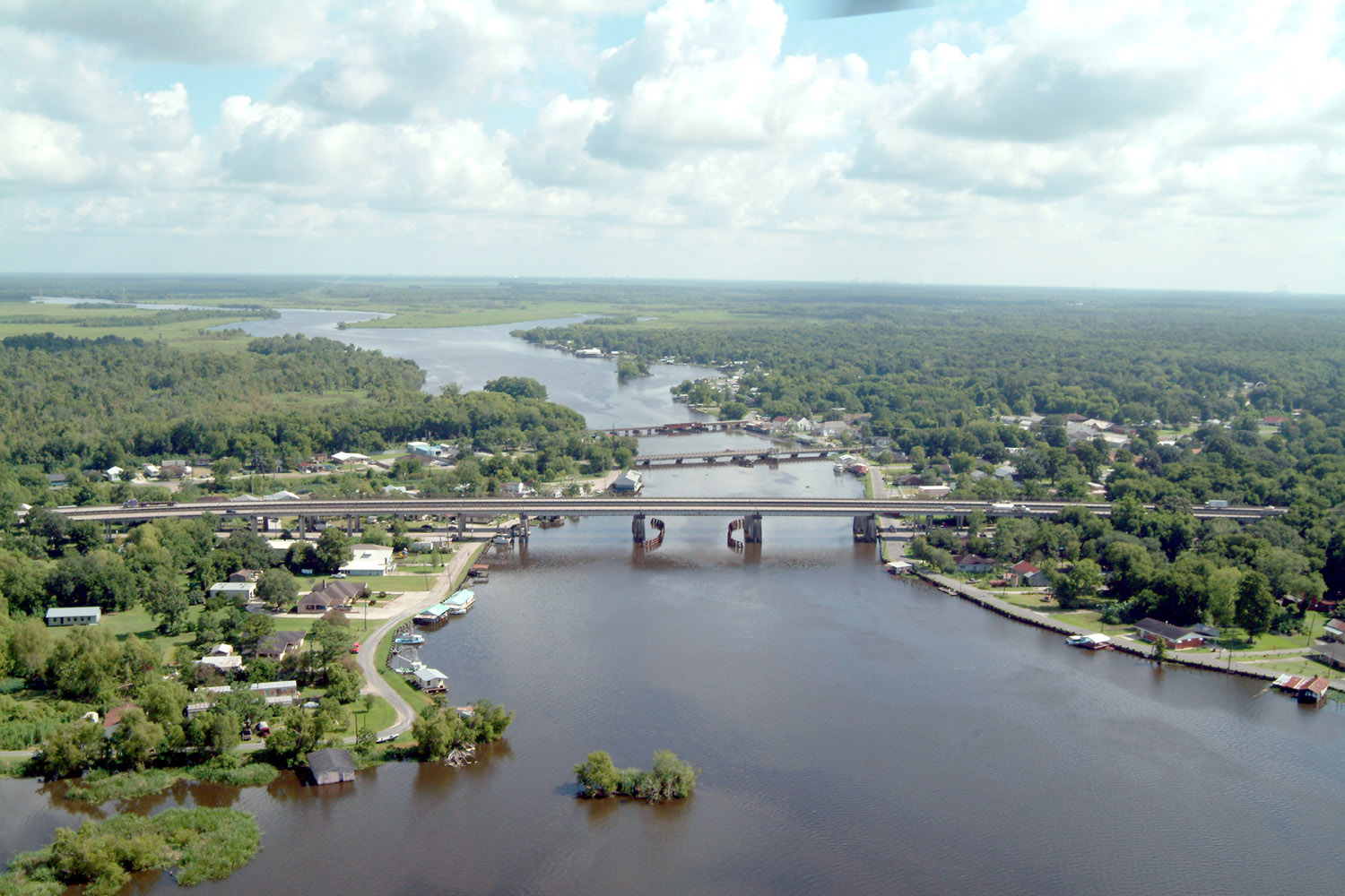
Bayou des Allemands and the town of Des Allemands, Louisiana, USA. The bayou is the boundary between St. Charles Parish (right) and Lafourche Parish (left). The three bridges crossing the bayou are (farthest to closest): A railroad bridge, Louisiana State Route 631, and U.S. Route 90. View is to the north.
Kommentar zur Lizenz:
This image or file is a work of a U.S. Army Corps of Engineers soldier or employee, taken or made as part of that person's official duties. As a work of the U.S. federal government, the image is in the public domain.
Lizenz:
Public domain
Credit:
U.S. Army Corps of Engineers Digital Visual Library
Image page
Image description page
Digital Visual Library home page
Image page
Image description page
Digital Visual Library home page
Bild teilen:


Relevante Bilder


.svg)


Relevante Artikel
U.S. Highway 90Der U.S. Highway 90 ist eine wichtige von West nach Ost verlaufende Fernstraße. Der Highway ist 2628 km lang und führt von Jacksonville Beach an der Atlantikküste Floridas nach Van Horn im westlichen Texas. Die Interstate 10 verläuft auf dem gesamten Streckenverlauf in unterschiedlichen Abständen parallel zum Highway 90. Trotz der Ziffer „0“ in der Nummer ist der Highway keine Verbindung von Küste zu Küste. .. weiterlesen