Argyre MOLA zoom 64
Autor/Urheber:
NASA / JPL-Caltech / Arizona State University
Shortlink:
Quelle:
Größe:
4220 x 3556 Pixel (7066080 Bytes)
Beschreibung:
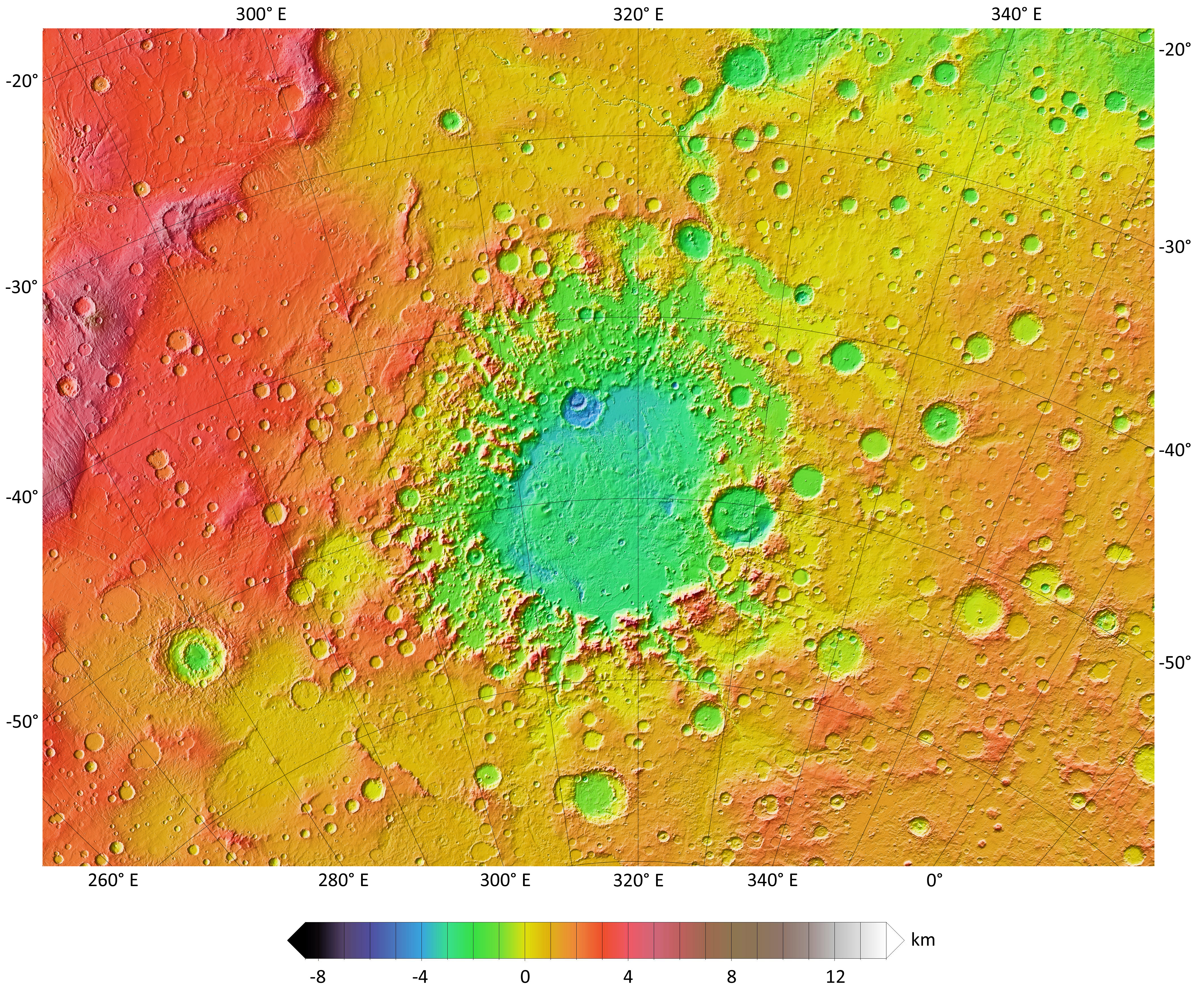
A colorized topographic map of the martian impact basin Argyre, together with its surroundings, from the Mars Orbiter Laser Altimeter (MOLA) instrument of the Mars Global Surveyor spacecraft. Argyre, the second deepest basin on Mars, lies in the southern hemisphere, southeast of the canyon system Valles Marineris.
Some of the features in this image have been annotated in Wikimedia Commons.
Some of the features in this image have been annotated in Wikimedia Commons.
Lizenz:
Public domain
Credit:
Bild teilen:


Relevante Bilder


Relevante Artikel
Argyre PlanitiaArgyre Planitia ist eine kreisförmige ausgedehnte Tiefebene auf der südlichen Hemisphäre des Planeten Mars. Ihr Name leitet sich aus dem Altgriechischen ab und bedeutet so viel wie „Silberne Ebene“. Argyre Planitia ist nach Hellas Planitia und Isidis Planitia das drittgrößte Einschlagbecken auf dem Mars. .. weiterlesen