Akash 2007 track
Autor/Urheber:
Shortlink:
Quelle:
Größe:
2700 x 1669 Pixel (5720284 Bytes)
Beschreibung:
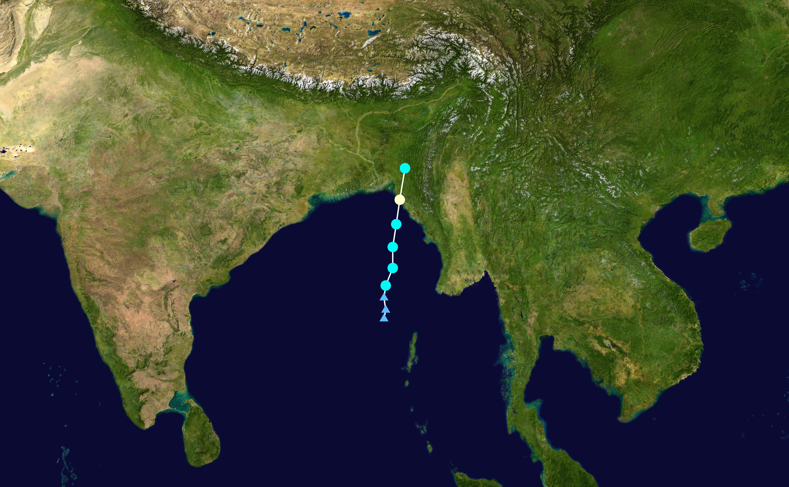
Track map of Cyclonic Storm Akash of the 2007 North Indian Ocean cyclone season. The points show the location of the storm at 6-hour intervals. The colour represents the storm's maximum sustained wind speeds as classified in the (see below), and the shape of the data points represent the nature of the storm, according to the legend below.
 Extratropical cyclone / Remnant low / Tropical disturbance / Monsoon depression
Tropical depression (≤38 mph, ≤62 km/h)
Tropical storm (39–73 mph, 63–118 km/h)
Category 1 (74–95 mph, 119–153 km/h)
Category 2 (96–110 mph, 154–177 km/h)
Category 3 (111–129 mph, 178–208 km/h)
Category 4 (130–156 mph, 209–251 km/h)
Category 5 (≥157 mph, ≥252 km/h)
Unknown
Storm type
Lizenz:
Public domain
Credit:
Created by Nilfanion using Wikipedia:WikiProject Tropical cyclones/Tracks. The background image is from NASA. Tracking data is from the Joint Typhoon Warning Center[1].
Bild teilen:


Relevante Bilder


Relevante Artikel
Zyklonsaison im Nordindik 2007Die Zyklonsaison im nördlichen Indik 2007 war ein Ereignis der jährlichen Zyklus der Bildung tropischer Wirbelstürme. Sie hat keinen offiziellen Grenzen, doch tendieren Zyklone dazu, sich im Indik zwischen dem Horn von Afrika und der Malaiischen Halbinsel zwischen April und Dezember zu bilden, wobei es in den Monaten Mai und November zwei Höhepunkte der Aktivität gibt. Dabei werden die Sturmsysteme nach dem Gebiet ihrer Entstehung nach den zwei Hauptseegebieten unterteilt: das Arabische Meer westlich des Indischen Subkontinents und der Golf von Bengalen östlich davon. .. weiterlesen