AYool GLODAP del pH
Autor/Urheber:
Attribution:
Das Bild ist mit 'Attribution Required' markiert, aber es wurden keine Informationen über die Attribution bereitgestellt. Vermutlich wurde bei Verwendung des MediaWiki-Templates für die CC-BY Lizenzen der Parameter für die Attribution weggelassen. Autoren und Urheber finden für die korrekte Verwendung der Templates hier ein Beispiel.
Shortlink:
Quelle:
Größe:
1683 x 1133 Pixel (237568 Bytes)
Beschreibung:
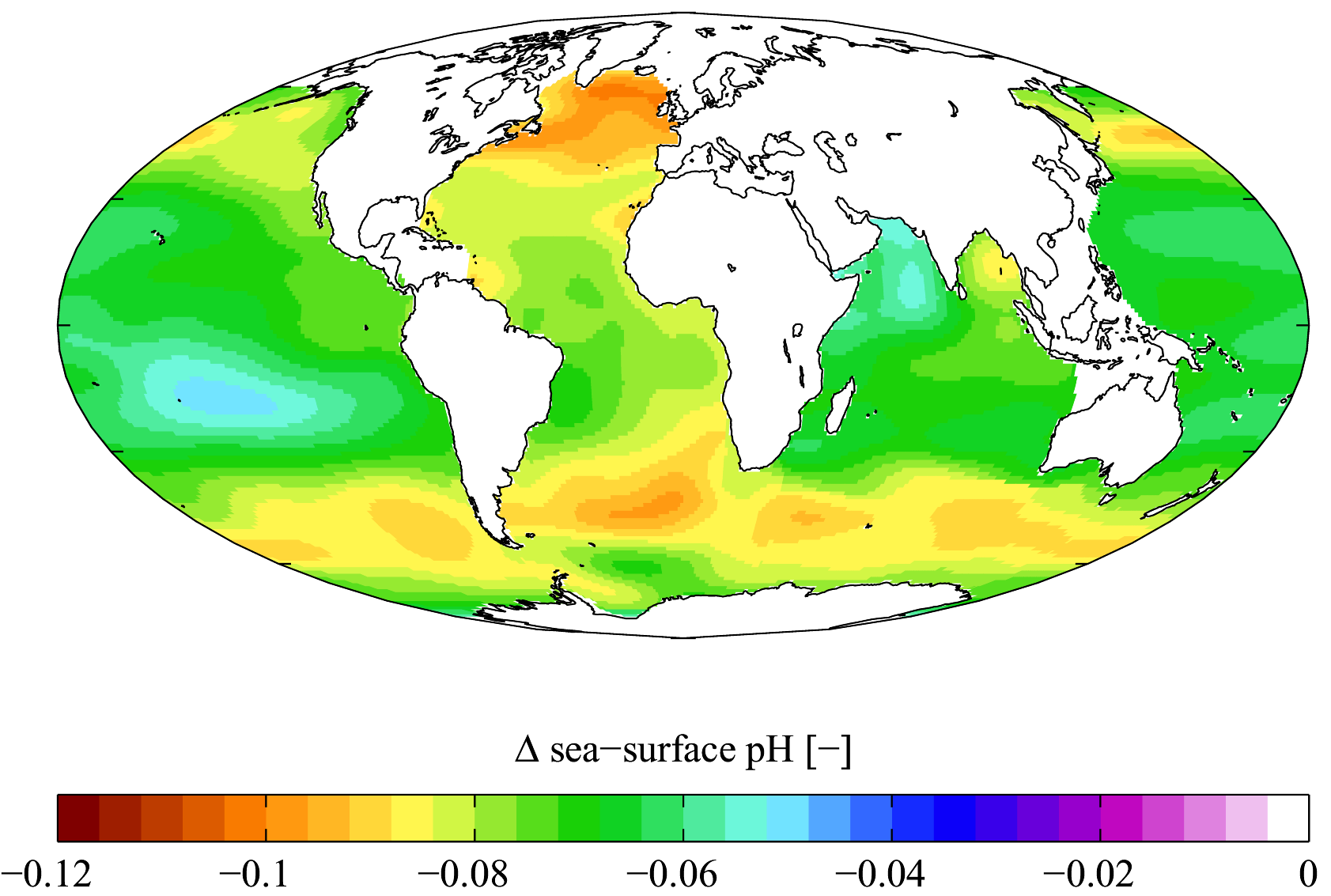
Estimated change in sea surface pH from the pre-industrial period (1700s) to the present day (1990s). Δ pH here is in standard pH units. This change is caused by the invasion of anthropogenic CO2 (see Ocean acidification). Calculated using Richard Zeebe's csys package with data from the Global Ocean Data Analysis Project[1][2] and World Ocean Atlas[3]climatologies. Δ pH is plotted here using a Mollweide projection (using MATLAB and the M_Map package).
Note that the GLODAP climatology is missing data in certain oceanic provinces including the Arctic Ocean, the Caribbean Sea, the Mediterranean Sea and the Malay Archipelago.
Lizenz:
Credit:
English Wikipedia
Bild teilen:


Relevante Bilder


.jpg)

.jpg)

.jpg)


Relevante Artikel
MeeresschutzDer Begriff Meeresschutz umfasst Maßnahmen, die dem Schutz und der Wiederherstellung mariner Lebensräume in Bezug auf ihre Funktionen im Naturhaushalt dienen. Somit ist der Meeresschutz ein Teilgebiet des Naturschutzes. .. weiterlesen