2007SanDiegoFiresradar1008z
Autor/Urheber:
Background map by NASA. Radar data from NCDC. Image created by Hello32020.
Shortlink:
Quelle:
Größe:
829 x 518 Pixel (353767 Bytes)
Beschreibung:
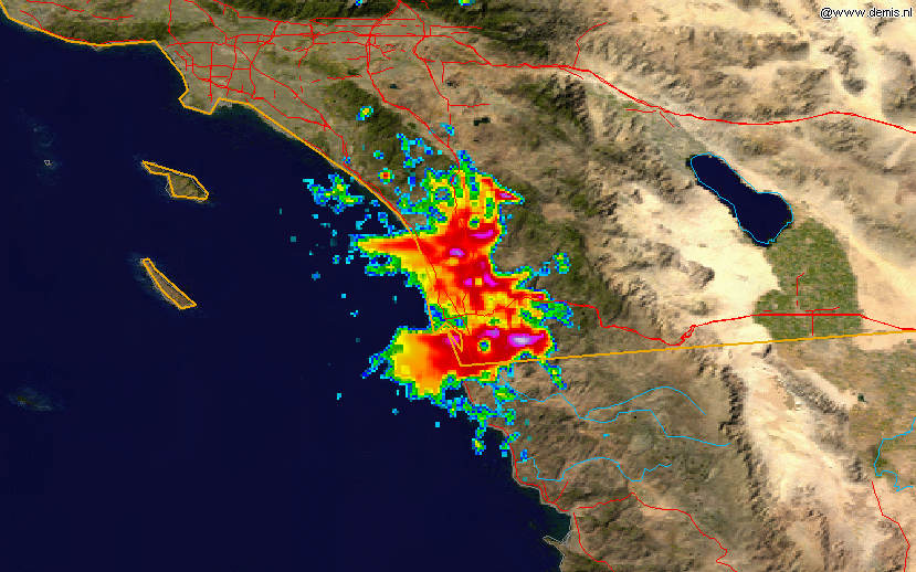
This radar image shows the smoke plume from the southern California fires of 2007 on 2007-10-23, at 10:08 UTC, overlain on a map. The data is from the NWS NEXRAD radar at KNKX (San Diego) and was processed in the NCDC's JAVA NEXRAD tool.
Lizenz:
Public domain
Credit:
Radar data is from the NCDC NEXRAD database and the background map is from the NASA.
Bild teilen:


Relevante Bilder


Relevante Artikel
Waldbrände in Südkalifornien 2007Die Waldbrände in Südkalifornien 2007 waren eine Serie von achtzehn Waldbränden in Südkalifornien, die am 20. Oktober bei Malibu im US-Bundesstaat Kalifornien ihren Anfang nahm und 19 Tage andauerte. Insgesamt sind 2800 km² Fläche verbrannt, mehr als 1500 Häuser und zehn Personen wurden Opfer der Flammen, mehr als siebzig Personen wurden verletzt. Die Sachschadenshöhe betrug mehr als eine Milliarde US-Dollar. Im Verlauf entstanden zahlreiche Brandherde. .. weiterlesen