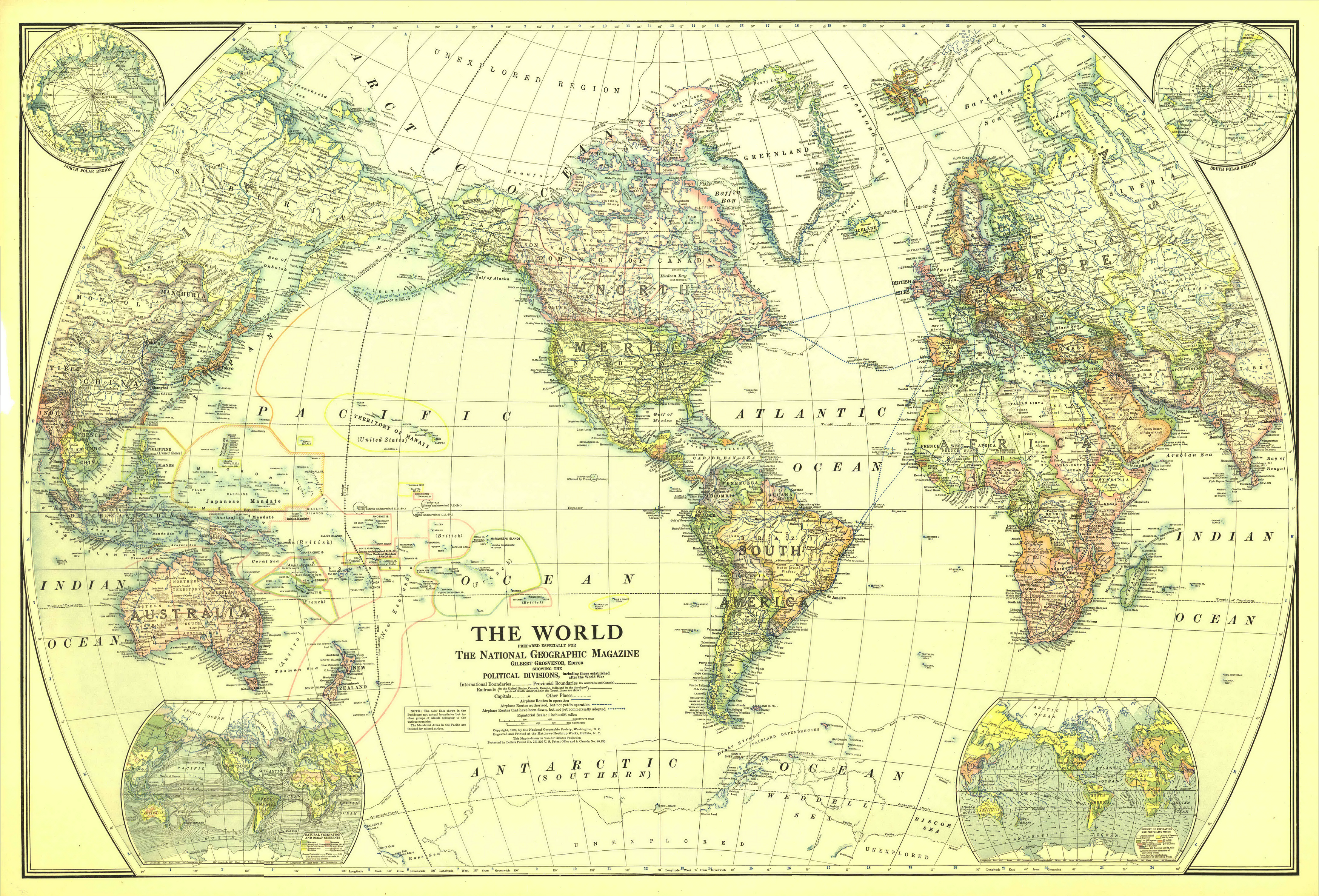
1922 world map
Autor/Urheber:
National Geographic Society
Shortlink:
Quelle:
Größe:
3495 x 2374 Pixel (18124991 Bytes)
Beschreibung:
Map of the World in 1922
Drawn with Van der Grinten projection. Scale on equator 1 inch = 625 miles (1 : 39,600,000)
Extra maps in the corners: North and South polar regions, natural vegetation and ocean currents, density of population and prevailing winds.
Kommentar zur Lizenz:
Copyright expired
Lizenz:
Public domain
Credit:
The Complete National Geographic Maps Collection (CD-ROM set owned by Angr)
Bild teilen:


Relevante Bilder


Relevante Artikel
Lasarew-SeeDie Lasarew-See ist ein Randmeer im Südlichen Ozean. Sie liegt zwischen der König-Haakon-VII.-See und der Riiser-Larsen-See im Osten und erstreckt sich vom Längengrad 0° bis 14° Ost. Sie ist durchschnittlich 3000 m tief und hat eine maximale Tiefe von 4500 m und sie ist 335.000 km² groß. Im Süden grenzt sie an die Prinzessin-Astrid-Küste, auf dem Königin-Maud-Land, welches von Norwegen beansprucht wird. .. weiterlesen