Waiag
| Waiag | ||
|---|---|---|
 | ||
| Gewässer | Halmaherasee, Pazifischer Ozean | |
| Inselgruppe | Waiaginseln, Raja Ampat | |
| Geographische Lage | 0° 9′ N, 130° 3′ O | |
 | ||
Waiag (indonesisch Pulau Waiag, auch Wayag oder Wajag) ist die Hauptinsel der indonesischen Waiaginseln.
Geographie
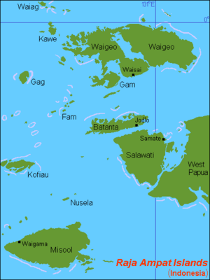
Waiag ist die größte der Waiaginseln, die zum Archipel von Raja Ampat gehören. Die Insel liegt im Nordwesten der Inselkette der Waiaginseln und ist umgeben von weiteren kleinen Inseln und Felsen.[1][2]
Waiag gehört zum Distrikt (Kecamatan) Westwaigeo Festland (Waigeo Barat Daratan) im Regierungsbezirk (Kabupaten) Raja Ampat (Provinz Papua Barat Daya).
Einzelnachweise
- ↑ Karte des Archipels von Raja Ampat mit den meisten Inselnamen, abgerufen am 28. Januar 2016.
- ↑ Karte Raja Ampats mit niederländischer Beschriftung, abgerufen am 28. Januar 2016.
Auf dieser Seite verwendete Medien
Map (rough) of Raja Ampat islands, Indonesia, own work composed from various mapreferences
Autor/Urheber: , Lizenz: CC BY 3.0
Autor/Urheber: Uwe Dedering, Lizenz: CC BY-SA 3.0
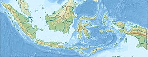
Location map of Indonesia.
Equirectangular projection. Strechted by 100.0%. Geographic limits of the map:
- N: 6.5° N
- W: 94.5° E
- E: 141.5° E
- S: -11.5° N


