Tarso Toussidé
| Tarso Toussidé | ||
|---|---|---|
 der Tarso Toussidé auf einer Satellitenaufnahme | ||
| Höhe | 3265 m | |
| Lage | Tschad | |
| Gebirge | Tibesti | |
| Koordinaten | 21° 2′ 27″ N, 16° 28′ 24″ O | |
| Typ | Schichtvulkan | |
Der Tarso Toussidé ist ein 3.265 Meter hoher Schichtvulkan im Nordwesten der Republik Tschad. Er bildet ein breites Vulkanmassiv am westlichen Rand des Tibesti-Gebirges und bedeckt ein Gebiet von ca. 6000 km².
Der Hauptgipfel des Vulkans entstand am westlichen Rande einer 14 km breiten Caldera aus dem Pleistozän. Das Massiv erhebt sich über präkambrischen Schiefern im Osten und Sandsteinen aus dem Paläozän im westlichen Teil. Auf dem Gipfel finden sich zahlreiche Fumarolen und sehr junge Lavaströme aus trachytischen und trachyt-andesitischen Materialien. Diese bedecken eine Fläche von ca. 288 km² und erstrecken sich 28 km vom Gipfel, vornehmlich auf der westlichen Seite des Hauptkraters.
Südöstlich des Toussidé befindet sich die 1 km tiefe und 8 km weite Caldera Trou au Natron. Die Vulkane Ehi Timi und Ehi Sosso und der kleinere 1,5 km breite Krater des Doon Kidimi befinden sich an den nordöstlichen und ost-südöstlichen Flanken des Tarso Toussidé-Massivs.
Weblinks
Quellen
- Tarso Toussidé im Global Volcanism Program der Smithsonian Institution (englisch)
Auf dieser Seite verwendete Medien
Tousside, Tibesti Mountains, Chad
- The Tibesti Mountains in northwestern Chad consist of rugged volcanic peaks, many impressive craters, and hot springs. Near the center of the photograph is Tousside Peak, which rises more than 10 710 feet (3265 meters) above sea level, the westernmost volcano of this high mountain range. The peak is almost centered within the black shape that has tentacle-shaped lava flows extending down the western flank. The volcano’s base measures approximately 55 miles (90 kilometers) in diameter. The light brownish area surrounding the peak shows a distinctive radial drainage pattern that is quite common for stratovolcanoes as the terrain falls away from the main peak. The depression southeast of the volcano measures approximately 5 miles (8 kilometers) in diameter and 3300 feet (1000 meters) in depth. The white base is caused by an accumulation of carbonate salts, creating this soda lake of Tibesti. With the exception of small vents that emit gasses and a few hot springs that continue to deposit minerals at the surface of the crater floor, little volcanic activity presently occurs in this region.
Image number STS052-73-14
Autor/Urheber: Eric Gaba (Sting - fr:Sting), Lizenz: CC BY-SA 3.0
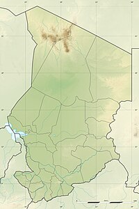
Blank physical map of Chad as since the 2008-02 reform of the Regions, for geo-location purposes.


