Studley (Warwickshire)
| Studley | |||
|---|---|---|---|
| |||
| Koordinaten | 52° 16′ N, 1° 53′ W | ||
| |||
| Traditionelle Grafschaft | Warwickshire | ||
| Einwohner | 6624 | ||
| Verwaltung | |||
| Post town | STUDLEY | ||
| Postleitzahlenabschnitt | B80 | ||
| Vorwahl | 01527 | ||
| Landesteil | England | ||
| Region | West Midlands | ||
| Shire county | Warwickshire | ||
| District | Stratford-on-Avon | ||
| ONS-Code | SP075635 | ||
| Website: studleyparishcouncil.org.uk | |||
Studley ist ein Dorf in der englischen Grafschaft Warwickshire. Sie grenzt im Nordwesten direkt an Redditch in der Grafschaft Worcestershire.
In je 20 bis 30 Kilometern Entfernung liegen Birmingham im Norden, Warwick im Osten, Stratford-upon-Avon im Süden und Worcester im Westen.
Im Ort befindet sich die Church of the Nativity of the Blessed Virgin Mary (St. Mariä Geburtskirche), die Little Zoar Chapel der strengen Baptisten und ein Kilometer weiter südlich das historische Kirchengebäude St Leonard.
1898 richtet Daisy Greville, Countess of Warwick in Studley das Studley Horticultural & Agricultural College for Women, eine Hauswirtschafts- und Gartenbauschule ein. Es war ab 1903 im Studley Castle untergebracht und bestand bis 1969.
Persönlichkeiten
- Dion Fortune (1890–1946), Okkultistin
- Andy Smith (* 1967), Dartspieler
Weblinks
Auf dieser Seite verwendete Medien
(c) David Stowell, CC BY-SA 2.0
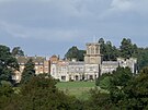
Church of the Nativity of the Blessed Virgin Mary, Studley, Warwickshire, next to The Old Castle
(c) Karte: NordNordWest, Lizenz: Creative Commons by-sa-3.0 de
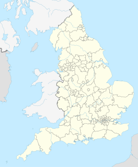
Positionskarte von England, Vereinigtes Königreich
Autor/Urheber: Amanda Slater, Lizenz: CC BY-SA 2.0
The Forest of Arden Agricultural Society 62nd Hedging and Ploughing Match. St Giles Farm, Spernal, Studley, Warwickshire.


