Stronsay Airport
| Stronsay Airport | ||
|---|---|---|
(c) Adam Ward, CC BY-SA 2.0 | ||
| Terminal des Stronsay Airport | ||
| ||
| Kenndaten | ||
| ICAO-Code | EGER | |
| IATA-Code | SOY | |
| Koordinaten | 59° 9′ 19″ N, 2° 38′ 29″ W | |
| Höhe über MSL | 12 m (39 ft) | |
| Basisdaten | ||
| Betreiber | Orkney Islands Council | |
| Start- und Landebahnen | ||
| 02/20 | 515 m Naturbelag | |
| 06/24 | 411 m Gras | |
| 10/28 | 404 m Gras | |
Der Stronsay Airport (IATA-Code: SOY, ICAO-Code: EGER) befindet sich auf der Insel Stronsay in Orkney, Schottland.
Der Flughafen hat eine CAA Ordinary Licence (Nummer P540), die Flüge für die Beförderung von Passagieren oder Flugunterricht erlaubt, die vom Lizenznehmer (Orkney Islands Council) zugelassen sind, Nachtflüge sind aber verboten.
Weblinks
Auf dieser Seite verwendete Medien
Contains Ordnance Survey data © Crown copyright and database right, CC BY-SA 3.0
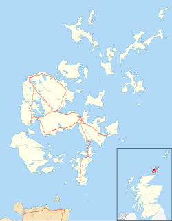
Blank map of the Orkney Islands (excluding Sule Stack and Sule Skerry), UK with the following information shown:
- Administrative borders
- Coastline, lakes and rivers
- Roads and railways
- Urban areas
Equirectangular map projection on WGS 84 datum, with N/S stretched 180%
Geographic limits:
- West: 3.50W
- East: 2.35W
- North: 59.42N
- South: 58.60N


