Slamet
| Gunung Slamet | ||
|---|---|---|
 Blick auf den Slamet vom Dorf Kutabawa | ||
| Höhe | 3428 m | |
| Lage | Java, Indonesien | |
| Dominanz | 419,06 km → Semeru | |
| Schartenhöhe | 3284 m | |
| Koordinaten | 7° 14′ 30″ S, 109° 12′ 52″ O | |
| Typ | Schichtvulkan | |
| Letzte Eruption | 2009 | |
Slamet (indonesisch Gunung Slamet) ist ein aktiver Schichtvulkan auf der indonesischen Insel Java. Er befindet sich in der Provinz Zentral-Java, etwa 20 Kilometer nördlich der Stadt Purwokerto.
Mit einer Höhe von 3428 m ist er der zweithöchste Berg der Insel Java. Der Vulkan hat mehrere Schlackenkegel an der Südost-Nordostseite und einen weiteren Schlackenkegel an der Westflanke.
Ausbrüche werden seit dem 18. Jahrhundert registriert. Der letzte Ausbruch fand im Jahr 2009 statt.
Siehe auch
Literatur
- Danilo Vukadinovic, Igan Sutawidjaja: Geology, mineralogy and magma evolution of Gunung Slamet Volcano, Java, Indonesia. In: Journal of Southeast Asian Earth Sciences. Band 11, Nr. 2, 1995, doi:10.1016/0743-9547(94)00043-E.
Weblinks
- Slamet im Global Volcanism Program der Smithsonian Institution (englisch)
Auf dieser Seite verwendete Medien
Autor/Urheber: NordNordWest, Lizenz: CC BY-SA 3.0 de
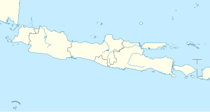
Positionskarte von Java, Indonesien
Gunung Slamet, Java's second highest volcano, towers above the village of Kutabawa. The modern volcano forms a less-vegetated cone that rises above the forested slopes of an older volcano in the foreground. Slamet is one of Java's most active volcanoes and has produced frequent explosive eruptions recorded since the 18th century.


