Südasien


Südasien ist ein Teil des asiatischen Kontinents und wird im Nordwesten, Norden und Nordosten durch Gebirge vom übrigen Asien abgetrennt. Der Raum wird bis heute, obwohl der Begriff teilweise als veraltet und kolonial-historisch besetzt gilt, früher als Vorderindien bezeichnet, es bestehen weitreichende Überlappungen zwischen den Begriffen Mittlerer Osten, indischer Subkontinent und Südasien.
In Südasien leben 25 Prozent der Weltbevölkerung, fast 2 Milliarden Menschen; allein in Indien leben über 1,4 Milliarden Menschen (2023).
Abgrenzung
Geologisch wird ein großer Teil Südasiens, da es eine eigene tektonische Platte darstellt, auch als indischer Subkontinent bezeichnet. Umgrenzt wird der Raum:
- vom Himalaya im Norden gegen Tibet (Ostasien) und dem Pamir gegen Zentralasien,
- dem Bergland von Belutschistan im Westen gegen Vorderasien,
- vom Patkai und Arakan-Joma-Gebirge im Osten gegen Südostasien.
- Nach Süden ist er vom Indischen Ozean umschlossen, mit dem Arabischen Meer westlich und dem Golf von Bengalen östlich der Halbinsel Indien.
Liste der Staaten
Alle Staaten in Südasien, unter anderem basierend auf der SAARC, sind:[1][2][3][4][5][6][7]
 Afghanistan (hauptsächlich jedoch zu Zentralasien gezählt[8])
 Bangladesch
 Bhutan
 Indien
 Malediven
 Nepal
Nepal Pakistan
 Sri Lanka
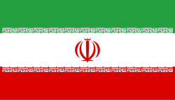
![]() Iran wird durch die UNSD, eine Abteilung der Vereinten Nationen, zu statistischen Zwecken ebenfalls zu Südasien gezählt,[9] in der Regel zählt Iran jedoch weltweit zu Westasien.
Iran wird durch die UNSD, eine Abteilung der Vereinten Nationen, zu statistischen Zwecken ebenfalls zu Südasien gezählt,[9] in der Regel zählt Iran jedoch weltweit zu Westasien.
Literatur
- Feroz Hassan Khan: Subcontinent Adrift: Strategic Futures of South Asia. Cambria, Amherst 2022, ISBN 978-1-62196-648-7.
- David Arnold: Südasien (= Neue Fischer Weltgeschichte. Band 11). S. Fischer, Frankfurt am Main 2012, ISBN 978-3-10-010841-8.
Weblinks
- Datenbank inhaltlich erschlossener Literatur zur gesellschaftlichen, politischen und wirtschaftlichen Situation in Südasien
- suedasien.info
Einzelnachweise
- ↑ Arthur Berriedale Keith: A Constitutional History of India: 1600–1935. Methuen & Co, 1936, S. 440–444.
- ↑ N. D. Arora: Political Science for Civil Services Main Examination. Tata McGraw-Hill Education, 2010, ISBN 978-0-07-009094-1, S. 42:1.
- ↑ Indian subcontinent. In: New Oxford Dictionary of English. Oxford University Press, New York 2001, ISBN 0-19-860441-6, S. 929: "the part of Asia south of the Himalayas which forms a peninsula extending into the Indian Ocean, between the Arabian Sea and the Bay of Bengal
- ↑ John McLeod: The history of India. Greenwood Publishing Group, 2002, ISBN 0-313-31459-4, S. 1.
- ↑ Stephen Adolphe Wurm, Peter Mühlhäusler, Darrell T. Tryon: Atlas of languages of intercultural communication in the Pacific, Asia, and the Americas. International Council for Philosophy and Humanistic Studies. Walter de Gruyter, 1996, ISBN 3-11-013417-9, S. 787.
- ↑ The Columbia Electronic Encyclopedia. 6. Auflage. Columbia University Press, 2003: "region, S central Asia, comprising the countries of Pakistan, India, and Bangladesh and the Himalayan states of Nepal, and Bhutan. Sri Lanka, an island off the southeastern tip of the Indian peninsula, is often considered a part of the subcontinent."
- ↑ Peter Haggett: Encyclopedia of World Geography (Vol. 1). Marshall Cavendish, 2001, ISBN 0-7614-7289-4, S. 2710.
- ↑ Svante E. Cornell: Modernization and Regional Cooperation in Central Asia: A New Spring? Central Asia-Caucasus Institute and the Silk Road Studies (englisch, silkroadstudies.org [PDF]).
- ↑ Standard country or area codes for statistical use. unstats.un.org, Seite 15
Koordinaten: 27° N, 72° O
Auf dieser Seite verwendete Medien
Flagge der Malediven.
Die Flagge von Nepal mit rechtem Rand (Seitenverhältnis 3:4)
Die Flagge von Nepal mit rechtem Rand (Seitenverhältnis 3:4)
Flagge des Irans. Die dreifarbige Flagge wurde 1906 eingeführt, aber nach der Islamischen Revolution von 1979 wurden die Arabische Wörter 'Allahu akbar' ('Gott ist groß'), in der Kufischen Schrift vom Koran geschrieben und 22-mal wiederholt, in den roten und grünen Streifen eingefügt, so daß sie an den zentralen weißen Streifen grenzen.
Autor/Urheber:
- Location_Asia.svg: Bosonic dressing
- Location-Asia-UNsubregions.png: Shushruth
- derivative work: The Illusional Ministry (talk)
Map: Asia (location), subregions as delineated by United Nations geographic classification scheme, except *:
- Russia in Eastern Europe
- territories geographically, wholly or partially, in Eastern Europe
- territories geographically, wholly or partially, in Eastern Europe, Southern Europe, or Northern Africa
Autor/Urheber: Cacahuate, Lizenz: CC BY-SA 4.0
Map of South Asia for use on Wikivoyage, English version
Autor/Urheber: user:Serg!o, Lizenz: CC BY-SA 3.0
South Asia


