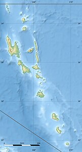
Rano (Vanuatu)
| Rano | ||
|---|---|---|
| Satellitenbild von Rano (unten) und Wala (oben) | ||
| Gewässer | Korallenmeer | |
| Inselgruppe | Neue Hebriden | |
| Geographische Lage | 15° 59′ 14″ S, 167° 23′ 25″ O | |
| Länge | 1,45 km | |
| Breite | 1,3 km | |
| Fläche | 1,48 km² | |
| Einwohner | 304 (2009) 205 Einw./km² | |
Rano ist eine Insel vor der Nordostküste von Malakula im Gebiet des westpazifischen Inselstaates Vanuatu. Laut dem Zensus von 1999 lebten damals 273 Menschen auf der Insel, 10 Jahre später waren es 304.[1]
Etwa 800 Meter nordwestlich grenzt Rano an die ebenfalls bewohnte Insel Wala.
Rano gehört zur vanuatuischen Provinz Malampa.
Einzelnachweise
Auf dieser Seite verwendete Medien
Autor/Urheber: MacedonianBoy, Lizenz: CC BY-SA 3.0
Flag of Malampa Province, Vanuatu.
Autor/Urheber: Eric Gaba (Sting - fr:Sting), Lizenz: CC BY-SA 3.0
Blank physical map of Vanuatu in Oceania, for geo-location purpose.
Autor/Urheber: Sentinel-2 cloudless 2016 by EOX IT Services GmbH is licensed under a Creative Commons Attribution 4.0 International License., Lizenz: CC BY-SA 4.0
Wala Island (in the north) and Rano Island (in the south), Vanuatu, Malampa, Sentinel-2 Satellite


