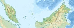
Pulau Jambongan
| Pulau Jambongan | ||
|---|---|---|
 | ||
| Gewässer | Sulusee | |
| Geographische Lage | 6° 41′ N, 117° 27′ O | |
| Länge | 20 km | |
| Breite | 14 km | |
| Höchste Erhebung | Buli Gantungan 156 m | |
| Hauptort | Pekan Jambongan | |
 | ||
Pulau Jambongan (engl. Jambongan Island), manchmal auch Pulau Jembongan, ist eine zu Sabah, Malaysia gehörende Insel in der Sulusee. Sie bildet die östliche Begrenzung der Paitan Bay und die nördliche Begrenzung der Schomburgk Bay.
Pulau Jambongan ist eine der größten Inseln Sabahs. Im Südosten der U-förmigen Insel liegt die Kleinstadt Jambongan (auch Jembongan genannt). Die Insel ist in ihrer größten Ausdehnung 20 Kilometer lang und 14 Kilometer breit. Der Insel ist vom Festland durch einen ca. 4 Kilometer breite Wasserfläche getrennt.
Die Ostseite der Insel ist von Mangrovenwäldern gesäumt. In der Nähe von Tanjong Landung Hayang, dem nordöstlichsten Punkt der Insel, ist das Ufer als Steilküste mit einer Höhe von 52 m ausgebildet. Südlich der Insel liegt das Mündungsgebiet des Sungai Paitan. Die Nordküste zwischen Tanjong Landung Taroh und Tanjong Buli Gantungan (Nordwestklippe) fällt 6 bis 15 m steil zum Meer hin ab.[1]
Zwischen der 156 m hohen Tanjong Buli Gantungan (Nordwestklippe, 6° 44' N., 117° 23' E.) und der zehn Kilometer Luftlinie entfernten und 140 m hohen Südwestklippe liegt eine schmale Bucht die sich fast fünf Kilometer in ostsüdöstlicher Richtung erstreckt. Die Einfahrt in diese Bucht ist etwa drei Kilometer breit mit einer Wassertiefe von mindestens 3,7 m. Die Küstenlinie der Bucht ist bewaldet.[1]
Nutzung
Die Insel ist stark bewaldet. Teile der Insel werden forstwirtschaftlich genutzt. Ein Teil des Waldbestandes wurde durch das Forstministerium unter Schutz gestellt. Die bereits auf der Insel angesiedelte Palmölindustrie (Asiatic Jambongan Estate Jambongan Island) wurde unter Beobachtung gestellt, um schädliche Einflüsse auf die Wälder zu verhindern oder abzumildern.[2] Der illegale Holzeinschlag auf Jambongan Island stellt das Forstministerium vor ein ernstes Problem, dem mit Razzien und der Beschlagnahmung von forstwirtschaftlichen Großmaschinen begegnet wird.[3]
Geschichte
In der Mat-Salleh-Rebellion war die Insel 1894 Schauplatz eines Mordes an zwei Mitgliedern des Stammes der Iban, für den der Häuptling Paduka Mat Salleh verantwortlich gemacht wurde. Captain Barnett und Barraut, der spätere Distriktsoffizier von Kudat, wurden beauftragt, Salleh in Jambongan zu ergreifen, blieben jedoch erfolglos.
Einzelnachweise
- ↑ a b Sailing Directions (Enroute) – Borneo, Jawa, Sulawesi and NUsa Tenggara. (Memento des vom 4. März 2016 im Internet Archive) Info: Der Archivlink wurde automatisch eingesetzt und noch nicht geprüft. Bitte prüfe Original- und Archivlink gemäß Anleitung und entferne dann diesen Hinweis. (PDF; 5,8 MB) United States Navy Publication 163, Sektor 10, 2002, S. 298; abgerufen am 24. August 2012.
- ↑ Forest Protection. (PDF; 1,7 MB)
- ↑ Enforcement & Investigation (PDF; 6,5 MB) Sabah Forestry Department, Jahresbericht 2010
Auf dieser Seite verwendete Medien
Autor/Urheber: Uwe Dedering, Lizenz: CC BY-SA 3.0
Location map of Malaysia.
Equirectangular projection. Strechted by 100.0%. Geographic limits of the map:
* N: 8.0° N
* S: 0.0° N
* W: 99.0° E
* E: 120.0° E
Made with Natural Earth. Free vector and raster map data @ naturalearthdata.com.
Flag of the Malaysian state Sabah. Based on a GIF from a government website, colors from a photo. Drawn by Mysid. The flag was adopted September 16, 1988.
- The mountain on the left is Mount Kinabalu.
Per the Constitution of the State of Sabah:
"The State Flag is in a rectangular shape and is in the proportion of 1:2. The canton which extends at the head half way to the fly and 2/3 at the hoist to the foot is in Icicle Blue (C1T9) as the background to a graphic silhouette of Mount Kinabalu which is in Royal Blue (B10) positioned at ¼ of the height of the canton from end to end. The fly of the flag is divided equally into three bands of colours the foot division of which extends right to the hoist. The top band is in Zircon Blue (C5T5) the second band is in white and the third band is in Chili Red (S6R4)."Autor/Urheber: Cccefalon; Pushpin: McSush, Lizenz: CC BY-SA 3.0
Sabah: Scheme of Islands off the northern coast / Pulau Jambongan (1024 px)
Jambongan Island (cropped from a bigger photo)


