Pulau Banggi
| Pulau Banggi | ||
|---|---|---|
 | ||
| Gewässer | Südchinesisches Meer, Sulusee | |
| Geographische Lage | 7° 15′ N, 117° 10′ O | |
| Fläche | 441 km² | |
| Höchste Erhebung | 529 m | |
| Einwohner | 20.000 45 Einw./km² | |
| Hauptort | Karakit | |
Banggi (malaiisch: Pulau Banggi, manchmal auch Bangi) ist eine zum malaysischen Bundesstaat Sabah gehörende Insel vor der Nordspitze Borneos. Die Insel gehört verwaltungstechnisch zum Distrikt Kudat der Kudat Division.
Banggi hat eine Fläche von 441 km² und etwa 20.000 Einwohner, die höchste Erhebung misst 529 m. An der Südspitze der Insel befindet sich die kleine Stadt Karakit mit Gesundheitszentrum, Moschee und einem Büro der Forstverwaltung. Ungefähr 24 ha der Insel wurden 1984 zum Schutzgebiet erklärt (Class V I Virgin Jungle Reserve, VJR)[1].
Im Südosten liegt eine Vielzahl weiterer Inselchen. 5 km im Westen liegt Pulau Balambangan, 15 km im Südosten Pulau Malawali.
Banggi liegt am Übergang vom westlich von ihr gelegenen Südchinesischen Meer zur Sulusee im Osten und wird im Norden durch die beide Meere verbindenden Balabacstraße von der philippinischen Insel Balabac getrennt.
Einzelnachweise
Weblinks
Auf dieser Seite verwendete Medien
Autor/Urheber: Cccefalon; Pushpin: McSush, Lizenz: CC BY-SA 3.0
Sabah: Scheme of Islands off the northern coast / Pulau Banggi
Autor/Urheber: Uwe Dedering, Lizenz: CC BY-SA 3.0
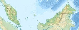
Location map of Malaysia.
Equirectangular projection. Strechted by 100.0%. Geographic limits of the map:
* N: 8.0° N
* S: 0.0° N
* W: 99.0° E
* E: 120.0° E
Made with Natural Earth. Free vector and raster map data @ naturalearthdata.com.
Flag of the Malaysian state Sabah. Based on a GIF from a government website, colors from a photo. Drawn by Mysid. The flag was adopted September 16, 1988.
- The mountain on the left is Mount Kinabalu.
Per the Constitution of the State of Sabah:
"The State Flag is in a rectangular shape and is in the proportion of 1:2. The canton which extends at the head half way to the fly and 2/3 at the hoist to the foot is in Icicle Blue (C1T9) as the background to a graphic silhouette of Mount Kinabalu which is in Royal Blue (B10) positioned at ¼ of the height of the canton from end to end. The fly of the flag is divided equally into three bands of colours the foot division of which extends right to the hoist. The top band is in Zircon Blue (C5T5) the second band is in white and the third band is in Chili Red (S6R4)."


