Portola Valley
| Portola Valley | ||
|---|---|---|
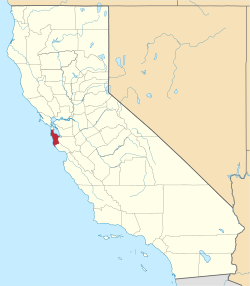
Lage in Kalifornien | ||
| Basisdaten | ||
| Staat: | Vereinigte Staaten | |
| Bundesstaat: | Kalifornien | |
| County: | San Mateo County | |
| Koordinaten: | 37° 23′ N, 122° 13′ W | |
| Zeitzone: | Pacific (UTC−8/−7) | |
| Einwohner: | 4.456 (Stand: 2020) | |
| Haushalte: | 1.742 (Stand: 2020) | |
| Fläche: | 23,7 km² (ca. 9 mi²) davon 23,7 km² (ca. 9 mi²) Land | |
| Bevölkerungsdichte: | 188 Einwohner je km² | |
| Höhe: | 140 m | |
| Postleitzahl: | 94028 | |
| Vorwahl: | +1 650 | |
| FIPS: | 06-58380 | |
| GNIS-ID: | 1659786 | |
| Website: | www.portolavalley.net | |
| Bürgermeister: | Craig Hughes | |
Portola Valley ist eine Stadt im San Mateo County im US-Bundesstaat Kalifornien mit 4456 Einwohnern (Stand: 2020).
Größere Städte in der Umgebung sind Palo Alto, Los Altos, Menlo Park und Mountain View.
Persönlichkeiten
- Joseph Fil (* 1953), Offizier der United States Army
Weblinks
Auf dieser Seite verwendete Medien
Autor/Urheber: NordNordWest, Lizenz: CC BY 3.0
Positionskarte von Kalifornien, USA
This is a locator map showing San Mateo County in California. For more information, see Commons:United States county locator maps.


