Northern Foothills
| Northern Foothills | ||
|---|---|---|
 Die Northern Foothills (oben rechts) am Westrand der Terra Nova Bay im Bereich der Evans Cove. Links: Inexpressible Island | ||
| Höchster Gipfel | Mount Abbott (1020 m) | |
| Lage | Viktorialand, Ostantarktika | |
| Teil des | Transantarktischen Gebirges | |
| Koordinaten | 74° 44′ S, 163° 55′ O | |
Die Northern Foothills (englisch für Nördliches Vorgebirge) sind eine Reihe von Hügeln an der Scott-Küste des ostantarktischen Viktorialands. Am Westufer der Terra Nova Bay bilden sie südlich des Browning-Passes eine halbinselähnliche Fortsetzung der Deep Freeze Range. Höchste Erhebung ist Mount Abbott mit 1020 m.
Benannt wurden sie von der Nordgruppe der Terra-Nova-Expedition (1910–1913) in Anlehnung an die ursprüngliche Benennung „Southern Foothills“ für die südlich gelegene Insel Inexpressible Island.
Weblinks
- Northern Foothills. In: Geographic Names Information System. United States Geological Survey, United States Department of the Interior, archiviert vom (englisch).
- Northern Foothills auf geographic.org (englisch)

Auf dieser Seite verwendete Medien
Autor/Urheber: Alexrk2, Lizenz: CC BY-SA 3.0
Physische Positionskarte Antarktis, Mittabstandstreue Azimutalprojektion
Just days away from the beginning of the Southern Hemisphere’s spring, Antarctica’s Inexpressible Island and the Northern Foothills Mountains were illuminated by a glimmer of sunlight from a low angle when the Advanced Land Imager (ALI) on NASA’s Earth Observing-1 (EO-1) satellite captured this image on September 16, 2009. The seaward slopes of the mountains are gleaming white, and they cast long shadows inland over the Nansen Ice Sheet. Terra Nova Bay appears in shadow.
The scene provides at least two indications of the bay’s persistent and fierce katabatic winds—downslope winds that blow from the interior of the ice sheet toward the coast. One is the windswept ground in the mountainous terrain. In many places, there is a pattern of bare rock and snow drifts that suggests the winds have scoured snow from upwind (inland-facing) slopes and deposited it on the lee sides.
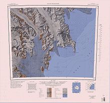
The second sign of the strong winds appears in the open waters of Terra Nova Bay. Parallel white streamers are composed of newly formed sea ice, probably frazil—crystals just millimeters wide—and congealed frazil, called “grease ice” because it resembles an oil slick on the water. The ice is continually pushed out to sea by the strong offshore winds, leaving a pocket of open water, a polynya.1:250,000-scale topographic reconnaissance map of the Mount Melbourne area from 162°-166°30'E to 74°-75°S in Antarctica. Mapped, edited and published by the U.S. Geological Survey in cooperation with the National Science Foundation.


