National Natural Landmark

National Natural Landmarks (NNL, deutsch Nationale Naturdenkmäler) sind geologische und ökologische Objekte in den Vereinigten Staaten, die vom US-Innenministerium als bedeutend für die Naturgeschichte des Landes eingestuft wurden. Das Programm wurde am 18. Mai 1962 vom damaligen US-Innenminister Stewart Udall ins Leben gerufen. Die als National Natural Landmarks ausgewiesenen Objekte können sich sowohl in öffentlichem wie auch in privatem Besitz befinden.
Die Liste der National Natural Landmarks umfasst 599 Objekte (Stand: Mai 2020) in den Bundesstaaten und den Außengebieten Amerikanisch-Samoa, Guam, Puerto Rico und den Amerikanischen Jungferninseln.[1] Einzig in den Bundesstaaten Delaware und Louisiana befinden sich keine National Natural Landmarks.[1] Etwa die Hälfte der ausgewiesenen Objekten befindet sich im Besitz öffentlicher Stellen, also in Bundes-, Staats-, County- oder Gemeindebesitz, ein Drittel ist alleinig im Besitz von Privatleuten und der Rest befindet sich gemischt auf öffentlichen als auch privaten Land. Aus diesem Grund sind einige Objekte nicht öffentlich zugänglich.[1]
Verwaltet wird das National Natural Landmarks Program vom National Park Service, der die Besitzer der Objekte im Bedarfsfall auch bei Schutz und Erhalt derselben unterstützt.
Die rechtliche Grundlage für die Befugnisse des Bundes bildet der Historic Sites Act aus dem Jahr 1935. National Natural Landmarks genießen nicht den Schutzstatus, der im National Historic Preservation Act von 1966 festgelegt wurde. Eine Ausweisung als NNL bedeutet somit nur ein Abkommen mit dem Besitzer, die bedeutenden Eigenschaften des jeweiligen Objekts falls möglich zu erhalten. Verwaltung und Erhalt der Landmarks liegen allein in der Verantwortung der Besitzer. Das Abkommen kann von beiden Parteien gekündigt werden.
Überblick der National Natural Landmarks
Diese Liste gibt einen Überblick über die Verteilung und anzahl der National Natural Landmarks in den Bundesstaaten beziehungsweise Außengebieten. Zu den jeweiligen Objekten siehe die Liste des zugehörigen Gebietes.
| Bundesstaat oder Territorium | Anzahl der National Natural Landmarks | Bild | |
|---|---|---|---|
| 1 | Alabama | 7 |  |
| 2 | Alaska | 16 |  |
| 3 | Amerikanisch-Samoa | 7 | |
| 4 | Arizona | 10 |  |
| 5 | Arkansas | 5 | 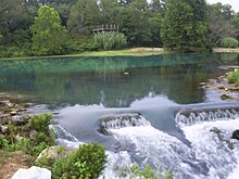 |
| 6 | Colorado | 15[Anm. 1] |  |
| 7 | Connecticut | 8[Anm. 2] | 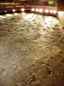 |
| 8 | Delaware | 0 | |
| 9 | Florida | 18 |  |
| 10 | Georgia | 11 |  |
| 11 | Guam | 4 | |
| 12 | Hawaii | 7 | 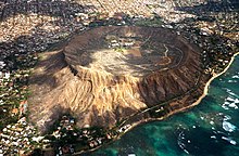 |
| 13 | Idaho | 11 |  |
| 14 | Illinois | 18 |  |
| 15 | Indiana | 30[Anm. 3] |  |
| 16 | Iowa | 7 | |
| 17 | Kalifornien | 36 |  |
| 18 | Kansas | 5 |  |
| 19 | Kentucky | 7[Anm. 3] | 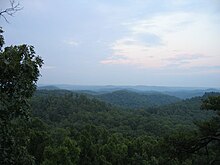 |
| 20 | Louisiana | 0 | |
| 21 | Maine | 14 |  |
| 22 | Maryland | 6[Anm. 4] |  |
| 23 | Massachusetts | 11[Anm. 2] |  |
| 24 | Michigan | 12[2] |  |
| 25 | Minnesota | 8[Anm. 5] |  |
| 26 | Mississippi | 5 |  |
| 27 | Missouri | 16 | 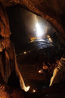 |
| 28 | Montana | 10 |  |
| 29 | Nebraska | 5 | (c) I, Pfly, CC BY-SA 3.0 |
| 30 | Nevada | 6 |  |
| 31 | New Hampshire | 11 | |
| 32 | New Jersey | 11[Anm. 6] |  |
| 33 | New Mexico | 12 |  |
| 34 | New York | 28[Anm. 6][Anm. 7] |  |
| 35 | North Carolina | 13 |  |
| 36 | North Dakota | 4 | |
| 38 | Ohio | 23 |  |
| 39 | Oklahoma | 3 |  |
| 40 | Oregon | 11 |  |
| 41 | Pennsylvania | 27 |  |
| 42 | Puerto Rico | 5 |  |
| 43 | Rhode Island | 1 |  |
| 44 | South Carolina | 6 |  |
| 45 | South Dakota | 13[Anm. 5] |  |
| 46 | Tennessee | 13 |  |
| 47 | Texas | 20 | |
| 48 | Utah | 4 |  |
| 49 | Vermont | 12[Anm. 7] |  |
| 50 | Amerikanische Jungferninseln | 7 |  |
| 51 | Virginia | 10 |  |
| 52 | Washington | 18 | 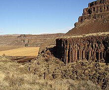 |
| 53 | Washington D.C. | 0 | |
| 54 | West Virginia | 15[Anm. 4] | |
| 55 | Wisconsin | 18 | 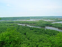 |
| 56 | Wyoming | 6[Anm. 1] | (c) Anky-man, CC BY-SA 3.0 |
Siehe auch
Anmerkungen
- ↑ a b Sand Creek befindet sich in Colorado und Wyoming
- ↑ a b Bartholomew’s Cobble befindet sich in Connecticut und Massachusetts
- ↑ a b Ohio Coral Reef befindet sich in Indiana und Kentucky
- ↑ a b Cranesville Swamp Nature Sanctuary befindet sich in Maryland und West Virginia
- ↑ a b Ancient River Warren Channel befindet sich in Minnesota und South Dakota
- ↑ a b Palisades of the Hudson befindet sich in New Jersey und New York
- ↑ a b Chazy Fossil Reef befindet sich in Vermont und New York
Einzelnachweise
- ↑ a b c National Park Service: National Natural Landmarks Directory, abgerufen am 3. Mai 2020 (englisch)
- ↑ Roscommon Red Pines, Department of Natural Resources.
Weblinks
Auf dieser Seite verwendete Medien
Autor/Urheber: Ikluft, Lizenz: CC BY-SA 4.0
San Andreas Fault in the Carrizo Plain, aerial view from 8500 feet altitude
Beach area in the northern unit of Illinois Beach State Park. Photo taken in 2006 by Dave Piasecki.
Autor/Urheber: Bobak Ha'Eri, Lizenz: CC BY-SA 2.5
Trona Pinnacles — with NPS sign in the Mojave Desert of California.
Autor/Urheber: Bowie Snodgrass, Lizenz: CC BY 2.0
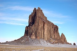
A photograph of Shiprock, Navajo Nation, New Mexico, USA.
(c) Kurankou at the English Wikipedia, CC BY-SA 3.0
Rocky plateau on summit of Mount Monadnock
Autor/Urheber: Matt Wright, Lizenz: CC BY-SA 2.5
Summit Lake Park in Colorado, USA
(c) Billwhittaker in der Wikipedia auf Englisch, CC BY-SA 3.0
Loess hills bluffs, Council Bluffs, Iowa, north of I-80
Autor/Urheber: NatalieMaynor, Lizenz: CC BY 2.0
A cliff in the Petrified Forest near Flora, Mississippi.
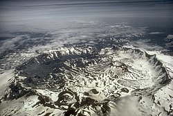
Luftaufnahme der Aniakchak Caldera mit Blick nach Osten. Der Aniakchak ist einer der spektakulärsten Vulkane auf der Alaska-Halbinsel. Entstanden während einer katastrophalen Ausbruchs vor rund 3.400 Jahren, ist die Aniakchak Caldera über 10 Kilometer (6 Meilen) breit und durchschnittlich 500 m (1.640 ft) tief. Der Vulkan ist Teil des Aniakchak National Monument and Preserve in Alaska.
Autor/Urheber: Daderot, Lizenz: CC BY-SA 3.0
Dinosaur State Park and Arboretum, Rocky Hill, Connecticut, USA. General view of dinosaur prints.
Autor/Urheber: Berean Hunter, Lizenz: CC BY-SA 2.5
Pilot Mountain Knob — in North Carolina.
- Photo taken 10-30-2008 from Little Pinnacle.
The view from a rocky ledge near the entrance at Hawk Mountain provides a spectacular view of the countryside and is a good vantage point for watching migrating raptors in the fall. This photo was taken the afternoon of 10-16-2006.
(c) Anky-man, CC BY-SA 3.0
Como Bluff, Wyoming, site of numerous important dinosaur discoveries in the late 1800s.
Autor/Urheber: Der ursprünglich hochladende Benutzer war Decumanus in der Wikipedia auf Englisch, Lizenz: CC BY-SA 3.0
Great Falls of the Passaic River in Paterson © 2004 Matthew Trump
Autor/Urheber: Easchiff, Lizenz: CC BY-SA 3.0
Round Lake, Green Lakes State Park, Fayetteville, New York. Looking NE down the spillway.
Fritillaria pudica, Yellow Bells at City of Rocks National Reserve in Idaho.
(c) I, Ruhrfisch, CC BY-SA 3.0
Pine Creek Gorge National Natural Landmark marker in Leonard Harrison State Park in Shippen Township, Tioga County, Pennsylvania, United States
Autor/Urheber: Der ursprünglich hochladende Benutzer war Mzzl in der Wikipedia auf Englisch, Lizenz: Copyrighted free use
View from Tater Knob in the Daniel Boone National Forest in Kentucky, USA.
(c) Meniscus aus der englischsprachigen Wikipedia, CC BY-SA 3.0
The "lighthouse" formation in Palo Duro Canyon.
View of the Columbus crew landing site taken from the National Park Service visitor center at Salt River Bay National Historical Park and Ecological Preserve. 17°46′47″N 64°45′42″W / 17.77972°N 64.76167°W
Luftbild des Mount Katahdin, 2005.
Autor/Urheber: Valerius Tygart, Lizenz: CC BY-SA 4.0
Battle Creek Cypress Swamp, Maryland, USA, in spring
The origin of this classic, simple meteorite impact crater was long the subject of controversy. The discovery of fragments of the Canyon Diablo meteorite, including fragments within the breccia deposits that partially fill the structure, and the presence of a range of shock-metamorphic features in the target sandstone, confirmed its impact origin. Target rocks include Paleozoic carbonates and sandstones; these rocks have been overturned just outside the rim during ejection. The hummocky deposits just beyond the rim are remnants of the ejecta blanket. This aerial view shows the dramatic expression of the crater in the arid landscape.
Mammoth spring
Autor/Urheber: Mailseth's wife, Lizenz: CC BY-SA 3.0
The Needles in Custer State Park, South Dakota
Autor/Urheber: http://en.wikipedia.org/wiki/User:Smylere_Snape, Lizenz: Copyrighted free use
limestone cliffs in Cabo Rojo, Puerto Rico
Autor/Urheber: Brian Stansberry, Lizenz: CC BY 3.0
Looking east from an overlook near the summit of Black Mountain in Cumberland County, Tennessee, in the southeastern United States. Part of Grassy Cove is visible below on the right. The edge of the Cumberland Plateau is visible along the horizon (the border between the dark brown and blue area). The smoke plume faintly visible at the top is from Watts Bar Nuclear Power Plant. This overlook is located just off the Cumberland Trail.
Autor/Urheber: Der ursprünglich hochladende Benutzer war Redjar in der Wikipedia auf Englisch, Lizenz: CC BY-SA 3.0
Description: Photograph of en:Mount Mansfield
Source: Photograph taken by Jared C. Benedict on 26 September 2004. Full resolution original available at: redjar.org/gallery/wikipedia_photos.
Copyright: © Jared C. Benedict.
en:Category:Stowe, Vermont(c) Eric Guinther aus der englischsprachigen Wikipedia, CC BY-SA 3.0
Portion of the dock area at Fagatogo, Pago Pago Harbor, American Samoa with Rainmaker Mt. (Pioa Mtn.) in the background.
Das Vista House in der Columbia River Gorge. Beacon Rock ist im Hintergrund sichtbar, links oberhalb des Vista House. Hamilton Mountain ist links des Beacon Rock.
Description: Shorelines from Glacial Lake Missoula on the hills above Missoula, Montana.
Source: National Park Service photograph from [1]
Caption: Wave-cut strandlines cut into the slope at left in photo. These cuts record former high-water lines, or shorelines of Glacial Lake Missoula near Missoula, Montana. Gullies above the highway are the result of modern-day erosion.Autor/Urheber: Rklawton, Lizenz: CC BY-SA 2.5
Marvel Cave, Silver Dollar City, Branson, Missouri.
Autor/Urheber: © Wyatt Greene, Lizenz: CC BY-SA 3.0
Canal Diggers Trail in Okefenokee Swamp
(c) Pytheas aus der englischsprachigen Wikipedia, CC BY-SA 3.0
Germany Valley in Pendleton County, West Virginia. Picture taken on US 33 on North Fork Mountain in July 2006. Picture taken and uploaded by Wyatt Greene.
Autor/Urheber: Cindy, Lizenz: CC BY-SA 2.0
The Wisconsin River delta into the Mississippi River taken at Wyalusing State Park in Wisconsin. The Wisconsin flows from the near right to the Mississippi River. The Mississippi River flows from the right to the left. Iowa is visible in the distance on the other side of the Mississippi River, & Prairie du Chien is just out of view to the right.
Autor/Urheber: Nationalparks, Lizenz: CC BY-SA 2.5
Rock City, Kansas, spheres of Dakota Sandstone
Autor/Urheber: U.S. Fish and Wildlife Service Northeast Region, Lizenz: CC BY 2.0
Photo of the Week - 05/04/2010
Lake Drummond at Great Dismal Swamp National Wildlife Refuge in Virginia.
Credit: Rebecca Wynn/USFWS
www.fws.gov/northeast/greatdismalswamp/Autor/Urheber: ProveIt, Lizenz: CC BY-SA 3.0
Diamond Head. Diamond Head is Oahu's largest tuff cone formed over 100,000 years ago by an active bubbling volcano. Nineteenth century British sailors nicknamed the crater Diamond Head when they mistook the calcite crystals for diamonds. A well-graded trail leads you up the 760-feet summit to a World War II bunker with a bird's eye view of Honolulu.
Autor/Urheber: AndrewKPepper, Lizenz: CC BY-SA 4.0
A view at Salt Plains National Wildlife Refuge in Oklahoma.
Autor/Urheber: Ebyabe, Lizenz: CC BY 2.5
Manatee Springs. A huge karst spring in Manatee Springs State Park, near Chiefland, Florida, USA


