Maxwell-Gunter Air Force Base
| Maxwell-Gunter Air Force Base | ||
|---|---|---|
 | ||
| Kenndaten | ||
| ICAO-Code | KMXF | |
| IATA-Code | MXF | |
| Koordinaten | 32° 22′ 45″ N, 86° 21′ 45″ W | |
| Höhe über MSL | 52 m (171 ft) | |
| Verkehrsanbindung | ||
| Entfernung vom Stadtzentrum | 1 km von Montgomery, Alabama | |
| Basisdaten | ||
| Eröffnung | 1910 | |
| Betreiber | US Air Force | |
| Start- und Landebahnen | ||
| 15/33 | 2441 m Asphalt | |
| Helicopter Landingzone | 919 m Asphalt | |
Die Maxwell-Gunter Air Force Base (kurz: Maxwell AFB, IATA-Code: MXF, ICAO-Code: KMXF)[1] ist ein Standort der United States Air Force bei Montgomery im US-Bundesstaat Alabama.
Der Standort umfasst zwei Liegenschaften, die Maxwell Air Force Base (Maxwell AFB) im Nordwesten von Montgomery und den Gunter Annex im Nordosten der Stadt.
Gunter Annex war auch einmal ein Flugplatz, das Gunter Field. Die Flugbetriebsflächen wurden in den 1970er Jahren als Bauland an die Stadt Montgomery verkauft. Heute ist dort unter anderem die U.S. Air Force Senior Noncommissioned Officer Academy stationiert.
Heutige Nutzung
Die Maxwell AFB ist ein aktiver militärischer Flugplatz.
- Der größte dort stationierte fliegende Verband ist die 908th Airlift Wing der US Air Force Reserves mit C-130H-Transportflugzeugen, die jedoch in einigen Jahren außer Dienst gestellt werden.
- Hinzu kommt seit 2024 die 24th Helicopter Squadron als Teil der 58th Operations Group, die dem 58th Special Operations Wing auf der Kirtland Air Force Base unterstellt ist. Die mit MH-139A ausgerüstete Einheit der regulären Air Force ist die „Formal Training Unit“ der US-Luftstreitkräfte für diesen Hubschraubertyp.[2][3]
Die Garnison beheimatet darüber hinaus die Air University, eine dem Air Education and Training Command unterstehende Ausbildungseinrichtung zur Weiterbildung der Offiziere und Unteroffiziere der US-Luftwaffe.
Zukunft
Der Standort wird ab 2023 erster und Ausbildungstandort von MH-139A-Helikoptern.[4]
Zwischenfälle
- Am 5. Dezember 1942 stürzte eine Douglas DC-3/C-47-DL der United States Army Air Forces (USAAF) (Luftfahrzeugkennzeichen 41-18494) 5 Kilometer südlich des Montgomery-Maxwell Field ab. Nähere Einzelheiten sind derzeit nicht verfügbar. Alle 12 Insassen kamen ums Leben.[5]
Weblinks
- Webpräsenz des Air University Maxwell AFB
- Jerome A. Ennels, Wesley Phillips Newton: Maxwell Air Force Base and Gunter Annex. In: encyclopediaofalabama.org
Einzelnachweise
- ↑ Airport Diagram – Maxwell AFB (KMXF). In: Federal Aviation Administration. U.S. Department of Transportation, 15. August 2019, abgerufen am 25. August 2019 (englisch).
- ↑ Alabama's Maxwell welcomes first active-duty flying training unit since 1945, Scramble.nl, 6. Februar 2024
- ↑ Air Force Reserve Command activates 24th Helicopter Squadron, Scramble.nl, 12. Dezember 2024
- ↑ Some C-130H units to be replaced by cyber ops, helicopters, Defense News, 15. Juli 2021
- ↑ Flugunfalldaten und -bericht DC-3 41-18494 im Aviation Safety Network (englisch), abgerufen am 29. August 2023.
Auf dieser Seite verwendete Medien
Autor/Urheber: TUBS
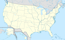
Location map of the USA (Hawaii and Alaska shown in sidemaps).
Main map: EquiDistantConicProjection : Central parallel :
* N: 37.0° N
Central meridian :
* E: 96.0° W
Standard parallels:
* 1: 32.0° N
* 2: 42.0° N
Made with Natural Earth. Free vector and raster map data @ naturalearthdata.com.
Formulas for x and y:
x = 50.0 + 124.03149777329222 * ((1.9694462586094064-({{{2}}}* pi / 180))
      * sin(0.6010514667026994 * ({{{3}}} + 96) * pi / 180))
y = 50.0 + 1.6155950752393982 * 124.03149777329222 * 0.02613325650382181
      - 1.6155950752393982  * 124.03149777329222 *
     (1.3236744353715044  - (1.9694462586094064-({{{2}}}* pi / 180))
      * cos(0.6010514667026994 * ({{{3}}} + 96) * pi / 180))
Hawaii side map: Equirectangular projection, N/S stretching 107 %. Geographic limits of the map:
- N: 22.4° N
- S: 18.7° N
- W: 160.7° W
- E: 154.6° W
Alaska side map: Equirectangular projection, N/S stretching 210.0 %. Geographic limits of the map:
- N: 72.0° N
- S: 51.0° N
- W: 172.0° E
- E: 129.0° W
Autor/Urheber: Alexrk2, Lizenz: CC BY 3.0
Positionskarte von Alabama, USA
Emblem of Air Education and Training Command
A C-130 Hercules aircraft of the 908th Airlift Wing takes off from Maxwell Air Force Base with the wing's maintenance hangers in the background. According to a recent Air Force announcement, the 908th's seven transport aircraft are to be retired. Although the unit will remain functional, members are concerned about the future, as any possible unit organization and mission have yet to be decided.


