Ljubim
| Stadt Ljubim Любим
| ||||||||||||||||||||||||||||||||||||||||||
| ||||||||||||||||||||||||||||||||||||||||||
| ||||||||||||||||||||||||||||||||||||||||||
| Liste der Städte in Russland | ||||||||||||||||||||||||||||||||||||||||||
Ljubim (russisch Любим) ist eine Kleinstadt in der Oblast Jaroslawl (Russland) mit 5555 Einwohnern (Stand 14. Oktober 2010).[1]
Geografie
Die Stadt liegt etwa 125 Kilometer nordöstlich der Oblasthauptstadt Jaroslawl an der Mündung des Flüsschens Obnora in die Kostroma, einem linken Nebenfluss der Wolga.
Ljubim ist Verwaltungszentrum des gleichnamigen Rajons.
Die Stadt liegt an der Stammstrecke der Transsibirischen Eisenbahn (Streckenkilometer 393 ab Moskau).
Geschichte
Ljubim wurde 1546 (oder 1538) gegründet und erhielt 1777 das Stadtrecht.
Bevölkerungsentwicklung
| Jahr | Einwohner |
|---|---|
| 1897 | 3000 |
| 1926 | 3700 |
| 1939 | 7117 |
| 1959 | 7619 |
| 1970 | 7722 |
| 1979 | 7374 |
| 1989 | 7074 |
| 2002 | 6254 |
| 2010 | 5555 |
Anmerkung: Volkszählungsdaten (1926 gerundet)
Wirtschaft
In Ljubim gibt es Betriebe der holzverarbeitenden, Leicht- und Lebensmittelindustrie.
Weblinks
- Inoffizielles Stadtportal (russisch)
- Ljubim auf mojgorod.ru (russisch)
Einzelnachweise
- ↑ a b Itogi Vserossijskoj perepisi naselenija 2010 goda. Tom 1. Čislennostʹ i razmeščenie naselenija (Ergebnisse der allrussischen Volkszählung 2010. Band 1. Anzahl und Verteilung der Bevölkerung). Tabellen 5, S. 12–209; 11, S. 312–979 (Download von der Website des Föderalen Dienstes für staatliche Statistik der Russischen Föderation)
Auf dieser Seite verwendete Medien
Autor/Urheber: Uwe Dedering, Lizenz: CC BY-SA 3.0
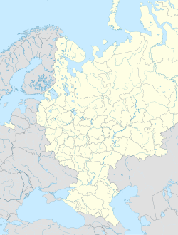
Location map of European_Russia.
- Projection: Lambert azimuthal equal-area projection.
- Area of interest:
- N: 75.0° N
- S: 40.0° N
- W: 25.0° E
- E: 60.0° E
- Projection center:
- NS: 57.5° N
- WE: 42.5° E
- GMT projection: -JA42.5/57.5/20c
- GMT region: -R25.450860698632475/38.37411418933942/86.79037939442836/70.79910933370674r
- GMT region for grdcut: -R-2.0/38.0/87.0/76.0r
- Made with Natural Earth. Free vector and raster map data @ naturalearthdata.com.
Russian town Lyubim, Yaroslavl region. Stone at the place where town was founded. "Here in year 1538 town Lyubim was founded".
Lyubim (Yaroslavl oblast), coat of arms (1778)
Flag of Yaroslavl Oblast
Флаг города Любим, Ярославская область
Autor/Urheber: Das steinerne Herz, Lizenz: CC BY-SA 3.0
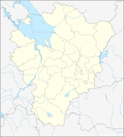
Russian Federation Yaroslavl Oblast location map


