Liste von Vulkanen in Nicaragua
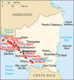
Dies ist eine Liste von Vulkanen in Nicaragua, die während des Quartärs, also etwa in den letzten 2,6 Millionen Jahren, mindestens einmal aktiv waren.

Siehe auch
Weblinks
Auf dieser Seite verwendete Medien
(c) OOjs UI Team and other contributors, MIT
An icon from the OOjs UI MediaWiki lib.
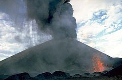
Ash falls at the left from a strombolian eruption column emanating from the summit crater of Cerro Negro volcano in 1968. At the same time incandescent spatter (lower right) is ejected from a small vent on the south flank of the cone. The 1968 eruption began on October 23 and lasted until December 15. The south-flank vent also fed a lava flow that traveled 1.5 km.
Autor/Urheber: Die Autorenschaft wurde nicht in einer maschinell lesbaren Form angegeben. Es wird Tabla als Autor angenommen (basierend auf den Rechteinhaber-Angaben)., Lizenz: CC BY-SA 3.0
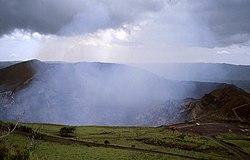
Cráter del Volcán Masaya. Nicaragua. 2002
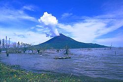
Telica volcano, seen here from the León-Chinandega highway, is one of a group of interlocking cones and vents along a NW trend. The summit of Telica, which is one of Nicaragua's most active volcanoes, is unvegetated, and deep erosional gulleys have been dissected into the lower flanks of the cone. Frequent historical eruptions have been recorded at Telica since the 16th century.
The broad Chiltepe Peninsula rises to the SE across the flood-stained waters of Lake Managua. Apoyeque caldera lies beyond its horizontal rim on the right-center horizon. The 11-km-wide peninsula extends into Lake Managua and marks the northern limit of a segment of the central Nicaraguan volcanic chain that is offset to the east.
Rota stratovolcano in Nicaragua.
Autor/Urheber: Adalberto Hernández Vega, Lizenz: CC BY 2.0
Concepción Volcano in Ometepe Island, Nicaragua
Cerro Motastepe cinder cone (upper left) is the youngest and most prominent feature of the Nejapa-Miraflores volcanic alignment. The cone, seen here from the SE with Laguna de Nejapa in the center of the photo, is elongated in an E-W direction and rises 160 m above its base to 360 m elevation. Cerro Motastepe formed less than 2500 years ago. The surface of saline Laguna de Nejapa collapse pit (center) lies at about the same level as Lake Managua, barely visible in the distance at the upper right.
Astronaut photograph of Cosigüina volcano, Nicaragua.
Las Pilas volcanic complex forms a broad massif seen here from the SSE rising above the Nicaraguan depression. This 30-km-long chain was erupted along a N-S-trending fissure and includes (from left to right) conical Asososca volcano, flat-topped Cerro Los Tacanistes, the unforested summit of Las Pilas itself (the high point of the range), and Cerro El Picacho.
Oxidized scoria layers in a cinder cone of the fissure-fed Granada in Nicaragua.
Autor/Urheber: Ryan Ballantyne --ryos 01:28, 18 June 2006 (UTC), Lizenz: CC BY-SA 2.5
San Cristóbal Volcano in Nicaragua, taken from an upper level of the sugar mill at the Ingenio San Antonio in Chichigalpa, Nicaragua.
Maderas Volcano as seen from the South in Ometepe island, Nicaragua. Taken at the entry to the trail leading to the San Ramon waterfall.


