Liste sizilianischer Inseln

Übersichtskarte der größeren Inseln

Die italienische Region Sizilien besteht neben der Hauptinsel Sizilien, die die größte Insel des Mittelmeers ist, aus zahlreichen kleineren Inseln und Felsen.

Überblick

Die meisten dieser Inseln gruppieren sich in drei größeren Inselgruppen: den Äolischen oder Liparischen Inseln vor der Nordküste im Tyrrhenischen Meer, den Ägadischen Inseln vor der Westspitze Siziliens und den Pelagischen Inseln südlich der Hauptinsel im offenen Mittelmeer, wo sich auch der südlichste Punkt des italienischen Territoriums befindet. Hinzu kommen Ustica und Pantelleria sowie eine Vielzahl kleiner, der Hauptinsel vorgelagerter küstennaher Inseln und Felsen oder Nebeninseln der größeren, bewohnten. Die geographisch ebenfalls in der Umgebung Siziliens liegende Insel Malta und ihre Nachbarinseln, die in der Antike und im Mittelalter auch politisch zu Sizilien zählten, sind seit 1530 von Sizilien unabhängig und daher in dieser Liste nicht aufgeführt.

Einige Inseln spielten eine Rolle bei der Sicherung von Hafeneinfahrten der Städte und bergen die Reste von Befestigungsanlagen, zwei von ihnen sind der historische Kern heutiger Städte, nämlich Augusta und Ortygia.

Viele der Inseln sind durch vulkanische Aktivität entstanden und daher bergig, im Jahre 1831 bestand für einige Monate die Vulkaninsel Ferdinandea. Die Isole dello Stagnone di Marsala hingegen sind flach und umschließen eine kleine Lagune. Die meisten Gebiete der kleineren Inseln um Sizilien stehen unter Naturschutz und leben heute zu einem beträchtlichen Teil vom Tourismus, die kleinen Felsen werden besonders von Tauchern besucht.

Die Übergänge im Italienischen zwischen den Begriffen Isola („Insel“) und Isolotto („Eiland“) sind fließend, die kleinen Felsinseln tragen häufig die Bezeichnungen Scoglio („Felsen“) oder Pietra („Stein“), steil aufragende Felsen auch Faraglione („Klippe“) im Namen.

Die Gemeinden der kleineren Inseln sind Mitglieder des Gemeindeverbands der kleineren Inseln Italiens, Associazione Nazionale Comuni Isole Minori (ANCIM).

Die Auflistung der Inseln in den folgenden Tabellen erfolgt nach ihrer geographischen Lage: Nach der Hauptinsel Sizilien beginnend im Norden (Ustica) im Uhrzeigersinn um die Hauptinsel herum. Andere Reihenfolgen (sortiert nach Name, Gemeinde, Größe usw.) können einfach über die Sortierfunktion erreicht werden.

Größere und bewohnte Inseln

NameInselgruppeProvinzGemeindeFläche
(km²)
EinwohnerLageBild
Sizilien
(italienisch: Sicilia)
9 Provinzen382 Gemeinden25.460,005.000.00038° 43′ 0″ N, 13° 11′ 0″ O
Etna i Sycylia.jpg
UsticaPalermoUstica8,001.30838° 43′ 0″ N, 13° 11′ 0″ O
AlicudiLiparische InselnMessinaLipari5,2010038° 32′ 38″ N, 14° 21′ 12″ O
Aerial image of Alicudi (view from the south).jpg
FilicudiLiparische InselnMessinaLipari9,5023538° 34′ 31″ N, 14° 33′ 30″ O
Aerial image of Filicudi (view from the south).jpg
SalinaLiparische InselnMessinaLeni, Malfa,
Santa Marina Salina
27,002.35038° 33′ 53″ N, 14° 50′ 19″ O
Aerial image of Salina (view from the southwest).jpg
LipariLiparische InselnMessinaLipari37,009.30038° 28′ 47″ N, 14° 57′ 18″ O
Aerial image of Lipari (view from the southwest).jpg
VulcanoLiparische InselnMessinaLipari21,209538° 23′ 28″ N, 14° 58′ 46″ O
Aerial image of Vulcano (view from the east).jpg
PanareaLiparische InselnMessinaLipari3,4035038° 38′ 13″ N, 15° 4′ 2″ O
Aerial image of Panarea (view from the southeast).jpg
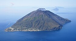
StromboliLiparische InselnMessinaLipari12,6050038° 48′ 14″ N, 15° 13′ 24″ O
Aerial image of Stromboli (view from the northeast).jpg
Augusta
(Isola delle Palme)
SyrakusAugusta37° 13′ 32″ N, 15° 13′ 18″ O
Augusta SR Panorama.JPG
Ortygia
(italienisch: Ortigia)
SyrakusSyrakus1,004.50037° 3′ 40″ N, 15° 17′ 39″ O
Seafront at Ortygia.jpg
LinosaPelagische InselnAgrigentLampedusa e Linosa5,0045035° 51′ 39″ N, 12° 51′ 15″ O
LampedusaPelagische InselnAgrigentLampedusa e Linosa20,004.50035° 30′ 35″ N, 12° 36′ 0″ O
PantelleriaTrapaniPantelleria83,007.64936° 47′ 0″ N, 11° 59′ 0″ O
Pantelleria North.jpg
Isola Grande
(Isola Lunga)
Isole dello Stagnone di MarsalaTrapaniMarsala037° 52′ 43″ N, 12° 26′ 41″ O
IsolaGrande-ProvinciaDiTrapani.jpg
FavignanaÄgadische InselnTrapaniFavignana19,803.50037° 56′ 0″ N, 12° 20′ 0″ O
Favignana lido burrone.jpg
MarettimoÄgadische InselnTrapaniFavignana12,0030037° 58′ 10″ N, 12° 3′ 26″ O
Marettimo02.jpg
LevanzoÄgadische InselnTrapaniFavignana5,8245038° 0′ 1″ N, 12° 20′ 8″ O
Levanzo.jpg

Kleine Eilande und Felsen

Name und AnmerkungenInselgruppeProvinzGemeindeLageBild
Scoglio del MedicoPalermoUstica38° 43′ 1″ N, 13° 9′ 23″ O
Scoglio PastizzoPalermoUstica38° 42′ 7,5″ N, 13° 11′ 33,5″ O
Isola delle FemminePalermoIsola delle Femmine38° 12′ 36″ N, 13° 14′ 9″ O
Isola delle Femmine.jpg
Faraglioni di Terrasini
mehrere kleine Felsen
PalermoTerrasini38° 9′ 12″ N, 13° 4′ 32″ O
Terrasini-bjs-16.jpg
Scoglio Formica
am Capo Zafferano
PalermoSanta Flavia38° 6′ 49″ N, 13° 32′ 16″ O
Capo-Zafferano-bjs2007-01.jpg
Scoglio Galera
(Scoglio Jalera)
Liparische InselnMessinaLipari38° 32′ 47″ N, 14° 20′ 20″ O
Scoglio PalombaLiparische InselnMessinaLipari38° 31′ 48″ N, 14° 21′ 43″ O
Scoglio GiafanteLiparische InselnMessinaLipari38° 35′ 13″ N, 14° 32′ 45,5″ O
La CannaLiparische InselnMessinaLipari38° 34′ 56″ N, 14° 31′ 17″ O
Scoglio di MontenassariLiparische InselnMessinaLipari38° 34′ 56″ N, 14° 31′ 57″ O
Scoglio La MitraLiparische InselnMessinaLipari38° 34′ 43,2″ N, 14° 32′ 20,8″ O
Scoglio NotaroLiparische InselnMessinaLipari38° 34′ 36,7″ N, 14° 32′ 19″ O
Scoglio della FortunaLiparische InselnMessinaLipari38° 34′ 25,7″ N, 14° 32′ 24,4″ O
Scoglio CudduraLiparische InselnMessinaLipari38° 34′ 11″ N, 14° 32′ 37″ O
Scoglio di Pollara
(Scoglio Faraglione)
Liparische InselnMessinaMalfa38° 34′ 46″ N, 14° 48′ 3″ O
Scoglio di Pollara.jpg
Scoglio Imerata
(Scoglio del Carabiniere)
Liparische InselnMessinaLipari38° 31′ 9″ N, 14° 54′ 44″ O
Pietra del BagnoLiparische InselnMessinaLipari38° 28′ 30″ N, 14° 53′ 45″ O
Le Formiche di LipariLiparische InselnMessinaLipari38° 26′ 37″ N, 14° 56′ 24″ O
La MummiaLiparische InselnMessinaLipari38° 26′ 30″ N, 14° 56′ 40,5″ O
La Mummia Lipari.jpg
Pietra LungaLiparische InselnMessinaLipari38° 26′ 23″ N, 14° 56′ 35″ O
Pietra Lunga Lipari.jpg
Pietra MenaldaLiparische InselnMessinaLipari38° 26′ 20″ N, 14° 56′ 31″ O
Lipari Scogli.jpg
Scoglio delle SireneLiparische InselnMessinaLipari38° 25′ 12,5″ N, 14° 57′ 4″ O
Scoglio Quaedri
(Pietra Quaglietto)
Liparische InselnMessinaLipari38° 23′ 59″ N, 14° 56′ 19″ O
La Nave
(La Nave di Panarea)
Liparische InselnMessinaLipari38° 38′ 49″ N, 15° 3′ 51″ O
Scoglio la Nave.jpg
Scoglio BastimentoLiparische InselnMessinaLipari38° 37′ 30,8″ N, 15° 3′ 41,5″ O
Le Formiche di Panarea
vier kleine Felsen
Liparische InselnMessinaLipari38° 37′ 38″ N, 15° 5′ 2″ O
DattiloLiparische InselnMessinaLipari38° 38′ 21″ N, 15° 5′ 49″ O
Dattilo Lisca bianca.jpg
I Panarelli
fünf kleine Felsen
Liparische InselnMessinaLipari38° 38′ 32″ N, 15° 5′ 57″ O
Lisca NeraLiparische InselnMessinaLipari38° 38′ 5″ N, 15° 6′ 23″ O
BottaroLiparische InselnMessinaLipari38° 38′ 16″ N, 15° 6′ 37″ O
Lisca BiancaLiparische InselnMessinaLipari38° 38′ 21″ N, 15° 6′ 49″ O
Dattilo Lisca bianca.jpg
Scoglio SpinazzolaLiparische InselnMessinaLipari38° 39′ 54″ N, 15° 6′ 29″ O
Spinazzola 1895.jpg
BasiluzzoLiparische InselnMessinaLipari38° 39′ 48″ N, 15° 6′ 50″ O
Basiluzzo.jpg
StrombolicchioLiparische InselnMessinaLipari38° 49′ 2″ N, 15° 15′ 12″ O
Strombolicchio2.jpg
Scoglio San BiagioMessinaCaronia38° 2′ 30,7″ N, 14° 30′ 39,5″ O
Scoglio di BroloMessinaBrolo38° 9′ 54,8″ N, 14° 49′ 32,2″ O
Pietra di PattiMessinaPatti38° 9′ 40″ N, 14° 59′ 24″ O
Scoglio di PattiMessinaPatti38° 9′ 39″ N, 14° 59′ 32,2″ O
Le Tre Pietracce
drei kleine Felsen
MessinaMilazzo38° 15′ 56,2″ N, 15° 14′ 7,8″ O
Scoglio della PortellaMessinaMilazzo38° 16′ 4,7″ N, 15° 13′ 26,5″ O
Isola BellaMessinaTaormina37° 51′ 1″ N, 15° 18′ 3″ O
Sicilia Isola Bella.jpg
Lachea
(Isola di Aci)
ZyklopeninselnCataniaAci Castello37° 33′ 41″ N, 15° 9′ 59″ O
Isola Lachea.jpg
Faraglione Grande
(Isola dei Ciclopi,
Faraglione di Santa Maria)
ZyklopeninselnCataniaAci Castello37° 33′ 35″ N, 15° 9′ 56″ O
Faraglione Grande Ciclopi.jpg
Faraglione Medio
(Faraglione Piccolo)
ZyklopeninselnCataniaAci Castello37° 33′ 32″ N, 15° 9′ 47″ O
Faraglione Medio.jpg
Faraglione degli UccelliZyklopeninselnCataniaAci Castello37° 33′ 30″ N, 15° 9′ 43″ O
Torre AvalosSyrakusAugusta37° 12′ 43″ N, 15° 13′ 26″ O
Forte VittoriaSyrakusAugusta37° 14′ 9,3″ N, 15° 12′ 19,4″ O
Forte GarciaSyrakusAugusta37° 14′ 8,4″ N, 15° 12′ 14,3″ O
I due fratelli
(I due frati,
i ru’ frati (siz.))
SyrakusSyrakus37° 5′ 8″ N, 15° 18′ 6″ O
37° 5′ 7″ N, 15° 18′ 5″ O
I due frati Siracusa.jpg
Scoglio a PizzoSyrakusSyrakus37° 4′ 19″ N, 15° 17′ 53″ O
Scoglio dei CaniSyrakusSyrakus37° 3′ 38,3″ N, 15° 18′ 8,3″ O
Scogli CastelluccioSyrakusSyrakus37° 2′ 37″ N, 15° 18′ 7″ O
Scoglio GaleraSyrakusSyrakus37° 2′ 30″ N, 15° 17′ 43,5″ O
Scoglio MiloccaSyrakusSyrakus37° 0′ 16″ N, 15° 16′ 54″ O
OgninaSyrakusSyrakus36° 58′ 45″ N, 15° 15′ 49″ O
Isola VendicariSyrakusPachino36° 47′ 31″ N, 15° 6′ 16″ O
Isola Piccola di Marzamemi
(Isolotto Brancati nach Vitaliano Brancati)
SyrakusPachino36° 44′ 18″ N, 15° 7′ 8″ O
Isola Grande di MarzamemiSyrakusPachino36° 44′ 6″ N, 15° 7′ 15″ O
Isola di Capo PasseroSyrakusPortopalo di Capo Passero36° 41′ 13″ N, 15° 8′ 54″ O
Isola Capo Passero.JPG
Isola delle CorrentiSyrakusPortopalo di Capo Passero36° 38′ 44″ N, 15° 4′ 39″ O
Isola delle correnti.jpg
Scoglio IannuzzoRagusaIspica36° 41′ 6,8″ N, 14° 58′ 31″ O
Isola dei porriRagusaIspica36° 41′ 10″ N, 14° 55′ 56″ O
Rocca San NicolaAgrigentLicata37° 6′ 45″ N, 13° 51′ 24″ O
Scogli(o)/Rocca Gucciarda
(Guicciarda,
i ziti: u zitu und a zita)
AgrigentRealmonte37° 17′ 28″ N, 13° 27′ 7″ O
Scoglio Pietra PatellaAgrigentPalma di Montechiaro37° 11′ 23″ N, 13° 39′ 25″ O
Faraglioni di Linosa
mehrere kleine Felsen
Pelagische InselnAgrigentLampedusa e Linosa35° 52′ 2,5″ N, 12° 52′ 55,5″ O
Scoglio PinaltaPelagische InselnAgrigentLampedusa e Linosa35° 31′ 37,7″ N, 12° 31′ 24,8″ O
Scoglio SacramentoPelagische InselnAgrigentLampedusa e Linosa35° 31′ 44″ N, 12° 31′ 42″ O
Faraglione
(Scoglio a vela)
Pelagische InselnAgrigentLampedusa e Linosa35° 31′ 44″ N, 12° 32′ 39,5″ O
Isola dei ConigliPelagische InselnAgrigentLampedusa e Linosa35° 30′ 37″ N, 12° 33′ 31″ O
Spiaggia-dei-conigli2.jpg
LampionePelagische InselnAgrigentLampedusa e Linosa35° 33′ 6,4″ N, 12° 19′ 16,2″ O
Lampione islet.JPG
Faraglione TracinoTrapaniPantelleria36° 47′ 56,2″ N, 12° 3′ 7,8″ O
Pantelleria Faraglione Tracino.jpg
Scoglio di Punta del DuceTrapaniPantelleria36° 46′ 39″ N, 12° 3′ 24″ O
Scogli del Formaggio
mehrere kleine Felsen
TrapaniPantelleria36° 46′ 18″ N, 12° 3′ 20″ O
Pantelleria Scogli del Formaggio.jpg
Faraglione Dietro l’IsolaTrapaniPantelleria36° 45′ 25″ N, 12° 3′ 11″ O
Pantalleria Faraglione dietro l'Isola.jpg
Galera della SalinaTrapaniPantelleria36° 45′ 18,1″ N, 12° 3′ 7,5″ O
Gli Scoglietti
mehrere kleine Felsen
TrapaniPantelleria36° 44′ 7″ N, 12° 1′ 34″ O
La GaleraTrapaniPantelleria36° 45′ 18,1″ N, 11° 58′ 39,4″ O
Scoglio Sibiliana
(Scibiliana)
TrapaniPetrosino37° 43′ 50″ N, 12° 28′ 10″ O
La Schola
(La Scola, La Scuola)
Isole dello Stagnone di MarsalaTrapaniMarsala37° 51′ 46″ N, 12° 27′ 24″ O
Isola Scola1.jpg
San Pantaleo
(Mozia)
Isole dello Stagnone di MarsalaTrapaniMarsala37° 52′ 6″ N, 12° 28′ 7″ O
Santa MariaIsole dello Stagnone di MarsalaTrapaniMarsala37° 52′ 55″ N, 12° 27′ 33″ O
PrevetoÄgadische InselnTrapaniFavignana37° 54′ 52″ N, 12° 18′ 7″ O
GaleottaÄgadische InselnTrapaniFavignana37° 54′ 43″ N, 12° 17′ 55″ O
GaleraÄgadische InselnTrapaniFavignana37° 54′ 51″ N, 12° 17′ 24″ O
Scoglio Correnti
(Scoglio Corrente)
Ägadische InselnTrapaniFavignana37° 54′ 52″ N, 12° 17′ 7″ O
Scoglio Cammello
(Scoglio Camello)
Ägadische InselnTrapaniFavignana37° 59′ 0″ N, 12° 3′ 55″ O
Scoglio Cammello.jpg
Il FaraglioneÄgadische InselnTrapaniFavignana37° 59′ 11,5″ N, 12° 19′ 42,5″ O
Faraglione di Levanzo.jpg
MaraoneÄgadische InselnTrapaniFavignana37° 59′ 24″ N, 12° 24′ 51″ O
FormicaÄgadische InselnTrapaniFavignana37° 59′ 21″ N, 12° 25′ 31″ O
Isola Formica.jpg
ColombaiaTrapaniTrapani38° 0′ 41″ N, 12° 29′ 36″ O
Trapani01.jpg
Scoglio PalumboTrapaniTrapani38° 0′ 45″ N, 12° 29′ 18″ O
Trapani Scoglio Palumbo.jpg
Sant’AntonioTrapaniTrapani38° 0′ 52″ N, 12° 29′ 48″ O
Scoglio Mal ConsiglioTrapaniTrapani38° 1′ 29,8″ N, 12° 29′ 47,7″ O
Scogli Porcelli
mehrere kleine Felsen
Ägadische InselnTrapaniTrapani38° 2′ 38″ N, 12° 26′ 22″ O
AsinelliTrapaniTrapani38° 3′ 51″ N, 12° 31′ 46″ O
Scoglio ScialandroTrapaniCustonaci38° 6′ 55″ N, 12° 41′ 7″ O
Faraglioni di Scopello
mehrere kleine Felsen
TrapaniCastellammare del Golfo38° 4′ 23″ N, 12° 49′ 23″ O
Scopello.jpg

Weblinks

Auf dieser Seite verwendete Medien

Etna i Sycylia.jpg
The height and southward extent of the ash plume emanating from Sicily's Mount Etna volcano on October 27 are captured in these four image panels from the Multi-angle Imaging SpectroRadiometer (MISR). Mount Etna, Europe's most active volcano, was revived when a series of intermittent minor earthquakes shook the eastern edge of Sicily and parts of mainland Italy during September and October. The eruption of Etna sent a thick blanket of volcanic ash over much of eastern Sicily, sparked forest fires, and destroyed or damaged hundreds of buildings with lava flows and pyroclastic activities. October 27, 2002, marks the start of the second period of intense activity from Etna in little over a year. The previous period of activity occurred during July and August 2001, during which time MISR also observed extensive ash plumes emanating from the volcano.
Lampedusa Nordküste.jpg
(c) Bickel, CC BY-SA 3.0
Die steil abfallende, felsige Nordküste von Lampedusa
Pantelleria North.jpg
Autor/Urheber: Luca Conti, Lizenz: CC BY 2.0
centro abitato di Pantelleria, Italy
Aerial image of Lipari (view from the southwest).jpg
Autor/Urheber: Carsten Steger, Lizenz: CC BY-SA 4.0
Luftbild von Lipari (Ansicht von Südwesten)
Trapani Scoglio Palumbo.jpg
Autor/Urheber: Leandro Neumann Ciuffo, Lizenz: CC BY 2.0
Casina Nasi and Scoglio di Palumbo, Trapani, Sicily, Italy, in the background Favignana
Sizilien Inseln.png
Autor/Urheber:

bearbeitet durch Pitichinaccio

, Lizenz: CC-by-sa 3.0

Übersicht der Inseln der Region Sizilien

Levanzo.jpg
Autor/Urheber: Dedda71, Lizenz: CC BY 3.0
Levanzo view from Favignana
Capo-Zafferano-bjs2007-01.jpg
Autor/Urheber: Bjs, Lizenz: CC BY-SA 3.0
Capo Zafferano, Leuchtturm und Scoglio Formica
Linosa Fischerhafen.jpg
(c) Bickel, CC BY-SA 3.0
Kleiner Fischerhafen auf Linosa. Gut sichtbar im Hintergrund verschiedene Schichten vulkanischen Gesteins
IsolaGrande-ProvinciaDiTrapani.jpg
Autor/Urheber: Martin Kroetz, Lizenz: CC BY-SA 3.0
Isola Grande (Provincia di Trapani) Nordspitze der Insel vom Festland aus gesehen
La Mummia Lipari.jpg
Autor/Urheber: Leandro Neumann Ciuffo, Lizenz: CC BY 2.0
La Mummia Rock, SW of Lipari, Aeolian Islands, Sicily, Italy
Isola Capo Passero.JPG
Autor/Urheber: Azotoliquido, Lizenz: CC BY-SA 3.0
Portopalo di Capo Passero (SR), Isola di Capo Passero.
Scoglio di Pollara.jpg
Autor/Urheber: Tore Urnes, Lizenz: CC BY 2.0
Scoglio di Pollara, Salina, Aeolian Islands, Sicily, Italy; in the background the island Filicudi
Pantelleria Scogli del Formaggio.jpg
Autor/Urheber: Luca Conti, Lizenz: CC BY 2.0
Scogli del Formaggio, Pantelleria, Italy
I due frati Siracusa.jpg
Autor/Urheber: Leandro Neumann Ciuffo, Lizenz: CC BY 2.0
Two Rocks: I due frati, Siracusa, Italy
Augusta SR Panorama.JPG
Autor/Urheber: Azotoliquido, Lizenz: CC BY-SA 3.0
Augusta (SR), View from Melilli
Sicilia Isola Bella.jpg
Autor/Urheber: Herandar, Lizenz: CC BY-SA 3.0
Picture of Isola Bella (Taormina) from the south. Taken by User:Herandar on 06/12/2005.
Spinazzola 1895.jpg
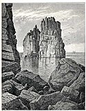
Island of Spinazzola
Trapani01.jpg
Autor/Urheber: lopez20, Lizenz: CC BY 2.0
Torre Colombaia, Trapani, Sicilia, Italia
Porto
Isola Formica.jpg
Autor/Urheber: Alessio Milan, Lizenz: CC BY-SA 2.0
Isola Formica (ital.Ameise) ist eine der kleineren Ägadischen Inseln. Sie liegt zwischen der Insel Levanzo und der Küstenstadt Trapani und gehört zu der Gemeinde Favignana. Auf ihr finden sich noch Überreste einer alten Tonnara und einem Kastell mit Leuchtturm. Die Insel ist im Privatbesitz und dient einer Stiftung als Rehabilitationszentrum für drogenabhängige Jugendliche.
Scoglio Cammello.jpg
Autor/Urheber: Francesco Crippa, Lizenz: CC BY 2.0
Scoglio Cammello, east of Marettimo, Egadian Islands, Italy
Spiaggia-dei-conigli2.jpg
Autor/Urheber: Der ursprünglich hochladende Benutzer war Frameme in der Wikipedia auf Italienisch, Lizenz: CC BY-SA 3.0
Foto da me scattata il 25/03/02 a Lampedusa
Scopello.jpg
Autor/Urheber: giulio nepi, Lizenz: CC BY 2.0
Faraglioni e tonnara di Scopello, Comune di Castellammare del Golfo (TP), Sicilia, Italia
Aerial image of Panarea (view from the southeast).jpg
Autor/Urheber: Carsten Steger, Lizenz: CC BY-SA 4.0
Luftbild von Panarea (Ansicht von Südosten)
Isola Lachea.jpg
Autor/Urheber: Andretna AndreaFiore (www.andreafiore.com), Lizenz: CC BY-SA 3.0
Isola Lachea
Faraglione di Levanzo.jpg
Il Faraglione, Levanzo (TP), Italy
Dattilo Lisca bianca.jpg
Autor/Urheber: Antoatwork, Lizenz: CC BY 2.0
Islets Dattilo and Lisca Bianca, East of Panarea, Aeolian Islands, Italy
Favignana lido burrone.jpg
Autor/Urheber: Dedda71, Lizenz: CC BY 3.0
Lido Burrone beach in Favignana
Lipari Scogli.jpg
Autor/Urheber: Tore Urnes, Lizenz: CC BY 2.0
Three Rocks SW of Lipari, Italy: Pietra Lunga, Pietra Menalda, Le Formiche
Isola delle correnti.jpg
Autor/Urheber: 3x0=3, Lizenz: CC BY 2.0
Sicilia, Isola delle correnti
Seafront at Ortygia.jpg
Autor/Urheber: Michael Wilson, Lizenz: CC BY 2.0

The seafront at Ortygia, Siracusa, Sicily with buildings dating back over 1000 years including the Castello Maniaces - left - (named after a Byzantine general who briefly reconquered the island from the Arabs in 1030 AD before dying in a failed coup d'etait against the Emporer Constantine IX) and the dome and facade of the Church of the Holy Spirit, headquarters of the Confraternity of the Holy Spirit and one of only a few churches opening on to the open sea.

Ortygia occupies the ancient Greek city of Syracuse. Originally a Greek colony but latterly a powerful city state ruled by the Tyrant of Syracuse. The title "tyrant" (female - tyranta) did not have it's modern meaning but rather was indicative of a king or dictator, often benign. However, since tyrants often came to power following a coup d'etat and were almost allways from outside the established ruling classes of a city, they were often painted as (modern) "tyrants" by those they had usurped.

This whole area is undergoing much restoration and rebuilding and I wager it will become a property "hot spot" in the not too distant future.... beautiful!

see...

<a href="http://en.wikipedia.org/wiki/Tyrant_of_Syracuse">en.wikipedia.org/wiki/Tyrant_of_Syracuse</a>

and <a href="http://en.wikipedia.org/wiki/Ortygia">en.wikipedia.org/wiki/Ortygia</a>
Lungomare
Faraglione Grande Ciclopi.jpg
Autor/Urheber: Matteo Bedendo, Lizenz: CC BY 2.0
Faraglione Grande, Isole dei Ciclopi, Sicilia, Italia
Isola delle Femmine.jpg
Autor/Urheber: Carlo Columba http://www.columba.it
uploaded by Esculapio, Lizenz: CC BY-SA 2.5
Isola delle Femmine, Sicily
Terrasini-bjs-16.jpg
Autor/Urheber: Bjs, Lizenz: CC0

Terrasini

Beach with rocks and Palazzo Aumale
Pantelleria Faraglione Tracino.jpg
Autor/Urheber: Gino Roncaglia, Lizenz: CC BY 2.0
Faraglione Tracino, Pantelleria, Italy
Aerial image of Alicudi (view from the south).jpg
Autor/Urheber: Carsten Steger, Lizenz: CC BY-SA 4.0
Luftbild von Alicudi (Ansicht von Süden)
Lampione islet.JPG
Autor/Urheber: Jeffrey Sciberras, Lizenz: CC BY 3.0
Lampione islet situated 17 km to the west of Lampedusa, photo by Arnold Sciberras
Aerial image of Stromboli (view from the northeast).jpg
Autor/Urheber: Carsten Steger, Lizenz: CC BY-SA 4.0
Luftbild von Stromboli (Ansicht von Nordosten); rechts ist die im nordwestlichen Teil der Insel gelegene Sciara del Fuoco zu sehen; im Hintergrund ist die Insel Panarea zu sehen
Scoglio la Nave.jpg
Autor/Urheber: Petr Vykoukal, Lizenz: CC BY 2.5
Panarea, Scoglio la Nave
Faraglione Medio.jpg
Autor/Urheber: Michael, Lizenz: CC BY 2.0
Faraglione Medio, Isole dei Ciclopi, Sicilia, Italy
Isola Scola1.jpg
Autor/Urheber: Der ursprünglich hochladende Benutzer war Otrebla86 in der Wikipedia auf Italienisch, Lizenz: CC BY-SA 3.0
Scattata il 24/06/2006 con il Nokia 6630
Marettimo02.jpg
Autor/Urheber: payhere, Lizenz: CC BY 2.0
Marettimo seen from Favignana, Sicily, Italy
Pantalleria Faraglione dietro l'Isola.jpg
Autor/Urheber: Luca Conti, Lizenz: CC BY 2.0
Faraglione dietro l'Isola, Pantelleria, southeast coast, Italy
Aerial image of Filicudi (view from the south).jpg
Autor/Urheber: Carsten Steger, Lizenz: CC BY-SA 4.0
Luftbild von Filicudi (Ansicht von Süden)
Aerial image of Salina (view from the southwest).jpg
Autor/Urheber: Carsten Steger, Lizenz: CC BY-SA 4.0
Luftbild von Salina (Ansicht von Südwesten)
Aerial image of Vulcano (view from the east).jpg
Autor/Urheber: Carsten Steger, Lizenz: CC BY-SA 4.0
Luftbild von Vulcano (Ansicht von Osten)
Pietra Lunga Lipari.jpg
Autor/Urheber: Leandro Neumann Ciuffo, Lizenz: CC BY 2.0
Pietra Lunga, SW of Lipari, Aeolian Islands, Sicily, TItaly
Strombolicchio2.jpg
Autor/Urheber: Giovanni from Catania, Sicily, Lizenz: CC BY-SA 2.0
L'isola di Strombolicchio.
UsticaFerry.jpg
(c) Erm67 aus der englischsprachigen Wikipedia, CC BY-SA 3.0
The island of Ustica seen from the sea.