Liste der Ramsar-Gebiete in Irland
Die Republik Irland trat am 15. März 1985 der Ramsar-Konvention bei, dem Übereinkommen über Feuchtgebiete von internationaler Bedeutung. Inzwischen gibt es 45 offiziell anerkannte Ramsar-Schutzgebiete mit einer Gesamtfläche von 66.994 Hektar. Auf nationaler Ebene ist das 2010 gegründete Irish Ramsar Wetlands Committee für diese Schutzgebiete zuständig. Es wird dabei vom National Parks and Wildlife Service Irlands (irisch An tSeirbhís Páirceanna Náisiúnta agus Fiadhúlra) und der irischen Environmental Protection Agency unterstützt. 2018 brachte das Komitee anlässlich der Bio Diversity Week, das Handbuch „Irish Wetland Types – An Identification Guide and Field Survey Manual“ heraus, das kostenlos heruntergeladen werden kann.
Liste der Ramsargebiete in Irland
| Name[1] | Gebiet | Lage | Fläche (km²) | Anerkannt seit | Beschreibung | Bild |
|---|---|---|---|---|---|---|
| Baldoyle Bay | County Dublin | 53° 24′ N, 6° 8′ W | 2,03 | 25. Oktober 1988 | Baldoyle Bay ist Teil des Dublin Bay Biosphärenreservats |  |
| Ballyallia Lough | County Clare | 52° 53′ N, 8° 55′ W | 3,08 | 11. Juni 1996 | Unterster See des River Fergus | (c) Ballyallia Lough by Gordon Hatton, CC BY-SA 2.0 |
| Ballycotton Bay | County Cork | 51° 50′ N, 8° 0′ W | 0,92 | 11. Juni 1996 |  | |
| Ballymacoda | County Cork | 51° 52′ N, 7° 55′ W | 3,75 | 11. Juni 1996 | ||
| Bannow Bay | County Wexford | 52° 27′ N, 6° 17′ W | 9,58 | 11. Juni 1996 |  | |
| Blacksod Bay and Broadhaven Bay | County Mayo | 54° 3′ N, 10° 0′ W | 6,83 | 11. Juni 1996 | Broadhaven Bay besteht aus Salzwiesen am Atlantik, Gezeitenflächen, Riffen und flachen Buchten |  |
| Blackwater Estuary | County Cork, County Waterford | 51° 57′ N, 7° 48′ W | 4,68 | 11. Juni 1996 | Die Flussmündung ist Heimat einer Vielzahl von Wattvögeln |  |
| Broadmeadow Estuary | County Fingal | 53° 27′ N, 6° 10′ W | 5,46 | 11. Juni 1996 | ||
| Castlemaine Harbour | County Kerry | 52° 7′ N, 9° 55′ W | 29,73 | 30. Mai 1990 |  | |
| Clara Bog | County Offaly | 53° 19′ N, 7° 37′ W | 4,60 | 6. Dezember 1988 | Eines der letzten Hochmoore in Irland |  |
| Coole Lough and Garryland Wood | County Galway | 53° 5′ N, 8° 51′ W | 3,64 | 30. Mai 1990 | Turloughs | (c) Dr Charles Nelson, CC BY-SA 2.0 |
| Cork Harbour | County Cork | 51° 50′ N, 8° 15′ W | 14,36 | 11. Juni 1996 |  | |
| Cummeen Strand | County Sligo | 54° 17′ N, 8° 30′ W | 14.91 | 11. Juni 1996 | ||
| Dundalk Bay | County Louth | 54° 0′ N, 6° 20′ W | 47.68 | 11. Juni 1996 | (c) Eric Jones, CC BY-SA 2.0 | |
| Dungarvan Harbour | County Waterford | 52° 3′ N, 7° 35′ W | 10,41 | 11. Juni 1996 | ||
| Easky Bog | County Sligo | 54° 11′ N, 8° 49′ W | 6,07 | 30. Mai 1990 | ||
| The Gearagh | County Cork | 51° 52′ N, 9° 1′ W | 3,07 | 30. Mai 1990 | ||
| Inner Galway Bay | 53° 12′ N, 9° 10′ W | 119,05 | 11. Juni 1996 | |||
| Killala Bay und Moy Estuary | County Mayo, County Sligo | 54° 15′ N, 9° 10′ W | 10,61 | 11. Juni 1996 | ||
| Knockmoyle und Sheskin | County Mayo | 54° 12′ N, 9° 33′ W | 11,98 | 1. Juni 1987 | ||
| Lough Barra Bog | County Donegal | 54° 57′ N, 8° 7′ W | 1,76 | 1. Juni 1987 |  | |
| Lough Corrib | 53° 30′ N, 9° 15′ W | 177,28 | 11. Juni 1996 |  | ||
| Lough Derravaragh | County Westmeath | 53° 40′ N, 7° 20′ W | 11,20 | 11. Juni 1996 |  | |
| Lough Ennell | County Westmeath | 53° 27′ N, 7° 23′ W | 14,04 | 11. Juni 1996 |  | |
| Lough Gara | County Sligo, County Roscommon | 53° 56′ N, 8° 25′ W | 17,42 | 11. Juni 1996 | ||
| Lough Glen | County Westmeath | 53° 25′ N, 7° 23′ W | 0,81 | 11. Juni 1996 | ||
| Lough Iron | County Westmeath | 53° 37′ N, 7° 17′ W | 1,82 | 11. Juni 1996 | ||
| Lough Oughter | 54° 2′ N, 7° 25′ W | 14,64 | 11. Juni 1996 |  | ||
| Lough Owel | County Westmeath | 53° 35′ N, 7° 23′ W | 10,32 | 11. Juni 1996 |  | |
| Meenachullion Bog | County Donegal | 54° 54′ N, 8° 7′ W | 1,94 | 30. Mai 1990 | ||
| Mongan Bog | County Offaly | 53° 19′ N, 7° 58′ W | 1,27 | 6. Dezember 1988 | ||
| North Bull Island | County Dublin | 53° 22′ N, 6° 8′ W | 14.36 | 6. September 1988 |  | |
| Owenboy | County Mayo | 54° 6′ N, 9° 28′ W | 3,97 | 1. Juni 1987 | ||
| Owenduff catchment | County Mayo | 54° 3′ N, 9° 40′ W | 13.82 | 31. Juli 1986 | ||
| Pettigo Plateau | County Donegal | 54° 37′ N, 7° 57′ W | 9,00 | 31. Juli 1986 | ||
| Pollardstown Fen | County Kildare | 53° 11′ N, 6° 51′ W | 1,30 | 30. Mai 1990 | (c) Anna Watson, CC BY-SA 2.0 | |
| Raheenmore Bog | County Offaly | 53° 20′ N, 7° 21′ W | 1,62 | 6. Dezember 1988 | ||
| The Raven | County Wexford | 52° 20′ N, 6° 19′ W | 5.89 | 31. Juli 1986 | (c) Chris, CC BY-SA 2.0 | |
| Rogerstown Estuary | Dublin | 53° 30′ N, 6° 8′ W | 1.95 | 25. Oktober 1988 | ||
| Sandymount Strand and Tolka Estuary | 53° 20′ N, 6° 12′ W | 6,54 | 11. Juni 1996 |  | ||
| Slieve Bloom Mountains | County Offaly, County Laois | 53° 3′ N, 7° 38′ W | 22,30 | 31. Juli 1986 | ||
| Tralee Bay | County Kerry | 52° 16′ N, 9° 48′ W | 8.61 | 10. Juli 1989 | (c) I, Terryballard, CC BY-SA 3.0 | |
| Tramore Backstrand | County Waterford | 52° 10′ N, 7° 7′ W | 3,67 | 11. Juni 1996 | Überwinterungsgebiet von Kiebitzregenpfeifer, Ufer- und Pfuhlschnepfen | (c) Eric Jones, CC BY-SA 2.0 |
| Trawbreaga Bay | County Donegal | 55° 17′ N, 7° 15′ W | 10,03 | 11. Juni 1996 | (c) Kenneth Allen, CC BY-SA 2.0 | |
| Wexford Wildfowl Reserve | County Wexford | 52° 30′ N, 6° 20′ W | 1,94 | 15. November 1984 | (c) Wexford Wildfowl Reserve by Mary and Angus Hogg, CC BY-SA 2.0 |
Einzelnachweise
- ↑ Ramsar Liste. Ramsar.org, abgerufen am 1. April 2023.
Weblinks
Auf dieser Seite verwendete Medien
Glengad stone circle overlooking Broadhaven Bay, Kilcommon, Erris, North Mayo, Ireland
(c) Anna Watson, CC BY-SA 2.0
Pollardstown Fen, a nature reserve, Special Area of Conservation, and Ramsar site in County Kildare, Ireland.
Autor/Urheber: Aerialpete, Lizenz: CC BY-SA 2.0
Looking SE into the sun on a flight from Manchester to Tenerife
Autor/Urheber: Jonjobaker, Lizenz: CC BY-SA 4.0
Baldoyle Bay Estuary From the Sky
(c) NL Buttonfreak, CC BY-SA 3.0
I monti Slieve Blooms, nella contea di Laois.
Sandymount Strand, Howth Head in the distance; Dublin, Ireland
Autor/Urheber: edward982, Lizenz: CC BY 3.0
A view of Cork Harbor from Blackrock Castle
The River Blackwater at Fermoy, Republic of Ireland
Autor/Urheber: Robert Leane, Lizenz: CC BY-SA 4.0
Castlemaine Harbour is located at the head of dingle bay and is the estuary of two rivers The River Maine and the River Laune. It is a Special Protection Area and a Special Area of Conservation.
(c) Eric Jones, CC BY-SA 2.0
View of the Mountains of the Cooley Peninsula from near the Halpenny Travel Garage
Lough Ennel
(c) Ballyallia Lough by Gordon Hatton, CC BY-SA 2.0
Ballyallia Lough
Lough Owel looking southwest
Autor/Urheber: Interfase, Lizenz: CC BY-SA 3.0
European countries (orthographic projection), as defined by the United Nations
(c) Dr Charles Nelson, CC BY-SA 2.0
Turlough in Garryland Wood. A turlough is a vanishing lough; full in winter, dry in summer. They are peculiar to, but not restricted to, the karst landscape of The Burren.
View of Ireland taken during ISS Expedition 16.
(c) Kenneth Allen, CC BY-SA 2.0
Trawbreaga Bay, Malin Pictured at Gorey Rocks
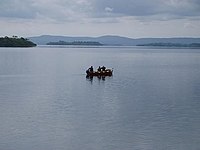
Fishermen on Lough Corrib, Ireland. From boat tour from Ashford Castle.
Dollymount Strand looking south towards the Dublin Mountains (Sarah777 21:38, 27 January 2007 (UTC))
(c) Wexford Wildfowl Reserve by Mary and Angus Hogg, CC BY-SA 2.0
Wexford Wildfowl Reserve
Autor/Urheber: Der ursprünglich hochladende Benutzer war Jeanne dArc in der Wikipedia auf Englisch, Lizenz: CC BY-SA 3.0
Knockeyon Hill and Lough Derravagh, County Westmeath, republic of Ireland
Autor/Urheber: Nacht Hexe, Lizenz: CC BY-SA 4.0
Captured in May 2016, in Clara Bog, Co.Offaly.
Lough Oughter, at Killykeen, County Cavan, Ireland


