Liste der Kategorie-A-Bauwerke in West Lothian

Lage von West Lothian in Schottland

Die Liste der Kategorie-A-Gebäude in West Lothian umfasst sämtliche in der Kategorie A eingetragenen Baudenkmäler in der schottischen Council Area West Lothian. Die Einstufung wird anhand der Kriterien von Historic Scotland vorgenommen, wobei in die höchste Kategorie A Bauwerke von nationaler oder internationaler Bedeutung einsortiert sind. In West Lothian sind derzeit 43 Bauwerke in der Kategorie A gelistet.

NameLageTypEintragBild
Abercorn ChurchAbercorn
55° 59′ 45,8″ N, 3° 28′ 27,4″ W
Kirche612
Abercorn Church
(c) M J Richardson, CC BY-SA 2.0
Hopetoun Housenahe South Queensferry
55° 59′ 43,2″ N, 3° 27′ 46,2″ W
Schloss613
Hopetoun House
(c) Peter Gumbrell, CC BY-SA 2.0
Außengebäude von Hopetoun Housenahe South Queensferry
55° 59′ 43,2″ N, 3° 27′ 46,2″ W
Wirtschaftsgebäude614
Midhope Castlenahe South Queensferry
55° 59′ 31,8″ N, 3° 29′ 16,3″ W
Tower House630Midhope Castle
House of the Binnsnahe Blackness
55° 59′ 26,5″ N, 3° 31′ 23,1″ W
Herrenhaus632
House of the Binns
(c) JThomas, CC BY-SA 2.0
Duntarvie Castlenahe Winchburgh
55° 58′ 21,8″ N, 3° 27′ 31,8″ W
Herrenhaus6422
Duntarvie Castle
(c) Richard Webb, CC BY-SA 2.0
Südtor von Hatton Housenahe Kirknewton
55° 54′ 4,6″ N, 3° 23′ 46,3″ W
Tor7355
Südtor von Hatton House
(c) Richard Webb, CC BY-SA 2.0
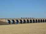
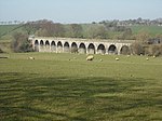
Linhouse Viaductnahe Livingston
55° 52′ 3,3″ N, 3° 28′ 36,8″ W
Brücke7365
Linhouse Viaduct
(c) Richard Webb, CC BY-SA 2.0
Almondell Bridgenahe Livingston
55° 54′ 13,7″ N, 3° 27′ 35,7″ W
Brücke7370
Almondell Bridge
(c) M J Richardson, CC BY-SA 2.0
Almondell Aqueductnahe Livingston
55° 54′ 4,2″ N, 3° 27′ 45,9″ W
Aquädukt7371
Almondell Aqueduct
(c) M J Richardson, CC BY-SA 2.0
Blackburn Housenahe Blackburn
55° 52′ 23,3″ N, 3° 35′ 53,8″ W
Herrenhaus7419Blackburn House
Broxburn Viaductnahe Broxburn
55° 56′ 14,7″ N, 3° 25′ 58,6″ W
Brücke7427
Broxburn Viaduct
(c) Richard Webb, CC BY-SA 2.0
Almond Valley Viaductnahe Broxburn
55° 56′ 1,9″ N, 3° 25′ 4,9″ W
Brücke7428Almond Valley Viaduct
Almond Aqueductnahe Broxburn
55° 55′ 13,2″ N, 3° 26′ 2,3″ W
Aquädukt7430Almond Aqueduct
Niddry Castlenahe Winchburgh
55° 57′ 14,1″ N, 3° 27′ 2,2″ W
Tower House7437
Niddry Castle
(c) Donald MacDonald, CC BY-SA 2.0
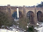
Avon Aqueductnahe Whitecross
55° 57′ 51,6″ N, 3° 39′ 22,5″ W
Aquädukt7468
Avon Aqueduct
(c) Eileen Henderson, CC BY-SA 2.0
Kingscavil Cottagesnahe Linlithgow
55° 58′ 16,9″ N, 3° 33′ 19,4″ W
Wohngebäude7482
Kingscavil Cottages
(c) M J Richardson, CC BY-SA 2.0
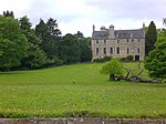
Grange Housenahe Linlithgow
55° 59′ 29,5″ N, 3° 36′ 14,9″ W
Villa12972
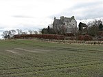
Ochiltree Castlenahe Bridgend
55° 57′ 21,8″ N, 3° 33′ 3,2″ W
Tower House12978
Ochiltree Castle
(c) M J Richardson, CC BY-SA 2.0
Preston HouseLinlithgow
55° 57′ 54,6″ N, 3° 36′ 36,6″ W
Herrenhaus12983
Avon Viaductnahe Westfield
55° 56′ 5,3″ N, 3° 42′ 27,2″ W
Brücke12985
Avon Viaduct
(c) Jim Smillie, CC BY-SA 2.0
Woodcockdalenahe Westfield
55° 57′ 54,5″ N, 3° 38′ 32″ W
Wohngebäude12989
Woodcockdale
(c) paul birrell, CC BY-SA 2.0
Mid Calder Parish ChurchMid Calder
55° 53′ 24,4″ N, 3° 28′ 57,2″ W
Kirche14144
Mid Calder Parish Church
(c) Paul Thomson, CC BY-SA 2.0
Calder HouseMid Calder
55° 53′ 21,9″ N, 3° 29′ 4″ W
Herrenhaus14153
Calder House
(c) Paul Thomson, CC BY-SA 2.0
Osttor von Calder HouseMid Calder
55° 53′ 22,1″ N, 3° 28′ 55,8″ W
Tor14155
Osttor von Calder House
(c) james denham, CC BY-SA 2.0
Linhousenahe Livingston
55° 51′ 2,7″ N, 3° 29′ 56,9″ W
Herrenhaus14156
Houstoun HouseUphall
55° 55′ 32,5″ N, 3° 31′ 4,5″ W
Hotel14243
Houstoun House
(c) Anne Burgess, CC BY-SA 2.0
Torphichen PreceptoryTorphichen
55° 56′ 4,8″ N, 3° 39′ 7,2″ W
Sakralbau14532
Torphichen Preceptory
(c) JThomas, CC BY-SA 2.0
Gowanbanknahe Avonbridge
55° 55′ 20,1″ N, 3° 44′ 12,1″ W
Bauernhof14557
Gowanbank
(c) paul birrell, CC BY-SA 2.0
Ehemalige Bathgate AcademyBathgate
55° 54′ 2″ N, 3° 38′ 2,1″ W
Schulgebäude22125
Ehemalige Bathgate Academy
(c) Richard Webb, CC BY-SA 2.0
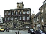
Linlithgow Burgh HallsLinlithgow
55° 58′ 38,7″ N, 3° 36′ 2,3″ W
Verwaltungsgebäude37362
Linlithgow Burgh Halls
(c) Thomas Nugent, CC BY-SA 2.0
Cross HouseLinlithgow
55° 58′ 38,5″ N, 3° 36′ 4″ W
Wohngebäude37363
Cross House
(c) Tom Sargent, CC BY-SA 2.0
St Michael’s WellLinlithgow
55° 58′ 36,1″ N, 3° 35′ 50,7″ W
Brunnen37383
St Michael’s Well
(c) Tom Sargent, CC BY-SA 2.0
West Port HouseLinlithgow
55° 58′ 33″ N, 3° 36′ 34,8″ W
Herrenhaus37430
38–44 High StreetLinlithgow
55° 58′ 33″ N, 3° 35′ 51,2″ W
Wohngebäude37438
46–48 High StreetLinlithgow
55° 58′ 36,8″ N, 3° 35′ 51,8″ W
Wohngebäude37439
Taubenturm von Learmonths GardensLinlithgow
55° 58′ 32,5″ N, 3° 35′ 54,4″ W
Taubenturm37468
Taubenturm von Learmonths Gardens
(c) Callum Black, CC BY-SA 2.0
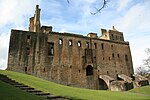
Linlithgow PalaceLinlithgow
55° 58′ 43,5″ N, 3° 36′ 3,1″ W
Palastruine37469Linlithgow Palace
Torhaus von Linlithgow PalaceLinlithgow
55° 58′ 41,2″ N, 3° 36′ 3,4″ W
Torhaus37470Torhaus von Linlithgow Palace
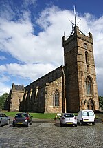
St Michael’s ChurchLinlithgow
55° 58′ 41,7″ N, 3° 36′ 1,5″ W
Kirche37499St Michael’s Church
Brucefield ChurchWhitburn
55° 52′ 0,7″ N, 3° 40′ 53,9″ W
Kirche51254
Brucefield Church
(c) Jim Smillie, CC BY-SA 2.0
Memorial Churchnahe Dechmont
55° 55′ 21,8″ N, 3° 33′ 3,3″ W
Kirche51902
Memorial Church
(c) M J Richardson, CC BY-SA 2.0
Halle des Bangour Village Hospitalnahe Dechmont
55° 55′ 15,3″ N, 3° 33′ 6,3″ W
Krankenhaus51903

Weblinks

Commons: Kategorie-A-Bauwerke in West Lothian – Sammlung von Bildern, Videos und Audiodateien

Auf dieser Seite verwendete Medien

Woodcockdale Stables - geograph.org.uk - 17097.jpg
(c) paul birrell, CC BY-SA 2.0
Woodcockdale Stables. These were once stables for the horses which towed barges along the Union Canal. Theya re now the headquarters of the West Lothian Sea Scouts!!
Avon Aqueduct - geograph.org.uk - 1691980.jpg
(c) Eileen Henderson, CC BY-SA 2.0
Avon Aqueduct This photo shows seven of the twelve arches of the Avon Aqueduct, which carries the Union Canal across the River Avon. At 247 metres long and 25.9 metres high, it is the longest and highest aqueduct in Scotland and the second longest in the UK. It was built between 1819 and 1822 by Hugh Baird (1770-1827), to a design by Thomas Telford (1757-1834) and, unusually, has a towpath on each side.
Linlithgow Town Hall - geograph.org.uk - 900869.jpg
(c) Thomas Nugent, CC BY-SA 2.0
Linlithgow Town Hall In Kirkgate, off High Street. St Michael's Church tower is visible to the top right.
Viaduct, Linhouse Water - geograph.org.uk - 1052530.jpg
(c) Richard Webb, CC BY-SA 2.0
Viaduct, Linhouse Water Carrying the Edinburgh to Carstairs Junction railway. Livingston in the background.
Viaduct over the Avon - geograph.org.uk - 1209635.jpg
(c) Jim Smillie, CC BY-SA 2.0
Viaduct over the Avon Bathed in spring sunshine.
Cross House - geograph.org.uk - 537781.jpg
(c) Tom Sargent, CC BY-SA 2.0
Cross House The building does not look like the Church Hall it is.
Niddry Castle.jpg
(c) Donald MacDonald, CC BY-SA 2.0
Niddry Castle, West Lothian, Scotland
Brucefield Church - geograph.org.uk - 1228608.jpg
(c) Jim Smillie, CC BY-SA 2.0
Brucefield Church The unusual design of this church opened in 1966 has recently been designated an 'A' listed building.
BlackburnHouse Seafield.jpg
Photo of Blackburn House, Near Seafield in West Lothian, Scotland.
Gingerbread House Avonbridge - geograph.org.uk - 168703.jpg
(c) paul birrell, CC BY-SA 2.0
Gingerbread House Avonbridge. I kid you not this is the name advertised on the gatepost for this ornate cottage at Gowanbank just south of Avonbridge
ScotlandWestLothian.png
Autor/Urheber: unknown, Lizenz: CC-BY-SA-3.0
Scottish-Castle-Symbol.svg
Autor/Urheber: Majo statt Senf, Lizenz: CC BY-SA 4.0
Schlosssymbol Schottland
Statue to St Michael - geograph.org.uk - 537214.jpg
(c) Tom Sargent, CC BY-SA 2.0
Statue to St Michael The Statue stands to the East end of the High Street. St Michael is the patron Saint of Linlithgow. The shield bears the Black Bitch which is the sign of Linlithgow. Use of the name as a description can lead to misunderstanding.
Bathgate Academy. - geograph.org.uk - 107140.jpg
(c) Richard Webb, CC BY-SA 2.0
Bathgate Academy. The school left the site in 1967, and the striking building has slowly decayed since. Now it is the centrepiece of new housing development.
RathoViaduct06.jpg
Ratho Railway Viaduct, West Lothian, Scotland
Abercorn Church - geograph.org.uk - 1298373.jpg
(c) M J Richardson, CC BY-SA 2.0
Abercorn Church A mostly post-reformation church, but with some Norman elements.
Almondell and Calder Wood Country Park - geograph.org.uk - 503059.jpg
(c) M J Richardson, CC BY-SA 2.0
Almondell and Calder Wood Country Park The feeder for the Union Canal crossing the R. Almond just downsteam from the weir NTo868 Almondellwhere the feed is taken from the river. The National Cycleway Network path no. 75 crosses the aqueduct. The water starts its journey at Cobbinshaw Reservoir NT0158 and reaches the Almond via the Murieston and Linhouse Waters. It enters the canal at the viaduct which crosses the Almond near Clifton Hall NT1070.
The Naysmith Bridge In Almondell - geograph.org.uk - 1758048.jpg
(c) M J Richardson, CC BY-SA 2.0
The Naysmith Bridge In Almondell Looking upstream from the west bank of the River Almond near the Visitor Centre. The bridge was built around 1800 and, after being wrecked for many years, was restored and reopened in 1998.
Kingscavil Cottages - geograph.org.uk - 1749562.jpg
(c) M J Richardson, CC BY-SA 2.0
Kingscavil Cottages At the junction of the Linlithgow-Winchburgh road and that from Ochiltree.
Midhope Castle 01.JPG
Autor/Urheber: Camer01, Lizenz: CC BY-SA 3.0
Midhope castle, general view.
Romanesque Church at Bangour - geograph.org.uk - 1735309.jpg
(c) M J Richardson, CC BY-SA 2.0
Romanesque Church at Bangour Built for the hospital between 1924-30.
Ochiltree in winter - geograph.org.uk - 1749365.jpg
(c) M J Richardson, CC BY-SA 2.0
Ochiltree in winter Large tower house in a prominent ridge-top position.
Gate, Hatton House - geograph.org.uk - 892997.jpg
(c) Richard Webb, CC BY-SA 2.0
Gate, Hatton House Ivy covered and very much disused. Under the pineapple is the date 1692, but either side, suggesting a rebuild is 1829.
LinlithgowPalaceGate.jpg
Autor/Urheber: Supergolden, Lizenz: CC-BY-SA-3.0
Gate or "forework" of Linlithgow Palace, Scotland.
Linlithgow-Palace.jpg
Autor/Urheber: Rob & Lisa Meehan, Lizenz: CC BY 2.0
Our first stop in our weekend drive through Scotland was Linlithgow Palace in Linlithgow, Scotland about 15 miles west of Edinburgh. Mary Queen of Scots was born at the Palace in December 1542
Calder House - geograph.org.uk - 761870.jpg
(c) james denham, CC BY-SA 2.0
Calder House An ancient entrance to and ancient house, home of the Sandiland family, Lords Torphican
Union icicle.jpg
Autor/Urheber: Citizenthom, Lizenz: CC BY-SA 3.0
Frozen icicle at the Almond Aqueduct overflow channel of the Union canal, near Ratho, Edinburgh
Doocot, Linlithgow canal basin - geograph.org.uk - 157859.jpg
(c) Callum Black, CC BY-SA 2.0
Doocot, Linlithgow canal basin This 16th century doocot (dovecot) just sneaks inside the northern edge of the square.
Viaduct, A89. - geograph.org.uk - 44301.jpg
(c) Richard Webb, CC BY-SA 2.0
Viaduct, A89. A small continuation of the Almond Valley Viaduct crosses the Edinburgh - Bathgate road just outside Broxburn. The boundary signs are for West Lothian Council, which has lost some of West Lothian here to the City of Edinburgh.
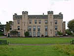
Houstoun House (geograph 3345301).jpg
(c) Anne Burgess, CC BY-SA 2.0
Houstoun House
St Michael's Church - Linlithgow 20090618.jpg
Autor/Urheber: Otter, Lizenz: CC BY-SA 3.0
St Michael's Church, Linlithgow, Scotland.