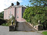
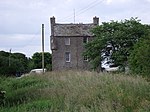
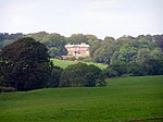
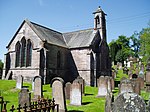
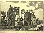
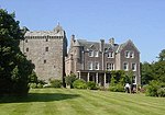
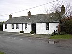
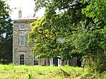
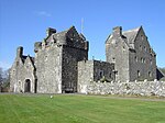
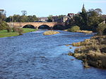
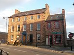
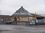
Liste der Kategorie-A-Bauwerke in Dumfries and Galloway

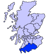
Lage von Dumfries and Galloway in Schottland

Die Liste der Kategorie-A-Gebäude in Dumfries and Galloway umfasst sämtliche in der Kategorie A eingetragenen Baudenkmäler in der schottischen Council Area Dumfries and Galloway. Die Einstufung wird anhand der Kriterien von Historic Scotland vorgenommen, wobei in die höchste Kategorie A Bauwerke von nationaler oder internationaler Bedeutung einsortiert sind. In Dumfries and Galloway sind derzeit 213 Bauwerke in der Kategorie A gelistet.

NameLageTypEintragBild
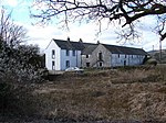
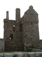
Rusco Towernahe Gatehouse of Fleet
54° 55′ 6,1″ N, 4° 12′ 37,7″ W
Tower House3299
Rusco Tower
(c) Colin Kinnear, CC BY-SA 2.0
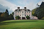
Ardwall Housenahe Gatehouse of Fleet
54° 52′ 2″ N, 4° 12′ 43,5″ W
Villa3302
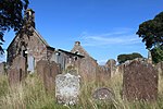
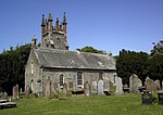
Friedhof der Anwoth Old Churchnahe Gatehouse of Fleet
54° 52′ 49,7″ N, 4° 12′ 38,2″ W
Friedhof3309
Friedhof der Anwoth Old Church
(c) Chris Newman, CC BY-SA 2.0
Barscobe Castlenahe Balmaclellan
55° 6′ 7,3″ N, 4° 6′ 7,7″ W
Wohngebäude3310Barscobe Castle
Ironmacannie Millnahe Balmaclellan
55° 3′ 16,3″ N, 4° 5′ 16,5″ W
Mühle3315
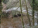
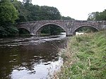
Ken Bridgenahe New Galloway
55° 4′ 51,4″ N, 4° 7′ 51,9″ W
Brücke3316
Ken Bridge
(c) David Medcalf, CC BY-SA 2.0
Millhouse BridgeMillhousebridge
55° 9′ 21,3″ N, 3° 24′ 23,5″ W
Brücke3324
Old Tollbar Cottagenahe Johnstonebridge
55° 11′ 51″ N, 3° 24′ 31,2″ W
Zollhaus3327
Old Tollbar Cottage
(c) Chris Newman, CC BY-SA 2.0
Stallungen von Jardine Hallnahe Templand
55° 10′ 36,1″ N, 3° 24′ 49,4″ W
Stallungen3340
Gärten von Jardine Hallnahe Templand
55° 10′ 36,6″ N, 3° 24′ 56,4″ W
Gärten3341
Buittle Bridgenahe Dalbeattie
54° 55′ 36″ N, 3° 50′ 20″ W
Brücke3364
Buittle Bridge
(c) Robert D Ferguson, CC BY-SA 2.0
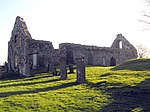
Buittle Old Churchnahe Dalbeattie
54° 55′ 8,2″ N, 3° 51′ 41,6″ W
Kirchenruine3365
Buittle Old Church
(c) Bill Henderson, CC BY-SA 2.0
Rammerscales Housenahe Hightae
55° 5′ 5,1″ N, 3° 26′ 22,8″ W
Herrenhaus3378
Rammerscales House
(c) Lynne Kirton, CC BY-SA 2.0
Corseyard Farmnahe Borgue
54° 48′ 43,6″ N, 4° 11′ 38,3″ W
Bauernhof3381
Corseyard Farm
(c) Lesley O'Hare, CC BY-SA 2.0
Borgue Old HouseBorgue
54° 48′ 36,1″ N, 4° 7′ 40,2″ W
Wohngebäude3393
Borgue Old House
(c) John M, CC BY-SA 2.0
Hensol Housenahe Crossmichael
55° 0′ 19,2″ N, 4° 4′ 20,4″ W
Villa3415
Hensol House
(c) Ann Cook, CC BY-SA 2.0
Sonnenuhr von Hensol Housenahe Crossmichael
55° 0′ 18,5″ N, 4° 4′ 18,8″ W
Sonnenuhr3416
Shillahill Bridgenahe Lockerbie
55° 6′ 45,4″ N, 3° 24′ 9,9″ W
Brücke3453
Shillahill Bridge
(c) Lynne Kirton, CC BY-SA 2.0
Friedhof der Dalton Old Parish ChurchDalton
55° 3′ 8,6″ N, 3° 23′ 16,8″ W
Friedhof3455
Friedhof der Dalton Old Parish Church
(c) Leslie Barrie, CC BY-SA 2.0
Denbie Housenahe Dalton
55° 2′ 35,2″ N, 3° 23′ 33,8″ W
Villa3469
Taubenturm von Denbie Housenahe Dalton
55° 2′ 38,6″ N, 3° 23′ 45,4″ W
Taubenturm3470
Bonshaw TowerKirtlebridge
55° 2′ 14,4″ N, 3° 11′ 12″ W
Tower House3489
Bonshaw Tower
(c) Colin Smith, CC BY-SA 2.0
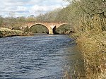
Brydekirk BridgeBrydekirk
55° 1′ 21,7″ N, 3° 16′ 26,5″ W
Brücke3494
Brydekirk Bridge
(c) John Holmes, CC BY-SA 2.0
Gilnockie Bridgenahe Canonbie
55° 5′ 39″ N, 2° 57′ 49,7″ W
Brücke3504
Gilnockie Bridge
(c) Mac McCarron, CC BY-SA 2.0
Byreburnfoot Bridgenahe Canonbie
55° 5′ 32,6″ N, 2° 57′ 25″ W
Brücke3520
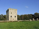
Gilnockie Towernahe Canonbie
55° 5′ 51,9″ N, 2° 58′ 10,6″ W
Tower House3527Gilnockie Tower
Scheune der Priorslynn FarmCanonbie
55° 4′ 23,8″ N, 2° 57′ 4,2″ W
Scheune3531
Riddings Junction Viaductnahe Canonbie
55° 4′ 16,6″ N, 2° 55′ 27,6″ W
Brücke3533
Riddings Junction Viaduct
(c) Simon Ledingham, CC BY-SA 2.0
Tarrasfoot Tile Worksnahe Langholm
55° 7′ 8,7″ N, 2° 58′ 22,6″ W
Ziegelei3535
Hoddom Castlenahe Brydekirk
55° 2′ 39,6″ N, 3° 19′ 22,2″ W
Burg3558
Hoddom Castle
(c) Mike and Kirsty Grundy, CC BY-SA 2.0
Repentance Towernahe Brydekirk
55° 2′ 15″ N, 3° 19′ 25,4″ W
Tower House3570
Repentance Tower
(c) Mike and Kirsty Grundy, CC BY-SA 2.0
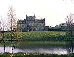
Kinmount Housenahe Cummertrees
55° 0′ 19,2″ N, 3° 20′ 44,5″ W
Herrenhaus3582
Kinmount House
(c) Barry Dale, CC BY-SA 2.0
Earlstoun Castlenahe St John’s Town of Dalry
55° 7′ 52,2″ N, 4° 10′ 39,3″ W
Tower House3624
Grennan Millnahe St John’s Town of Dalry
55° 5′ 55,5″ N, 4° 7′ 39,5″ W
Mühle3625
Crossmichael Parish ChurchCrossmichael
54° 58′ 52,2″ N, 3° 59′ 11″ W
Kirche3698
Crossmichael Parish Church
(c) Chris Newman, CC BY-SA 2.0
Gordon MemorialCrossmichael
54° 58′ 52,2″ N, 3° 59′ 10,1″ W
Denkmal3699
Glenlochar BridgeGlenlochar
54° 57′ 32,7″ N, 3° 58′ 54″ W
Brücke3706
Greenlaw Housenahe Castle Douglas
54° 57′ 31,6″ N, 3° 56′ 50,7″ W
Villa3708
Southwick Home Farmnahe Southerness
54° 53′ 42,9″ N, 3° 39′ 33,6″ W
Bauernhof3723
Southwick Home Farm
(c) Chris Newman, CC BY-SA 2.0
Stapleton Towernahe Annan
55° 0′ 30,5″ N, 3° 11′ 53,1″ W
Tower House3782
Stapleton Tower
(c) Walter Baxter, CC BY-SA 2.0
Dornock HouseDornock
54° 58′ 58,9″ N, 3° 12′ 7″ W
Bauernhof3792
Crichton Royal HospitalDumfries
55° 3′ 12,2″ N, 3° 35′ 47,1″ W
Krankenhaus3839Crichton Royal Hospital
Durisdeer Parish ChurchDurisdeer
55° 18′ 56″ N, 3° 44′ 39,5″ W
Kirche3856Durisdeer Parish Church
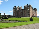
Drumlanrig Castlenahe Thornhill
55° 16′ 25,1″ N, 3° 48′ 32,1″ W
Schloss3886
Drumlanrig Castle
(c) M J Richardson, CC BY-SA 2.0
Wallacehall AcademyCloseburn
55° 12′ 49,3″ N, 3° 43′ 35,8″ W
Schule3953
Auldgirth BridgeAuldgirth
55° 9′ 34,2″ N, 3° 42′ 35,3″ W
Brücke3966
Auldgirth Bridge
(c) Walter Baxter, CC BY-SA 2.0
Dalgonar Bridgenahe Dunscore
55° 8′ 16,4″ N, 3° 47′ 21,7″ W
Brücke4227
Dunscore Parish ChurchDunscore
55° 8′ 25,3″ N, 3° 46′ 46,2″ W
Kirche4230
Dunscore Parish Church
(c) Chris Newman, CC BY-SA 2.0
Ellisland Farmnahe Auldgirth
55° 8′ 14,6″ N, 3° 40′ 48,6″ W
Bauernhof4232Ellisland Farm
Crichton FarmDumfries
55° 2′ 52,1″ N, 3° 35′ 33,4″ W
Bauernhof6693
Crichton Memorial ChurchDumfries
55° 3′ 3,5″ N, 3° 35′ 37,7″ W
Kirche6695
Crichton Memorial Church
(c) Chris Upson, CC BY-SA 2.0
Hills Towernahe Lochfoot
55° 2′ 11,5″ N, 3° 42′ 13,3″ W
Tower House9715
Hills Tower
(c) Colin Kinnear, CC BY-SA 2.0
Duchess BridgeLangholm
55° 9′ 26,1″ N, 3° 0′ 44,6″ W
Brücke9734
Duchess Bridge
(c) Howard Mattinson, CC BY-SA 2.0
Scheune von Knocknalling Housenahe St John’s Town of Dalry
55° 8′ 17″ N, 4° 12′ 11,9″ W
Scheune9746
Milnholm Farmhousenahe Langholm
55° 10′ 32,3″ N, 3° 0′ 50,6″ W
Bauernhaus9763
Skipper’s Bridgenahe Langholm
55° 8′ 27,3″ N, 2° 59′ 19,5″ W
Brücke9764
Skipper’s Bridge
(c) Anne Burgess, CC BY-SA 2.0
Mossknowe Housenahe Kirkpatrick-Fleming
55° 1′ 1,7″ N, 3° 7′ 33″ W
Herrenhaus9799
Springkell Housenahe Eaglesfield
55° 3′ 55,8″ N, 3° 10′ 4,8″ W
Herrenhaus9805
Stallungen von Wyseby HouseKirtlebridge
55° 2′ 27,7″ N, 3° 11′ 21,5″ W
Stallungen9808
Grabstätte der Grahams of MossknoweKirkpatrick-Fleming
55° 1′ 12,3″ N, 3° 7′ 59,9″ W
Grabstätte9813
Grabstätte der Grahams of Mossknowe (flacher, ruinöser Anbau rechts)
(c) james denham, CC BY-SA 2.0
Douglas Mausoleumnahe Castle Douglas
54° 55′ 20,4″ N, 3° 56′ 17,7″ W
Mausoleum9835
Douglas Mausoleum
(c) Chris Newman, CC BY-SA 2.0
Gelston Castlenahe Gelston
54° 54′ 17,1″ N, 3° 54′ 31,3″ W
Herrenhaus9836
Gelston Castle
(c) Chris Newman, CC BY-SA 2.0
Old Bridge of DeeBridge of Dee
54° 55′ 5,7″ N, 3° 58′ 34,5″ W
Brücke9838
Old Bridge of Dee
(c) Les Harvey, CC BY-SA 2.0
Craigielands HouseBeattock
55° 17′ 58,4″ N, 3° 27′ 22,9″ W
Villa9842
Cally Palace Hotelnahe Gatehouse of Fleet
54° 52′ 10,5″ N, 4° 10′ 59,9″ W
Hotel9854
Cally Palace Hotel
(c) Christine Matthews, CC BY-SA 2.0
Friedhof der Girthon Old KirkGirthon
54° 51′ 20,6″ N, 4° 10′ 25,5″ W
Friedhof9859
Friedhof der Girthon Old Kirk
(c) Robert Guthrie, CC BY-SA 2.0
Raehills Housenahe Johnstonebridge
55° 14′ 3,5″ N, 3° 28′ 25,5″ W
Herrenhaus9898
Raehills House
(c) Chris Newman, CC BY-SA 2.0
The Old Brig InnBeattock
55° 18′ 39,3″ N, 3° 27′ 17,5″ W
Hotel9908
The Old Brig Inn
(c) Oliver Dixon, CC BY-SA 2.0
Hutton and Corrie Parish ChurchBoreland
55° 12′ 17,3″ N, 3° 18′ 18″ W
Kirche9911
Hutton and Corrie Parish Church
(c) Chris Newman, CC BY-SA 2.0
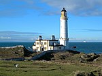
Corsewall LighthouseCorsewall Point
55° 0′ 25,5″ N, 5° 9′ 33,9″ W
Leuchtturm9923
Corsewall Lighthouse
(c) Mary and Angus Hogg, CC BY-SA 2.0
Kinnel Bridgenahe Templand
55° 9′ 3,7″ N, 3° 25′ 49,4″ W
Brücke9950
Kinnel Bridge
(c) M J Richardson, CC BY-SA 2.0
Spedlins Towernahe Templand
55° 10′ 26,3″ N, 3° 25′ 5,6″ W
Tower House9965
Spedlins Tower
(c) Chris Newman, CC BY-SA 2.0
Elshieshields Towernahe Templand
55° 9′ 3″ N, 3° 27′ 45,4″ W
Tower House9970
Stallungen von Halleathsnahe Lochmaben
55° 7′ 37,3″ N, 3° 25′ 1,4″ W
Stallungen9971
Hoddom Bridgenahe Brydekirk
55° 2′ 30,6″ N, 3° 18′ 37,7″ W
Brücke10026
Hoddom Bridge
(c) Peter Bond, CC BY-SA 2.0
Windmühle von Shortriggnahe Ecclefechan
55° 3′ 24,1″ N, 3° 18′ 51,5″ W
Windmühle10041
Geburtshaus von Thomas CarlyleEcclefechan
55° 3′ 32,9″ N, 3° 15′ 51,3″ W
Wohngebäude10065
Geburtshaus von Thomas Carlyle
(c) Nigel Homer, CC BY-SA 2.0
Kirkcowan Parish ChurchKirkcowan
54° 54′ 55″ N, 4° 36′ 39,1″ W
Kirche10066
Kirkcowan Parish Church
(c) David Baird, CC BY-SA 2.0
Craichlaw Housenahe Kirkcowan
54° 54′ 56,6″ N, 4° 38′ 38,6″ W
Herrenhaus10076
Craichlaw House
(c) David Baird, CC BY-SA 2.0
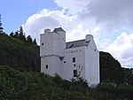
Barholm Castlenahe Carsluith
54° 50′ 58,2″ N, 4° 18′ 19,7″ W
Tower House10093Barholm Castle
Carsluith Castlenahe Carsluith
54° 51′ 33,9″ N, 4° 20′ 48″ W
Tower House10104
Carsluith Castle
(c) Alison Stamp, CC BY-SA 2.0
Torzufahrt zu Baldoon Castlenahe Bladnoch
54° 51′ 9,3″ N, 4° 27′ 13,1″ W
Tor10109
Torzufahrt zu Baldoon Castle
(c) Andy Farrington, CC BY-SA 2.0
Old Place of Monreithnahe Port William
54° 45′ 21,2″ N, 4° 31′ 1,5″ W
Tower House10123
Old Place of Monreith
(c) Andy Farrington, CC BY-SA 2.0
Ravenstone Castlenahe Sorbie
54° 46′ 2,3″ N, 4° 28′ 26,8″ W
Tower House10133
Ravenstone Castle
(c) Chris Newman, CC BY-SA 2.0
Glasserton Parish Churchnahe Whithorn
54° 42′ 46,5″ N, 4° 27′ 8,3″ W
Kirche10137
Glasserton Parish Church
(c) Colin Kinnear, CC BY-SA 2.0
Craigcaffie Towernahe Stranraer
54° 56′ 6,5″ N, 4° 59′ 6,4″ W
Tower House10164
Craigcaffie Tower
(c) Colin McDonald, CC BY-SA 2.0
Lochryan HouseCairnryan
54° 58′ 33,2″ N, 5° 1′ 35,5″ W
Herrenhaus10168
Lochryan House
(c) Julia MacDonald, CC BY-SA 2.0
Lochinch Castlenahe Castle Kennedy
54° 54′ 52,9″ N, 4° 57′ 22″ W
Herrenhaus10179Lochinch Castle
Old Bridge of Urr MillOld Bridge of Urr
54° 59′ 19,8″ N, 3° 54′ 49,5″ W
Mühle10191
Old Bridge of Urr Mill
(c) Kirsty Smith, CC BY-SA 2.0
Fourmerkland Towernahe Dumfries
55° 6′ 32,9″ N, 3° 42′ 44,7″ W
Tower House10204
Fourmerkland Tower
(c) Bob Cowan, CC BY-SA 2.0
West Galloberry Farmnahe Kirkton
55° 7′ 37,7″ N, 3° 37′ 34,1″ W
Bauernhof10218
Stallungen von Blackwood Housenahe Auldgirth
55° 9′ 54,9″ N, 3° 43′ 3,3″ W
Stallungen10244
Capenoch Housenahe Penpont
55° 13′ 30,4″ N, 3° 49′ 11,2″ W
Herrenhaus10247
Kilneiss HouseMoniaive
55° 11′ 53,4″ N, 3° 55′ 41,8″ W
Villa10298
Carnsalloch Housenahe Kirkton
55° 6′ 22,8″ N, 3° 36′ 52,5″ W
Herrenhaus10300
Carnsalloch Chapel at the Mountnahe Kirkton
55° 6′ 44,4″ N, 3° 36′ 31,9″ W
Kirche10301
Stallungen von Carnsalloch Housenahe Kirkton
55° 6′ 26,1″ N, 3° 36′ 39,9″ W
Stallungen10303
Glenluiart Housenahe Moniaive
55° 11′ 47,5″ N, 3° 56′ 34,7″ W
Villa10307
Glencairn Parish Churchnahe Moniaive
55° 11′ 38,8″ N, 3° 52′ 20,7″ W
Kirche10312
Glencairn Parish Church
(c) Craig Brown, CC BY-SA 2.0
Craigdarroch Housenahe Moniaive
55° 11′ 46,4″ N, 3° 58′ 43,3″ W
Herrenhaus10340
Craigdarroch House
(c) Lee Brown, CC BY-SA 2.0
Ross Mainsnahe Templand
55° 11′ 0,3″ N, 3° 28′ 1,7″ W
Bauernhaus10353
John Paul Jones’ Cottagenahe Southerness
54° 53′ 55,6″ N, 3° 34′ 48,7″ W
Wohngebäude10397
John Paul Jones’ Cottage
(c) Duncan MacMillan, CC BY-SA 2.0
Arbigland Housenahe Southerness
54° 54′ 4,8″ N, 3° 34′ 37″ W
Herrenhaus10398
Southerness LighthouseSoutherness
54° 52′ 22,2″ N, 3° 35′ 42″ W
Leuchtturm10415
Southerness Lighthouse
(c) Anne Burgess, CC BY-SA 2.0
Shennanton Housenahe Kirkcowan
54° 56′ 44,6″ N, 4° 35′ 34,6″ W
Villa13106
Kirkdale Bridgenahe Carsluith
54° 51′ 2,4″ N, 4° 18′ 39,4″ W
Brücke13137
Kirkdale Housenahe Carsluith
54° 51′ 8,2″ N, 4° 18′ 53,5″ W
Villa13138Kirkdale House
Kirkdale Kirknahe Carsluith
54° 51′ 32,7″ N, 4° 19′ 10,1″ W
Kirchenruine13139
Kirkdale Kirk
(c) Anthony O'Neil, CC BY-SA 2.0
Stallungen von Kirkdale Housenahe Carsluith
54° 51′ 17,9″ N, 4° 19′ 4,6″ W
Stallungen13140
Lochnaw Castlenahe Leswalt
54° 55′ 10,8″ N, 5° 8′ 8,7″ W
Herrenhaus13498
Lochnaw Castle
(c) Richard Paxman, CC BY-SA 2.0
Gärten von Lochnaw Castlenahe Leswalt
54° 55′ 17,8″ N, 5° 8′ 26,8″ W
Gärten13505
Logan Housenahe Port Logan
54° 44′ 39,4″ N, 4° 57′ 31,7″ W
Herrenhaus13564
Logan House
(c) Jonathan Wilkins, CC BY-SA 2.0
Logan Windmillnahe Ardwell
54° 45′ 12,9″ N, 4° 55′ 49,1″ W
Windmühle13570
Logan Windmill
(c) Patrick Lee, CC BY-SA 2.0
Mull of Galloway LighthouseMull of Galloway
54° 38′ 5,9″ N, 4° 51′ 26,6″ W
Leuchtturm13578
Mull of Galloway Lighthouse
(c) Tam and Karen, CC BY-SA 2.0
Old Parish Church of Kirkmaidennahe Drummore
54° 41′ 32,4″ N, 4° 54′ 40,8″ W
Kirche13581
Old Parish Church of Kirkmaiden
(c) Jeff Wells, CC BY-SA 2.0
Kirkmadrine Churchnahe Sandhead
54° 47′ 36,8″ N, 4° 59′ 15,9″ W
Kirche16739
Kirkmadrine Church
(c) Ann Cook, CC BY-SA 2.0
Portpatrick Old Parish ChurchPortpatrick
54° 50′ 33,7″ N, 5° 6′ 59,7″ W
Kirchenruine16743
Portpatrick Old Parish Church
(c) Bill Henderson, CC BY-SA 2.0
Isle CastleIsle of Whithorn
54° 42′ 4,8″ N, 4° 21′ 56,7″ W
Tower House16751
Isle Castle
(c) Astrid Horn, CC BY-SA 2.0
Castle of Parknahe Glenluce
54° 52′ 33,5″ N, 4° 49′ 31,9″ W
Tower House16761Castle of Park
Haugh BridgeHaugh of Urr
54° 58′ 26,5″ N, 3° 52′ 4,2″ W
Brücke16807
Haugh Bridge
(c) Robert D Ferguson, CC BY-SA 2.0
Scheune der Archbank Farmnahe Moffat
55° 20′ 49,5″ N, 3° 26′ 7,3″ W
Scheune16847
Granton Housenahe Moffat
55° 22′ 28,1″ N, 3° 27′ 43,2″ W
Villa16858
HeatheryhaughMoffat
55° 20′ 30,8″ N, 3° 25′ 56,8″ W
Villa16861
Cruggleton Churchnahe Garlieston
54° 45′ 25,6″ N, 4° 22′ 0,1″ W
Kirche16875
Cruggleton Church
(c) Leslie Barrie, CC BY-SA 2.0
Galloway Housenahe Garlieston
54° 46′ 45,4″ N, 4° 22′ 1,9″ W
Herrenhaus16876
Galloway House
(c) John Clive Nicholson, CC BY-SA 2.0
Castlemilknahe Kettleholm
55° 5′ 3,6″ N, 3° 20′ 2,7″ W
Herrenhaus16888
Brücke von Castlemilknahe Kettleholm
55° 4′ 57,1″ N, 3° 19′ 56,4″ W
Brücke16890
Johnstone MausoleumBentpath
55° 12′ 9,4″ N, 3° 4′ 52,3″ W
Mausoleum16921
Johnstone Mausoleum
(c) Kevin Rae, CC BY-SA 2.0
Bentpath BridgeBentpath
55° 12′ 6,1″ N, 3° 4′ 59,3″ W
Brücke16939
Bentpath Bridge
(c) Walter Baxter, CC BY-SA 2.0
Barwhinnock Housenahe Twynholm
54° 52′ 17,6″ N, 4° 5′ 40,6″ W
Villa16989
Cumstoun Housenahe Kirkcudbright
54° 51′ 26″ N, 4° 3′ 10,2″ W
Herrenhaus16993
Cumloden Housenahe Minnigaff
54° 58′ 43,2″ N, 4° 28′ 27,5″ W
Villa17052
Cumloden House
(c) Chris Newman, CC BY-SA 2.0
Dundrennan AbbeyDundrennan
54° 48′ 24,5″ N, 3° 56′ 50″ W
Klosterruine17072Dundrennan Abbey
Tor von Corsock Housenahe Corsock
55° 3′ 39,8″ N, 3° 56′ 24,8″ W
Tor17094
Tor von Corsock House
(c) Ruth Madigan, CC BY-SA 2.0
Argrennan Housenahe Tongland
54° 54′ 3″ N, 4° 0′ 22″ W
Herrenhaus17114
Argrennan House
(c) Ed Iglehart, CC BY-SA 2.0
Old Tongland BridgeTongland
54° 51′ 38,5″ N, 4° 1′ 53,7″ W
Brücke17123
Tongland BridgeTongland
54° 51′ 28,1″ N, 4° 2′ 20,8″ W
Brücke17125Tongland Bridge
Wasserkraftwerk TonglandTongland
54° 51′ 35″ N, 4° 2′ 3,6″ W
Kraftwerk17126Wasserkraftwerk Tongland
Torthorwald Cruck CottageTorthorwald
55° 5′ 28,6″ N, 3° 31′ 1,4″ W
Wohngebäude17157
Miners’ LibraryWanlockhead
55° 23′ 52,4″ N, 3° 46′ 46,9″ W
Bücherei17192
Miners’ Library
(c) Donald MacDonald, CC BY-SA 2.0
Goldielea Viaductnahe Cargenbridge
55° 2′ 43,3″ N, 3° 40′ 32,6″ W
Brücke17201
Goldielea Viaduct
(c) Richard Webb, CC BY-SA 2.0
Kirkconnel Housenahe New Abbey
54° 59′ 47″ N, 3° 35′ 46″ W
Herrenhaus17204
Stallungen von Terregles HouseTerregles
55° 4′ 54,3″ N, 3° 40′ 31,2″ W
Stallungen17208
Tynron Parish ChurchTynron
55° 13′ 0,5″ N, 3° 52′ 42,1″ W
Kirche17222
Tynron Parish Church
(c) Kevin Rae, CC BY-SA 2.0
Amisfield Towernahe Amisfield
55° 8′ 17,8″ N, 3° 34′ 57,5″ W
Tower House17233Amisfield Tower
Tinwald Housenahe Tinwald
55° 6′ 26,2″ N, 3° 32′ 30,2″ W
Herrenhaus17238
Tinwald House
(c) Colin Kinnear, CC BY-SA 2.0
Cottages von Tinwald Housenahe Tinwald
55° 6′ 24,3″ N, 3° 32′ 29,4″ W
Wohngebäude17239
Gutshof von Tinwald Housenahe Tinwald
55° 6′ 27,3″ N, 3° 32′ 33,5″ W
Stallungen17240
Comlongon Castlenahe Clarencefield
55° 0′ 23,4″ N, 3° 26′ 26,8″ W
Tower House17245
Comlongon Castle
(c) Angus Townley, CC BY-SA 2.0
Ruthwell MuseumRuthwell
54° 59′ 34,6″ N, 3° 24′ 19,2″ W
Museum17249
Ruthwell Museum
(c) Colin Kinnear, CC BY-SA 2.0
Nith Bridgenahe Thornhill
55° 14′ 26,1″ N, 3° 46′ 38,7″ W
Brücke17286
Nith Bridge
(c) David Hamilton, CC BY-SA 2.0
Gärtnerhaus von Drumlanrig Castlenahe Thornhill
55° 15′ 53,1″ N, 3° 47′ 57,4″ W
Wohngebäude17297
Sweetheart AbbeyNew Abbey
54° 58′ 48,9″ N, 3° 37′ 7,8″ W
Klosterruine17304
Sweetheart Abbey
(c) Debbie Turner, CC BY-SA 2.0
New Abbey MillNew Abbey
54° 58′ 48″ N, 3° 37′ 23,2″ W
Mühle17323
New Abbey Mill
(c) John Lord, CC BY-SA 2.0
Thornhill CrossThornhill
55° 14′ 26,6″ N, 3° 45′ 53,7″ W
Marktkreuz17337
Thornhill Cross
(c) derek menzies, CC BY-SA 2.0
The Old HouseNew Abbey
54° 58′ 47,1″ N, 3° 37′ 25,1″ W
Wohngebäude17346
Henry Duncan MonumentMouswald
55° 1′ 47,3″ N, 3° 27′ 12,6″ W
Denkmal17388
Sorbie Towernahe Sorbie
54° 47′ 38,8″ N, 4° 24′ 39,6″ W
Tower House19181
Sorbie Tower
(c) Astrid Horn, CC BY-SA 2.0
All Saints Episcopal Churchnahe Newton Stewart
54° 58′ 32,7″ N, 4° 31′ 28,4″ W
Kirche19190
All Saints Episcopal Church
(c) Mark McKie, CC BY-SA 2.0
Tonderghie Housenahe Isle of Whithorn
54° 41′ 31,1″ N, 4° 25′ 0,4″ W
Villa19248
Tonderghie House
(c) Chris Newman, CC BY-SA 2.0
Gutshof von Tonderghie Housenahe Isle of Whithorn
54° 41′ 21,4″ N, 4° 25′ 6,4″ W
Bauernhof19249
Heron MonumentMinnigaff
54° 58′ 6,1″ N, 4° 29′ 7,8″ W
Grabstätte19313
Monreith Housenahe Port William
54° 45′ 13,3″ N, 4° 33′ 22,9″ W
Herrenhaus19561
Monreith House
(c) Ann Cook, CC BY-SA 2.0
Old Place of Mochrumnahe Kirkcowan
54° 51′ 10,5″ N, 4° 38′ 13,8″ W
Tower House19570
Old Place of Mochrum
(c) Slidzenicely, CC BY-SA 2.0
Annan BridgeAnnan
54° 59′ 14,2″ N, 3° 15′ 56,9″ W
Brücke21061Annan Bridge
27–29 Bank StreetAnnan
54° 59′ 10,2″ N, 3° 15′ 43,6″ W
Wohn- und Geschäftsgebäude21066
5–9 High StreetAnnan
54° 59′ 12,6″ N, 3° 15′ 53,6″ W
Wohngebäude21086
5–9 High Street
(c) Chris Downer, CC BY-SA 2.0
Annan Old Parish ChurchAnnan
54° 59′ 15,1″ N, 3° 15′ 29,8″ W
Kirche21106
Annan Old Parish Church
(c) james denham, CC BY-SA 2.0
Viehmarkthalle von Castle DouglasCastle Douglas
54° 56′ 32,8″ N, 3° 55′ 28,6″ W
Markthalle22976
Viehmarkthalle von Castle Douglas
(c) derek menzies, CC BY-SA 2.0
Lincluden Collegiate ChurchDumfries
55° 5′ 6″ N, 3° 37′ 14,7″ W
Kirchenruine26075
Lincluden Collegiate Church
(c) Darrin Antrobus, CC BY-SA 2.0
5–11 Bank StreetDumfries
55° 4′ 4,2″ N, 3° 36′ 44,7″ W
Wohn- und Geschäftsgebäude26083
Alte Methodistische KircheDumfries
55° 4′ 13,2″ N, 3° 36′ 48,5″ W
Kirche26102
Alte Methodistische Kirche von Dumfries
(c) Richard Dorrell, CC BY-SA 2.0
Robert Burns’ HouseDumfries
55° 3′ 57,9″ N, 3° 36′ 29,1″ W
Wohngebäude26115Robert Burns’ House
25–37 Castle StreetDumfries
55° 4′ 14″ N, 3° 36′ 49,5″ W
Wohngebäude26118
41–47 Castle StreetDumfries
55° 4′ 16,6″ N, 3° 36′ 53″ W
Wohngebäude26120
14–24 Castle StreetDumfries
55° 4′ 14,2″ N, 3° 36′ 47,5″ W
Wohngebäude26122
26–30 Castle StreetDumfries
55° 4′ 17″ N, 3° 36′ 51,4″ W
Wohngebäude26123
Greyfriars ChurchDumfries
55° 4′ 13,5″ N, 3° 36′ 45,4″ W
Kirche26126
Greyfriars Church
(c) Richard Dorrell, CC BY-SA 2.0
Dumfries MuseumDumfries
55° 3′ 55,1″ N, 3° 36′ 52,8″ W
Museum26135
Dumfries Museum
(c) Lairich Rig, CC BY-SA 2.0
Queensberry ColumnDumfries
55° 4′ 8,9″ N, 3° 36′ 39″ W
Denkmal26173Queensberry Column
MidsteepleDumfries
55° 4′ 7,7″ N, 3° 36′ 38,8″ W
Rathaus26215Midsteeple
The Globe InnDumfries
55° 4′ 3,2″ N, 3° 36′ 34,6″ W
Gasthaus26230
The Globe Inn
(c) Colin Smith, CC BY-SA 2.0
Trades HallDumfries
55° 4′ 8,4″ N, 3° 36′ 38,1″ W
Versammlungsgebäude26234Trades Hall
29 Irish StreetDumfries
55° 3′ 58,8″ N, 3° 36′ 38,8″ W
Villa2624029 Irish Street
24 Nith PlaceDumfries
55° 3′ 59,5″ N, 3° 36′ 33,5″ W
Villa26305
St Michael’s ChurchDumfries
55° 3′ 54,4″ N, 3° 36′ 22,6″ W
Kirche26335
St Michael’s Church
(c) Alison Stamp, CC BY-SA 2.0
Friedhof der St Michael’s ChurchDumfries
55° 3′ 54,4″ N, 3° 36′ 20,5″ W
Friedhof26336
Burns’ MausoleumDumfries
55° 3′ 54,3″ N, 3° 36′ 17,7″ W
Mausoleum26337Burns’ Mausoleum
Devorgilla BridgeDumfries
55° 4′ 5,4″ N, 3° 36′ 58,4″ W
Brücke26354
Devorgilla Bridge
(c) John Jardine, CC BY-SA 2.0
MacLellan’s CastleKirkcudbright
54° 50′ 13,4″ N, 4° 3′ 11,3″ W
Tower House36484MacLellan’s Castle
Blair HouseKirkcudbright
54° 50′ 13,3″ N, 4° 3′ 15,2″ W
Villa36529
Broughton HouseKirkcudbright
54° 50′ 12,6″ N, 4° 3′ 15,7″ W
Villa36530
Broughton House
(c) Anthony O'Neil, CC BY-SA 2.0
Tolbooth von KirkcudbrightKirkcudbright
54° 50′ 7,6″ N, 4° 3′ 20,5″ W
Rathaus36542
Tolbooth von Kirkcudbright
(c) Chris Newman, CC BY-SA 2.0
66–70 High StreetKirkcudbright
54° 50′ 7,3″ N, 4° 3′ 19,4″ W
Wohngebäude36545
74 High StreetKirkcudbright
54° 50′ 7″ N, 4° 3′ 18,4″ W
Wohngebäude36546
Langholm Parish ChurchLangholm
55° 9′ 1,1″ N, 3° 0′ 12,1″ W
Kirche37137
Langholm Parish Church
(c) Chris Newman, CC BY-SA 2.0
Lochmaben Parish ChurchLochmaben
55° 7′ 34,9″ N, 3° 26′ 19,1″ W
Kirche37539
Lochmaben Parish Church
(c) Oliver Dixon, CC BY-SA 2.0
Tolbooth von LochmabenLochmaben
55° 7′ 44,5″ N, 3° 26′ 29,2″ W
Rathaus37541
Tolbooth von Lochmaben
(c) Kevin Rae, CC BY-SA 2.0
Rathaus von LockerbieLockerbie
55° 7′ 17,9″ N, 3° 21′ 17″ W
Rathaus37579
St Andrew’s Parish ChurchMoffat
55° 19′ 53,9″ N, 3° 26′ 40,7″ W
Kirche37881
St Andrew’s Parish Church
(c) John Fielding, CC BY-SA 2.0
Moffat House HotelMoffat
55° 20′ 1,9″ N, 3° 26′ 45,5″ W
Hotel37928Moffat House Hotel
Sidmount CottageMoffat
55° 20′ 8″ N, 3° 26′ 11,6″ W
Villa37935
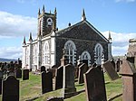
Penninghame Parish ChurchNewton Stewart
54° 57′ 28,5″ N, 4° 29′ 6,7″ W
Kirche38663
Penninghame Parish Church
(c) Chris Newman, CC BY-SA 2.0
Cree BridgeNewton Stewart
54° 57′ 36,6″ N, 4° 28′ 56,4″ W
Brücke38667
Cree Bridge
(c) Dennis Turner, CC BY-SA 2.0
Douglas HouseNewton Stewart
54° 58′ 0,4″ N, 4° 29′ 14,4″ W
Villa38672
Tolbooth von SanquharSanquhar
55° 22′ 4,7″ N, 3° 55′ 30,2″ W
Rathaus40540
Tolbooth von Sanquhar
(c) Colin Smith, CC BY-SA 2.0
Stranraer MuseumStranraer
54° 54′ 16″ N, 5° 1′ 41,8″ W
Museum41745
Stranraer Museum
(c) Rose and Trev Clough, CC BY-SA 2.0
Stranraer CastleStranraer
54° 54′ 15,8″ N, 5° 1′ 33,6″ W
Tower House41765Stranraer Castle
Torweg zu Whithorn PrioryWhithorn
54° 43′ 59,3″ N, 4° 24′ 56,9″ W
Wohngebäude42195
Torweg zu Whithorn Priory
(c) Lairich Rig, CC BY-SA 2.0
55–57 George StreetWhithorn
54° 43′ 58,8″ N, 4° 24′ 57,2″ W
Wohngebäude42196
Whithorn PrioryWhithorn
54° 44′ 1,1″ N, 4° 25′ 0,8″ W
Klosterruine42266Whithorn Priory
18–20 King StreetStranraer
54° 54′ 17,9″ N, 5° 1′ 49,3″ W
Wohn- und Geschäftsgebäude45230

Weblinks

Commons: Kategorie-A-Bauwerke in Dumfries and Galloway – Sammlung von Bildern, Videos und Audiodateien

Auf dieser Seite verwendete Medien

Girthon Church, Galloway - geograph.org.uk - 464862.jpg
(c) Robert Guthrie, CC BY-SA 2.0
Girthon Church, Galloway Ruins of Girthon Church
Comlongon Castle.jpg
(c) Angus Townley, CC BY-SA 2.0
Comlongon Castle
Kirkpatrick Fleming Kirk in Dumfriesshire. - geograph.org.uk - 1161659.jpg
(c) james denham, CC BY-SA 2.0
Kirkpatrick Fleming Kirk in Dumfriesshire. Other photographs on the site are taken from the opposite side of the church, I feel the front is much more interesting. Here caught,in all its splendour, by the late afternoon Winter sun, the latest in along line of churches which are reputed to have stood here for a thousand years. A wonderful example of the old Scottish Presbyterian Kirk in the style of post reformation.
Durisdeer Church, Dumfries & Galloway.JPG
Durisdeer church, Dumfries & Galloway, Scotland
Goldielea - geograph.org.uk - 133483.jpg
(c) Richard Webb, CC BY-SA 2.0
Goldielea. House with viaduct behind, once carried the "Paddy" the direct railway to the Irish ferries.
Globe Inn - geograph.org.uk - 401545.jpg
(c) Colin Smith, CC BY-SA 2.0
Globe Inn Entrance from Dumfries High Street to the pend occupied by Rabbie Burns' famous howff. The pub dates back to 1610 and the sign advertises the Burns Room and Poet's Chair.
Remains of Kirkdale Church (geograph 4505851).jpg
(c) Anthony O'Neil, CC BY-SA 2.0
Remains of Kirkdale Church
Logan Windmill 2 - geograph.org.uk - 51931.jpg
(c) Patrick Lee, CC BY-SA 2.0
Logan Windmill 2. Another view of Logan Windmill showing the curious vaulted structure at its base
Tinwald House - geograph.org.uk - 861306.jpg
(c) Colin Kinnear, CC BY-SA 2.0
Tinwald House Tinwald House.
Thomas Carlyle's Birthplace. The Arched House, Ecclefechan - geograph.org.uk - 179939.jpg
(c) Nigel Homer, CC BY-SA 2.0
Thomas Carlyle's Birthplace. The Arched House, Ecclefechan. Thomas Carlyle, one of the 19th century’s leading voices on morals and social equality,was born here in 1795 in this house constructed by his father and uncle, both local stonemasons.
Rusco Castle - geograph.org.uk - 1240081.jpg
(c) Colin Kinnear, CC BY-SA 2.0
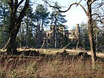
Rusco Castle Rusco Castle, or Rusko Castle, probably dates from the early 16th century. It is a simple rectangular tower, three storeys and a garret high, measuring 38 1/2' by 29' over walls 6'-8' thick. There is a ruinous two storeyed addition to the N, dating probably from the 17th century, provided with a stair-tower projecting W. This addition measures 57' by 22' over walls which nowhere exceed 3' thick. Rusco, which in early times belonged to the Carsnane family and was known as Glenskyreburn passed by marriage in the early 16th century to Sir Robert Gordon of Lochinvar. It was inhabited till about 1890. After this it became ruinous but has now been restored as a family home.
Lochmaben Town Hall - geograph.org.uk - 210239.jpg
(c) Kevin Rae, CC BY-SA 2.0
Lochmaben Town Hall. View along the main street of this beautifully situated town towards the 18th century town hall with Robert the Bruce's statue in front.
Hensol House - geograph.org.uk - 263579.jpg
(c) Ann Cook, CC BY-SA 2.0
Hensol House This imposing house sits on the south bank of the River Dee where the river joins Loch Ken.
Buittle Bridge - geograph.org.uk - 177604.jpg
(c) Robert D Ferguson, CC BY-SA 2.0
Buittle Bridge. The Buittle Bridge over the River Urr carries the A711 road from Castle Douglas to Dalbeattie. A short distance downstream from here the river becomes tidal and was originally navigable by quite large vessels.
Old Brig Inn, Beattock - geograph.org.uk - 1005821.jpg
(c) Oliver Dixon, CC BY-SA 2.0
Old Brig Inn, Beattock. Compare with 634663. The hotel is now closed and up for sale. Note the old stable block behind.
Tongland Bridge August 2013.png
Autor/Urheber: Parrot of Doom, Lizenz: CC BY-SA 3.0
Thomas Telford's bridge in Tongland
St Andrew's Church of Scotland, Church Gate Moffat - geograph.org.uk - 1744964.jpg
(c) John Fielding, CC BY-SA 2.0
St Andrew's Church of Scotland, Church Gate Moffat
Queensberry Square, Dumfries, with flowers.jpg
Autor/Urheber: Irene M, Lizenz: CC BY-SA 3.0
Flowers and buildings in Queensberry Square / High Street, Dumfries, 2011. The most prominent structures illustrated are the Trades Hall on the left, the Midsteeple (the tall building with the clock) and the Queensberry Monument (the structure with a tall thin column towards the right of the picture). Unaltered photo.
Midsteeple, Dumfries 2010.JPG
Autor/Urheber: MSDMSD, Lizenz: CC BY-SA 3.0
Midsteeple, High Street, Dumfries after the area's refurbishment in June 2010.
Ken Bridge and Ken Bridge Hotel - geograph.org.uk - 212410.jpg
(c) David Medcalf, CC BY-SA 2.0
Ken Bridge and Ken Bridge Hotel. Looking east over the Water of Ken, which flows into Loch Ken, to the right of the photo, about 3km away.
Stapleton Tower and Crow Wood - geograph.org.uk - 573049.jpg
(c) Walter Baxter, CC BY-SA 2.0
Stapleton Tower and Crow Wood Stapleton Tower built by the Johnstones is empty but kept in good repair by the Vivers family. Viewed on a fine October day with Crow Wood in the background.
Portpatrick - St Andrew's Auld Kirk - geograph.org.uk - 225434.jpg
(c) Bill Henderson, CC BY-SA 2.0
Portpatrick - St Andrew's Auld Kirk. This Church was built in the 17th century and has been disused since 1842.
Castle Douglas cattle market - geograph.org.uk - 925283.jpg
(c) derek menzies, CC BY-SA 2.0
Castle Douglas cattle market
Gilnockie Bridge from mill lade outfall (geograph 3688318).jpg
(c) Mac McCarron, CC BY-SA 2.0
Gilnockie Bridge from mill lade outfall
Fourmerkland Tower, Holywood, Dumfriesshire.jpg
(c) Bob Cowan, CC BY-SA 2.0
Fourmerkland Tower. Built in 1590, on older foundations, it is well hidden in the wood. See archaeological notes here: http://canmore.rcahms.gov.uk/en/site/65914/details/fourmerkland+tower+and+barmkin/
Carsluith Castle.jpg
(c) Alison Stamp, CC BY-SA 2.0
Carsluith Castle
Westerkirk Bridge - geograph.org.uk - 830094.jpg
(c) Walter Baxter, CC BY-SA 2.0
Westerkirk Bridge. This bridge spanning the River Esk at Bentpath was built between 1734 and 1736. See 830086.
Annan- the Old Academy (geograph 4594840).jpg
(c) Chris Downer, CC BY-SA 2.0
Annan: the Old Academy
Coo Palace, Corseyard - geograph.org.uk - 262755.jpg
(c) Lesley O'Hare, CC BY-SA 2.0
Coo Palace, Corseyard, an early C20th dairy; architect probably G H Higginbottom.
Scottish-Castle-Symbol.svg
Autor/Urheber: Majo statt Senf, Lizenz: CC BY-SA 4.0
Schlosssymbol Schottland
John Paul Jones's Cottage - geograph.org.uk - 370596.jpg
(c) Duncan MacMillan, CC BY-SA 2.0
John Paul Jones's Cottage The view out over the Solway Firth - the one that inspired a young John Paul Jones to go to sea and later become "The Father Of The American Navy".
Gilnockie Tower 20100924.jpg
Autor/Urheber: Otter, Lizenz: CC BY-SA 3.0
Gilnockie Tower, Dumfries and Galloway, Scotland.
Logan House (geograph 3088070).jpg
(c) Jonathan Wilkins, CC BY-SA 2.0
Logan House
Ellisland Farm Auldgirth.JPG
Ellisland Farm from the approach lane. Auldgirth, Scotland
Crichton Memorial Church - geograph.org.uk - 118294.jpg
(c) Chris Upson, CC BY-SA 2.0
Crichton Memorial Church. A large (almost cathedral-sized) church built for the inmates and staff of the Crichton Royal Hospital. The church was designed by Sydney Mitchell in 1890, and the interior is a fantastic example of Victorian ecclesiastical architecture.
Boreland, Hutton and Corrie Parish Church - geograph.org.uk - 672487.jpg
(c) Chris Newman, CC BY-SA 2.0
Boreland: Hutton & Corrie Parish Church Church perches on shoulder of hill on the Corrie road, just SSE of the village of Boreland. Church dates from 1710 with alterations up to about 1871. The churchyard has some fine 17-18 century gravestones.
Douglas Mausoleum - geograph.org.uk - 821526.jpg
(c) Chris Newman, CC BY-SA 2.0
Douglas Mausoleum The Douglas Mausoleum dates from 1821; an extraordinary Aegypto-Grecian building N of Kelton Kirk, with pagoda roof, Doric portal and carved frieze. Ownership is unknown so legal possession is being sort for its care to come under Historic Scotland.
Cruggleton Church - geograph.org.uk - 1282501.jpg
(c) Leslie Barrie, CC BY-SA 2.0
Cruggleton Church Dating from the 12th-century, the church was restored from a ruinous condition by the Marquess of Bute around 1890.
Hoddom Castle - geograph.org.uk - 31411.jpg
(c) Mike and Kirsty Grundy, CC BY-SA 2.0
Hoddom Castle. Picturesque dereliction in the centre of a top-rated caravan site with own golf course.
Skipper's Bridge - geograph.org.uk - 1383479.jpg
(c) Anne Burgess, CC BY-SA 2.0
Skipper's Bridge The bridge carries the A7 across the River Esk just south of Langholm. It was not built for modern traffic, and a set of traffic lights controls its use. This view is looking upstream towards Langholm.
Broughton House, High Street, Kirkcudbright - geograph.org.uk - 1594014.jpg
(c) Anthony O'Neil, CC BY-SA 2.0
Broughton House, High Street, Kirkcudbright Dating from around 1750 and once (1910) the home of famous Glasgow artist, E. A. Hornel - one of the so-called Glasgow Boys - now open to the public as a museum.
The Cruick Cottage - geograph.org.uk - 1277133.jpg
(c) Colin Kinnear, CC BY-SA 2.0
The Cruick Cottage The Cruck Cottage, Shieldhill Road, Torthorwald, Dumfries, Scotland, was originally constructed in the mid 18th century or thereabouts. It is of the ‘cruck’ construction common at that time, i.e. the main supports consist of oak crucks or trunks, which support the roof. The roof consists of counter tie beams and branch rafters, laid with heather turf, and thatched with rye straw. The original walls would be of clay or turf, but are now built with rubble and lime mortar. http://www.cruckcottage.zoomshare.com/
The Crichton Royal Institution, Dumfries, Scotland. Wood eng Wellcome L0010258.jpg
Autor/Urheber: unknown, Lizenz: CC BY 4.0

The Crichton Royal Institution, Dumfries, Scotland. Wood engraving.

Iconographic Collections

Stranraer Castle.jpg
Autor/Urheber: jaqian from Dublin, Ireland, Lizenz: CC BY 2.0
Stranraer Castle, also known as the Castle of St. John, in Stranraer, sout-west Scotland.
Craig Caffie Tower near Innermessan, Stranraer - geograph.org.uk - 159961.jpg
(c) Colin McDonald, CC BY-SA 2.0
Craig Caffie Tower near Innermessan, Stranraer Craig Caffie Tower was built around 1580 near Innermessan, the former capital of the Rhins of Galloway.
Lochnaw Castle.jpg
(c) Richard Paxman, CC BY-SA 2.0
Lochnaw Castle Lochnaw Castle (in the pouring rain), home (once upon a time) of the Agnew family. The oldest bit is the tall tower, which is 16th century. It was an hotel for a while, but had stopped being so when I arrived there to stay recently! It is now a private home again (with a very long and muddy drive!).
Rammerscales House - geograph.org.uk - 520371.jpg
(c) Lynne Kirton, CC BY-SA 2.0
Rammerscales House An 18th century Georgian manor house near Lochmaben. It is built of sandstone and designed in Palladian style. It contains fine circular staircases, Jacobite relics, and a collection of 20th century paintings, tapestries and sculpture. There is a walled garden, woodland walks and wonderful views over Annandale. The house is open at certain times, which may be obtained by telephoning. See http://guide.visitscotland.com/vs/guide/edinburgh,en,SCH1/objectId,SIG49342Svs,curr,GBP,season,at1,selectedEntry,home/home.html for contact details.
St Michaels Church. Dumfries - geograph.org.uk - 23603.jpg
(c) Alison Stamp, CC BY-SA 2.0
St Michaels Church. Dumfries. The graveyard is on the Burns Trail, and the Burns Mausoleum can be found in the graveyard. This photo was taken from by the statue of Jean Amour
Amisfield Tower, Tinwald, Dumfriesshire c.1789. PD-old-100.jpg
Amisfield Tower, Tinwald, Dumfriesshire, Scotland.

Drawing by Francis Grose. c.1789.

Public domain

Dieses Werk ist gemeinfrei, weil seine urheberrechtliche Schutzfrist abgelaufen ist.
Dies gilt für das Herkunftsland des Werks und alle weiteren Staaten mit einer gesetzlichen Schutzfrist von 100 oder weniger Jahren nach dem Tod des Urhebers.


Dialog-warning.svgParallel zu dieser Lizenz muss auch ein Lizenzbaustein für die United States public domain gesetzt werden, um anzuzeigen, dass dieses Werk auch in den Vereinigten Staaten gemeinfrei ist.
Isle of Whithorn, Isle Castle - geograph.org.uk - 1498864.jpg
(c) Astrid Horn, CC BY-SA 2.0
Isle of Whithorn, Isle Castle The castle is inhabited, but it is visible from the main street.
Robert the Bruce, Dumfries - geograph.org.uk - 1769851.jpg
(c) Richard Dorrell, CC BY-SA 2.0
Robert the Bruce, Dumfries Behind the imposing façade is a public house, and part of the large J.D. Wetherspoon group. The building stands in Buccleuch Street on the corner of Castle Street. The building was formerly a Methodist church, and stood as a roofless ruin for many years before being restored as a pub.
Tonderghie House - geograph.org.uk - 818813.jpg
(c) Chris Newman, CC BY-SA 2.0
Tonderghie House Built C18 close to the coast west of Isle of Whithorn, Tonderghie is a harled laird’s house with main 4-storey block and single storey pavilion/garage; the gardens and house had C20 additions and alterations.
Old Place of Monreith - Dowies House - Ballingrene, Glasserton.jpg
(c) Andy Farrington, CC BY-SA 2.0
Dowies Castle, Glasserton. otherwise Old Place of Monreith or Ballingrene.
Argrennan House - geograph.org.uk - 1376631.jpg
(c) Ed Iglehart, CC BY-SA 2.0
Argrennan House Nestled in its mature woodland
Greyfriars Church, Dumfries - geograph.org.uk - 1769872.jpg
(c) Richard Dorrell, CC BY-SA 2.0
Greyfriars Church, Dumfries, completed in 1868. It is the Burgh Church of Dumfries and contains the Provost's throne and Baillies' chairs. The statue on the left is of Robert Burns.
The Bridge - geograph.org.uk - 463912.jpg
(c) Les Harvey, CC BY-SA 2.0
The Bridge Looking northwest.
Kirkdale House, Carsluith, nr Gatehouse of Fleet.JPG
Autor/Urheber: Aksteven, Lizenz: CC BY-SA 4.0
Dieses Foto zeigt das geschützte Denkmal in Schottland mit der Nummer
Kirkmadrine Church - geograph.org.uk - 263127.jpg
(c) Ann Cook, CC BY-SA 2.0
Kirkmadrine Church This is no longer used as a church but it is the site of an early Christian community. The Kirkmadrine Stones are fine sculptured stones from the 5th century. They are displayed in a glass-fronted porch at the west of the church.
Kirkcudbright Tollbooth - geograph.org.uk - 841001.jpg
(c) Chris Newman, CC BY-SA 2.0
Kirkcudbright Tollbooth The Tollbooth dates from 1625-7, it now contains the Arts Centre. At the tower base/steps are the Mercat cross (1610), old well (1762-3) and inset into the walls are iron 'jougs'. Top of the spire is a Battle of Trafalgar weather-vane (1805).
Anwoth Old Kirk and Kirkyard - geograph.org.uk - 890377.jpg
(c) Chris Newman, CC BY-SA 2.0
Anwoth Old Kirk & Kirkyard The old kirk ruins (1626) retains a medieval bell and has a Samuel Rutherford plaque over the doorway. Interesting gravestones include table stones and a cross-slab. The 2.4m/7.9ft-high granite Gordon mausoleum was built 1878.
Lochryan House (geograph 2941725).jpg
(c) Julia MacDonald, CC BY-SA 2.0
Lochryan House
Mull of Galloway - geograph.org.uk - 883167.jpg
(c) Tam and Karen, CC BY-SA 2.0
Mull of Galloway The lighthouse on the Mull of Galloway.
Drumlanrig Castle - geograph.org.uk - 1369990.jpg
(c) M J Richardson, CC BY-SA 2.0
Drumlanrig Castle From the south west, one of the seats of the Duke of Buccleuch and Queensbury.
Miners' Library, Wanlockhead - geograph.org.uk - 1387057.jpg
(c) Donald MacDonald, CC BY-SA 2.0
Miners' Library, Wanlockhead The Miners' Library, Wanlockhead, is the second oldest subscription library in Europe.
Shillahill Bridge - geograph.org.uk - 62241.jpg
(c) Lynne Kirton, CC BY-SA 2.0
Shillahill Bridge. Carries the A709 Lockerbie to Dumfries over the River Annan 2 miles west of Lockerbie.
Penninghame Parish Church - geograph.org.uk - 767524.jpg
(c) Chris Newman, CC BY-SA 2.0
Penninghame Parish Church Penninghame St John’s Parish Church (1838-40): Large steepled Gothic, one of the earliest of its type in Scotland. Glass replaced 1996 and tower clock restored 2004.
Spottes Bridge - geograph.org.uk - 177597.jpg
(c) Robert D Ferguson, CC BY-SA 2.0
Spottes Bridge. This bridge carries the Old Military Road from Castle Douglas to Haugh of Urr
Galloway House - geograph.org.uk - 547115.jpg
(c) John Clive Nicholson, CC BY-SA 2.0
Galloway House Near Garlieston
Kirkmaiden Parish Church - geograph.org.uk - 218016.jpg
(c) Jeff Wells, CC BY-SA 2.0
Kirkmaiden Parish Church. Formerly known as 'Kirk Covenant' a church was built here in 1638. Remodelled in 1839, this building is the parish church of Kirkmaiden.
Lochmaben Parish Church - geograph.org.uk - 572036.jpg
(c) Oliver Dixon, CC BY-SA 2.0
Lochmaben Parish Church At the south end of the town centre. Built 1820.
Repentance Tower - geograph.org.uk - 31412.jpg
(c) Mike and Kirsty Grundy, CC BY-SA 2.0
Repentance Tower. Ancient tower and burial ground overlooking Hoddom Castle
Lochinch Castle (6559790843).jpg
Autor/Urheber: Andrew Bowden from London, United Kingdon, Lizenz: CC BY-SA 2.0

Home to the Earl and Countess of Stair. It's not possible to visit inside, but you can stand just outside the main garden and look at it.

Day 2 on the Southern Upland Way blogged about at ramblingman.org.uk/southernuplandway/day2
The Old Parish Church, Annan, Dumfriesshire - geograph.org.uk - 1027055.jpg
(c) james denham, CC BY-SA 2.0
The Old Parish Church, Annan, Dumfriesshire
Annan river bridge - Oct 2006.JPG
Autor/Urheber:

Der ursprünglich hochladende Benutzer war Red Sunset in der Wikipedia auf Englisch

(Originaltext: Red Sunset), Lizenz: CC BY-SA 3.0
Photo taken by myself 29/10/06 of the River Annan, facing upstream towards the 3-arch road-bridge entering the western side of Annan.
Cumloden House - geograph.org.uk - 962944.jpg
(c) Chris Newman, CC BY-SA 2.0
Cumloden House Large cottage orné house built 1825 for Sir William Stewart; it has carved bargeboards and prominent eaves and a verandah at the entrance.
Crossmichael Church and graveyard - geograph.org.uk - 697892.jpg
(c) Chris Newman, CC BY-SA 2.0
Crossmichael Church & graveyard Crossmichael Parish Church (1749-51) with its centrally sited round tower and C19 conical roof paired with Balmaghie (opposite side of Loch Ken). The Churchyard has an fine enriched Gordon monument (1757), a Covenanter’s gravestone and three war graves. A table stone has an acrostic epitaph to Rev Andrew Dick.
Corsewell Lighthouse and Hotel - geograph.org.uk - 1708569.jpg
(c) Mary and Angus Hogg, CC BY-SA 2.0
Corsewell Lighthouse and Hotel
Dunscore Church and Churchyard - geograph.org.uk - 698384.jpg
(c) Chris Newman, CC BY-SA 2.0
Dunscore Church & Churchyard A notable Heritors’ Gothic towered church (1823-4) retaining a largely unaltered interior; memorial plaque to the missionary Jane Haining, who died in Auschwitz. The churchyard contains the burial enclosure of the Griersons of Dalgonar and three war graves.
Langholm Parish Church - geograph.org.uk - 989767.jpg
(c) Chris Newman, CC BY-SA 2.0
Langholm Parish Church. View across the Esk of the large Georgian-survival parapeted Gothic parish kirk built 1842-6. 989776
Hills Tower.JPG
(c) Colin Kinnear, CC BY-SA 2.0
Hills Tower Hills Tower, near Lochfoot was the 16th century stronghold of the Maxwell Family.
Cally Palace Hotel, Gatehouse of Fleet - geograph.org.uk - 86175.jpg
(c) Christine Matthews, CC BY-SA 2.0
Cally Palace Hotel, Gatehouse of Fleet. The Cally Palace Hotel at Gatehouse of Fleet is in both gridsquare NX6054 and NX5954. This image is taken from gridsquare NX5954 with the boundary with square NX6054 being just past the central part of the building with the right hand wing being in that gridsquare.
Ruthwell Savings Bank Museum.jpg
(c) Colin Kinnear, CC BY-SA 2.0
Ruthwell Savings Bank Museum, Dunfries and Galloway, Scotland
Tynron Church - geograph.org.uk - 190925.jpg
(c) Kevin Rae, CC BY-SA 2.0
Tynron Church. This Church sits on a knoll behind the village cottages and the Churchyard provides fine views of the surrounding countryside.
Ravenstone Castle - geograph.org.uk - 818977.jpg
(c) Chris Newman, CC BY-SA 2.0
Ravenstone Castle. Substantial mansion house in course of restoration after years of dereliction. Constructed from 1773, Ravenstone incorporated remains of a C16 tower; it was extensively altered during the C18. Also see 818987.
Viaduct over River Liddel - geograph.org.uk - 280061.jpg
(c) Simon Ledingham, CC BY-SA 2.0
Viaduct over River Liddel Disused viaduct on the English - Scottish border. http://www.visitcumbria.com/car/waverley-railway.htm
Castle of Park Glenluce exterior.JPG
The Castle of Park is a 16th century L-plan tower house near Glenluce, in Dumfries and Galloway, southwest Scotland. It is a category A listed building.
The river Annan at Brydekirk. - geograph.org.uk - 143045.jpg
(c) John Holmes, CC BY-SA 2.0
The river Annan at Brydekirk. Plenty of water in the river today.
ScotlandDumfriesGalloway.png
Autor/Urheber: unknown, Lizenz: CC-BY-SA-3.0
Barholm Castle.jpg
Barholm Castle, Gatehouse of Fleet, Dumfries and Galloway, Scotland. Restored from a ruinous state 2003-2005.
Spedlins Tower - geograph.org.uk - 679446.jpg
(c) Chris Newman, CC BY-SA 2.0
Spedlins Tower Substantial tower house (c.1500) of the Jardines of Applegarth. Extended upwards 1605, restored 1988-9. Sketch by Francis Grose : https://archive.org/stream/antiquitiesofsco01grosuoft#page/n311/mode/2up/search/Spedlin
Bonshaw Tower, Annan, Dumfriesshire.jpg
(c) Colin Smith, CC BY-SA 2.0
Bonshaw Tower House, a peel tower and seat of the Irvings, standing by the Kirtle Water.
Southwick Home Farm, Caulkerbush - geograph.org.uk - 729502.jpg
(c) Chris Newman, CC BY-SA 2.0
Southwick Home Farm, Caulkerbush Older (north) dairy buildings of Southwick Home Farm.
Bridge over the River Nith (3) - geograph.org.uk - 533035.jpg
(c) David Hamilton, CC BY-SA 2.0
Two-arched stone bridge carrying the A702 road over the River Nith in Penpont parish, just west of Thornhill, Dumfriesshire
Southerness Lighthouse Newall.jpg
(c) Anne Burgess, CC BY-SA 2.0
Southerness Lighthouse: The lighthouse is distinctive because of its unusual square plan. A tower was built in 1749 and the light added about 1800, making it one of the oldest lighthouses in Scotland. It has not been in use since the 1930s.
Kinnel Bridge - geograph.org.uk - 729250.jpg
(c) M J Richardson, CC BY-SA 2.0
Kinnel Bridge The bridge taking the B7020 Lochmaben to Beattock road over the Kinnel Water.
Lincluden Collegiate Church ruins - geograph.org.uk - 536894.jpg
(c) Darrin Antrobus, CC BY-SA 2.0
Lincluden Collegiate Church ruins
Baldoon Castle.jpg
(c) Andy Farrington, CC BY-SA 2.0
The ruined, ivy covered remains of the castle are said to be haunted by the ghost of Janet Dalrymple, the daughter of Sir James Dalrymple, who walks the ruins on the anniversary of her untimely death, 12th September, 1669.
Part of the mill complex at Old Bridge of Urr - geograph.org.uk - 70111.jpg
(c) Kirsty Smith, CC BY-SA 2.0
Part of the mill complex at Old Bridge of Urr. This building to the left is the Kiln House part of the original mill complex at Old Bridge of Urr. It is now being restored as a private house. Between it and the camera was a later wooden extension which has recently been demolished. The further building to the right is the Miller's House. It was later the post office and has also recently been restored. The mills themselves (a cornmill and saw mill sharing the same wheel) are out of shot to the right.
Tongland Powerstation 05-08-31 63.jpeg
Autor/Urheber: Die Autorenschaft wurde nicht in einer maschinell lesbaren Form angegeben. Es wird AHEMSLTD~commonswiki als Autor angenommen (basierend auf den Rechteinhaber-Angaben)., Lizenz: CC BY 2.5

Tongland Powerstation. Part of the Galloway Hydros scheme. The generator on the far right of the building is in operation, other two are shut down. 31st August 2005 Photographer - A.M.Hurrell Camera - Fuji FinePix F10

Modified - Trimmed and file size reduced using Finepix Software
Robert Burns House - Dumfries.JPG
Autor/Urheber: Rosser1954, Lizenz: CC BY-SA 3.0
Robert Burns's last home in Dumfries, Scotland
Duchess Bridge - geograph.org.uk - 359958.jpg
(c) Howard Mattinson, CC BY-SA 2.0
Duchess Bridge Foot bridge across the River Esk
Dundrennan Abbey 2012 (1).jpg
Autor/Urheber: Craig Murphy from Scotland, Lizenz: CC BY 2.0
Dundrennan Abbey
The Pend - geograph.org.uk - 939561.jpg
(c) Lairich Rig, CC BY-SA 2.0
The Pend The medieval gatehouse leading to St Ninian's Priory.
Glenuiart House - Dumfries and Galloway - Scotland.jpg
Autor/Urheber: Regnissalohcin, Lizenz: CC BY-SA 3.0
Dieses Foto zeigt das geschützte Denkmal in Schottland mit der Nummer
Barscobe Castle 1.jpg
Autor/Urheber: JMiall, Lizenz: CC BY-SA 3.0
view of Barscobe Castle near Balmaclellan, Dumfries & Galloway. Taken 12 Sept 2011.
Whithorn Priory 20080423 nave.jpg
Autor/Urheber: Otter, Lizenz: CC BY-SA 3.0
Whithorn Priory, Whithorn, Dumfries and Galloway, Scotland - nave
The Johnstone Mausoleum, Bentpath - geograph.org.uk - 208025.jpg
(c) Kevin Rae, CC BY-SA 2.0
The Johnstone Mausoleum, Bentpath. This Mausoleum was built by Robert Adam in 1790 and is located in the churchyard which is also the last resting place of Thomas Telford's father.
Dinwoodie Toll House - Bow Front - geograph.org.uk - 832967.jpg
(c) Chris Newman, CC BY-SA 2.0
Dinwoodie Toll House - Bow Front Only possible view (until hedges cut) of the bow-front of 1822-3 Telford toll-house.
Robert Burns Mausoleum.jpg
Robert Burns Mausoleum located in the churchyard of St Michael's Church, Dumfries.
Raehills House - North Side - geograph.org.uk - 831645.jpg
(c) Chris Newman, CC BY-SA 2.0
Raehills House – North Side Raehills (1782 & 1829-34) is unusual in having Egyptian revival and battlemented details. A colonnade runs above the terrace.
Dalton Old Parish Church & Graveyard (geograph 4113427).jpg
(c) Leslie Barrie, CC BY-SA 2.0
Dalton Old Parish Church & Graveyard
Stranraer Museum - geograph.org.uk - 870543.jpg
(c) Rose and Trev Clough, CC BY-SA 2.0
Stranraer Museum The museum occupies the Old Town Hall, built in 1777. On the front of the building is the town coat of arms - a ship.
Kinmount House.jpg
(c) Barry Dale, CC BY-SA 2.0
Kinmount House
Dumfries, 29 Irish Street and 92 Whitesands.jpg
Autor/Urheber: Irishgait, Lizenz: CC BY-SA 3.0
Dieses Foto zeigt das geschützte Denkmal in Schottland mit der Nummer
The Burn at Craighlaw - geograph.org.uk - 1132158.jpg
(c) David Baird, CC BY-SA 2.0
The Burn at Craighlaw The burn which feeds Craighlaw Loch has been dammed to provide a series of ponds.
Glasserton Church - geograph.org.uk - 865640.jpg
(c) Colin Kinnear, CC BY-SA 2.0
Glasserton Church Glasserton church and graveyard.
Buittle Old Kirk - geograph.org.uk - 225429.jpg
(c) Bill Henderson, CC BY-SA 2.0
Buittle Old Kirk. This old church is in the same grounds as the new Church.
Auldgirth Bridge - geograph.org.uk - 385513.jpg
(c) Walter Baxter, CC BY-SA 2.0
Auldgirth Bridge Spans the River Nith and closed to vehicular traffic. Viewed from the modern road bridge.
Gelston Castle - geograph.org.uk - 686085.jpg
(c) Chris Newman, CC BY-SA 2.0
Gelston Castle Viewed through the trees, the romantic Adam-style castle (c.1805) built of the finest red sandstone; sadly now a roofless shell.
Sanquhar Tolbooth - geograph.org.uk - 1472970.jpg
(c) Colin Smith, CC BY-SA 2.0
Sanquhar Tolbooth 18th century building, following a William Adam design. It has seen life as town hall, school and prison before becoming today's local museum. In the distance is the current Town Hall. http://en.wikipedia.org/wiki/Sanquhar
Dumfries Museum (windmill).jpg
(c) Lairich Rig, CC BY-SA 2.0
Dumfries Museum, converted from a windmill.
Sorbie Tower - geograph.org.uk - 1511024.jpg
(c) Astrid Horn, CC BY-SA 2.0
Sorbie Tower When we visited Sorbie Tower, there was a member of Clan Hannah, who explained us a lot about the clan and the tower history. He was so friendly and enthusiastic in describing his work and his efforts with repairs and ensuring maintenance for the building - it was indescribable. An unforgettable afternoon.