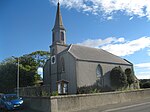
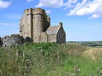
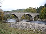
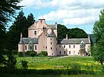
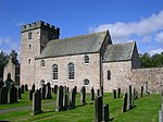
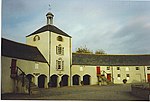
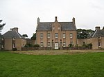
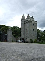
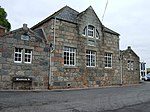
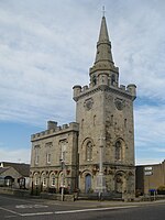
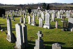
Liste der Kategorie-A-Bauwerke in Aberdeenshire

Lage von Aberdeenshire in Schottland

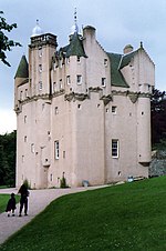
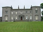
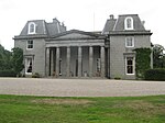
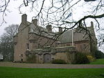
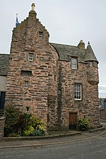
Die Liste der Kategorie-A-Gebäude in Aberdeenshire umfasst sämtliche in der Kategorie A eingetragenen Baudenkmäler in der schottischen Council Area Aberdeenshire. Die Einstufung wird anhand der Kriterien von Historic Scotland vorgenommen, wobei in die höchste Kategorie A Bauwerke von nationaler oder internationaler Bedeutung einsortiert sind. In Aberdeenshire sind derzeit 192 Bauwerke in der Kategorie A gelistet.

NameLageTypEintragBild
North BridgeArbuthnott
56° 52′ 2,2″ N, 2° 20′ 16,3″ W
Brücke31
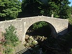
North Bridge
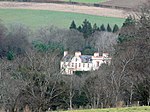
(c) Stanley Howe, CC BY-SA 2.0
Braemar CastleBraemar
57° 0′ 53″ N, 3° 23′ 29,2″ W
Schloss36
Braemar Castle
(c) Stanley Howe, CC BY-SA 2.0
Tilquhillie Castlenahe Banchory
57° 2′ 15,1″ N, 2° 27′ 36,2″ W
Tower House38
Tilquhillie Castle
(c) Peter Ward, CC BY-SA 2.0
Park Bridgenahe Drumoak
57° 4′ 27″ N, 2° 20′ 14,2″ W
Brücke45
Park Bridge
(c) Alan Findlay, CC BY-SA 2.0
Craig Castlenahe Rhynie
57° 18′ 39,3″ N, 2° 52′ 49,1″ W
Tower House2736
Druminnor Castlenahe Rhynie
57° 19′ 32,2″ N, 2° 48′ 36,4″ W
Tower House2743
Aberdour Housenahe New Aberdour
57° 39′ 54,7″ N, 2° 9′ 10″ W
Herrenhaus2768
Orrok Housenahe Balmedie
57° 16′ 0,1″ N, 2° 3′ 41,1″ W
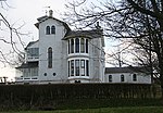
Villa2778Orrok House
Mounie Castlenahe Oldmeldrum
57° 20′ 52,4″ N, 2° 23′ 21,9″ W
Herrenhaus2793
Mounie Castle
(c) Greg Stringham, CC BY-SA 2.0
Mill of Benholmnahe Benholm
56° 48′ 46,3″ N, 2° 19′ 6,5″ W
Mühle2805
Mill of Benholm
(c) Peter Ward, CC BY-SA 2.0
Benholm CastleBenholm
56° 49′ 29,4″ N, 2° 19′ 21,1″ W
Herrenhaus2807
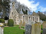
Benholm Parish ChurchBenholm
56° 48′ 51,6″ N, 2° 19′ 18,9″ W
Kirche2813
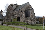
Benholm Parish Church
(c) C Page, CC BY-SA 2.0
Bourtie Parish Churchnahe Oldmeldrum
57° 18′ 49,9″ N, 2° 19′ 34,2″ W
Kirche2815
Bourtie Parish Church
(c) Jim Benvie, CC BY-SA 2.0
Bourtie Housenahe Inverurie
57° 18′ 23,4″ N, 2° 21′ 27,9″ W
Herrenhaus2819Bourtie House
Barra Castlenahe Oldmeldrum
57° 19′ 18,8″ N, 2° 20′ 48″ W
Herrenhaus2821
Barra Castle
(c) Andrew Wood, CC BY-SA 2.0
Pitcaple Castlenahe Pitcaple
57° 19′ 27,8″ N, 2° 27′ 16,3″ W
Herrenhaus2830
Pittodrie’s YateChapel of Garioch
57° 18′ 25,1″ N, 2° 28′ 23,3″ W
Tor2846
Pittodrie’s Yate
(c) Bill Harrison, CC BY-SA 2.0
Arbuthnott Parish ChurchArbuthnott
56° 51′ 46″ N, 2° 19′ 37,5″ W
Kirche2876
Arbuthnott Parish Church
(c) Andrew Wood, CC BY-SA 2.0
Allardice Castlenahe Inverbervie
56° 51′ 23,6″ N, 2° 18′ 4,1″ W
Herrenhaus2878
Allardice Castle
(c) Alan Thomson, CC BY-SA 2.0
Tor von Allardice Castlenahe Inverbervie
56° 51′ 23,2″ N, 2° 18′ 4,4″ W
Tor2879
Arbuthnott HouseArbuthnott
56° 52′ 0″ N, 2° 20′ 16,9″ W
Herrenhaus2880
Arbuthnott House
(c) Stanley Howe, CC BY-SA 2.0
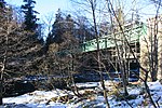
Bridge of Alvahnahe Banff
57° 38′ 18,3″ N, 2° 32′ 14,4″ W
Brücke2883
Bridge of Alvah
(c) Anne Burgess, CC BY-SA 2.0
Fishing Templenahe Banff
57° 39′ 16,1″ N, 2° 31′ 11,8″ W
Tempel2885
Fishing Temple
(c) Anne Burgess, CC BY-SA 2.0
Dunlugas Housenahe Turriff
57° 35′ 18,3″ N, 2° 30′ 38,9″ W
Herrenhaus2888
Dunlugas House
(c) Anne Burgess, CC BY-SA 2.0
Castle Frasernahe Kemnay
57° 12′ 10,8″ N, 2° 27′ 38″ W
Schloss2924
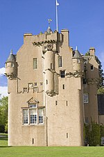
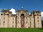
Castle Fraser
(c) Richard Slessor, CC BY-SA 2.0
Stallungen von Castle Frasernahe Kemnay
57° 12′ 7,4″ N, 2° 27′ 52,7″ W
Stallungen2925
Stallungen von Castle Fraser
(c) Andrew Wood, CC BY-SA 2.0
Sonnenuhr von Castle Frasernahe Kemnay
57° 12′ 15,4″ N, 2° 27′ 34,3″ W
Sonnenuhr2927
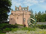
Sonnenuhr von Castle Fraser
(c) Bob Jones, CC BY-SA 2.0
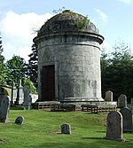
Fraser Mausoleumnahe Sauchen
57° 12′ 10,2″ N, 2° 31′ 23,9″ W
Mausoleum2947
Fraser Mausoleum
(c) Stanley Howe, CC BY-SA 2.0
Alter Friedhof von Clunynahe Sauchen
57° 12′ 9,9″ N, 2° 31′ 24,5″ W
Friedhof2948
Alter Friedhof von Cluny
(c) Martyn Gorman, CC BY-SA 2.0
Cluny Castlenahe Sauchen
57° 12′ 16,3″ N, 2° 30′ 59,5″ W
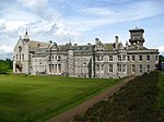
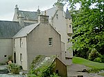
Burg2949Cluny Castle
Tillycairn Castlenahe Sauchen
57° 11′ 32,6″ N, 2° 33′ 22,3″ W
Tower House2959
Culsalmond Old Parish Churchnahe Colpy
57° 23′ 8″ N, 2° 35′ 1,4″ W
Kirchenruine2960
Culsalmond Old Parish Church
(c) Martyn Gorman, CC BY-SA 2.0
Crathie Suspension Bridgenahe Crathie
57° 2′ 0,6″ N, 3° 12′ 39,7″ W
Brücke2988
Crathie Suspension Bridge
(c) John Ferguson, CC BY-SA 2.0
Crathie Girder Bridgenahe Crathie
57° 2′ 21,9″ N, 3° 13′ 4″ W
Brücke2989
Crathie Girder Bridge
(c) Andrew Wood, CC BY-SA 2.0
Invercauld Housenahe Braemar
57° 0′ 57″ N, 3° 21′ 43,2″ W
Herrenhaus2995
Invercauld House
(c) Alan Findlay, CC BY-SA 2.0
Abergeldie Castlenahe Crathie
57° 2′ 35,8″ N, 3° 10′ 35,1″ W
Tower House3005
Abergeldie Castle
(c) Peter Gordon, CC BY-SA 2.0
Auchanachie Castlenahe Huntly
57° 30′ 35,1″ N, 2° 50′ 18,8″ W
Tower House3016
Crimond Parish ChurchCrimond
57° 36′ 3,1″ N, 1° 54′ 41,9″ W
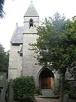
Kirche3028Crimond Parish Church
Finzean Turning Millnahe Aboyne
57° 0′ 49″ N, 2° 40′ 29,2″ W
Mühle3046
Finzean Turning Mill
(c) Stanley Howe, CC BY-SA 2.0
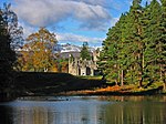
Inchdrewer Castlenahe Banff
57° 38′ 6,1″ N, 2° 34′ 40,3″ W
Burg3049
Inchdrewer Castle
(c) Richard Paxman, CC BY-SA 2.0
Potarch Bridgenahe Kincardine O’Neil
57° 3′ 54,5″ N, 2° 38′ 55,7″ W
Brücke3095
Potarch Bridge
(c) Stanley Howe, CC BY-SA 2.0
Finzean Bucket Millnahe Aboyne
57° 0′ 36,2″ N, 2° 41′ 49,5″ W
Mühle3100
Finzean Bucket Mill
(c) phil smith, CC BY-SA 2.0
Park Housenahe Drumoak
57° 4′ 6,1″ N, 2° 21′ 52″ W
Herrenhaus3103
Park House
(c) Alan Findlay, CC BY-SA 2.0
Drum Castlenahe Drumoak
57° 5′ 42,2″ N, 2° 20′ 16,7″ W
Burg3113Drum Castle
Rhu-Na-HavenAboyne
57° 4′ 5,1″ N, 2° 48′ 10,7″ W
Villa3126
Rhu-Na-Haven
(c) paddy heron, CC BY-SA 2.0
Dunecht Housenahe Dunecht
57° 9′ 39,3″ N, 2° 24′ 47,6″ W
Herrenhaus3133
Dunecht House
(c) Ian Sutherland, CC BY-SA 2.0
Echt Parish Churchnahe Echt
57° 8′ 28,1″ N, 2° 25′ 57,6″ W
Kirche3152
Echt Parish Church
(c) Stanley Howe, CC BY-SA 2.0
The Ha Housenahe Banchory
57° 5′ 8,7″ N, 2° 30′ 17,2″ W
Hotel3247
The Ha House
(c) Colin Smith, CC BY-SA 2.0
Crathes Castlenahe Banchory
57° 3′ 41,5″ N, 2° 26′ 23,3″ W
Tower House3262
Crathes Castle
(c) Bill Harrison, CC BY-SA 2.0
Balfluig CastleAlford
57° 13′ 27,2″ N, 2° 41′ 11,3″ W
Tower House3278
Balfluig Castle
(c) Anne Burgess, CC BY-SA 2.0
St Margaret’s Episcopal ChurchBraemar
57° 0′ 20,7″ N, 3° 23′ 50,1″ W
Kirche6266
St Margaret’s Episcopal Church
(c) Alan Morrison, CC BY-SA 2.0
South Colleonardnahe Banff
57° 39′ 11,1″ N, 2° 33′ 28,9″ W
Villa6662
South Colleonard
(c) Anne Burgess, CC BY-SA 2.0
Gairnshiel Bridgenahe Crathie
57° 5′ 36″ N, 3° 9′ 55″ W
Brücke6747
Gairnshiel Bridge
(c) Lyn Mcleod, CC BY-SA 2.0
Castle of Fiddesnahe Stonehaven
56° 55′ 21″ N, 2° 17′ 25″ W
Tower House6753
Balbegno Castlenahe Fettercairn
56° 50′ 48,9″ N, 2° 35′ 34,4″ W
Tower House6754
Balbegno Castle
(c) Stanley Howe, CC BY-SA 2.0
Marktkreuz von FettercairnFettercairn
56° 51′ 7,3″ N, 2° 34′ 28,7″ W
Marktkreuz6755
Marktkreuz von Fettercairn
(c) Trish Steel, CC BY-SA 2.0
Taubenturm von Findlater Castlenahe Cullen
57° 41′ 17,4″ N, 2° 46′ 23,6″ W
Taubenturm6759
Taubenturm von Findlater Castle
(c) JThomas, CC BY-SA 2.0
Bridge of Keignahe Keig
57° 15′ 26,1″ N, 2° 38′ 6″ W
Brücke9057
Aquhorthies Housenahe Inverurie
57° 16′ 11,9″ N, 2° 27′ 3,9″ W
Villa9073
Aquhorthies House
(c) Alison Mack, CC BY-SA 2.0
Castle BridgeHuntly
57° 27′ 20,3″ N, 2° 46′ 49,9″ W
Brücke9081
Auchmacoy Dovecotnahe Ellon
57° 22′ 23,5″ N, 2° 1′ 7,5″ W
Taubenturm9089Auchmacoy Dovecot
Kildrummy Parish ChurchKildrummy
57° 14′ 45,1″ N, 2° 52′ 34,4″ W
Kirche9093
Kildrummy Parish Church
(c) Stanley Howe, CC BY-SA 2.0
Nether Ardgrainnahe Ellon
57° 23′ 45,7″ N, 2° 4′ 47,6″ W
Bauernhaus9106Nether Ardgrain
Old Parish Churchnahe Bellabeg
57° 13′ 21,6″ N, 3° 2′ 8,3″ W
Kirche9126
Old Parish Church
(c) Stanley Howe, CC BY-SA 2.0
Keith Hallnahe Inverurie
57° 16′ 51,3″ N, 2° 21′ 11,9″ W
Herrenhaus9136Keith Hall
Balbithan Housenahe Inverurie
57° 15′ 36,9″ N, 2° 18′ 47″ W
Tower House9140
Beldorney Castlenahe Dufftown
57° 25′ 10,4″ N, 2° 57′ 46,8″ W
Tower House9163
Beldorney Castle
(c) Anne Burgess, CC BY-SA 2.0
Grabplatte an der Foveran Parish ChurchFoveran
57° 18′ 28,2″ N, 2° 1′ 35,9″ W
Platte9166
Leith Hallnahe Kennethmont
57° 21′ 22,6″ N, 2° 45′ 53,4″ W
Herrenhaus9183
Leith Hall
(c) Alan Findlay, CC BY-SA 2.0
Kemnay HouseKemnay
57° 13′ 41,6″ N, 2° 26′ 34,3″ W
Tower House9212
Kemnay House
(c) Peter Robinson, CC BY-SA 2.0
Mains of Hallhead Housenahe Alford
57° 10′ 12,8″ N, 2° 47′ 14,9″ W
Bauernhaus9218
Mains of Hallhead House
(c) Stanley Howe, CC BY-SA 2.0
Craigievar Castlenahe Alford
57° 10′ 27,1″ N, 2° 43′ 5,1″ W
Tower House9229
Cairness Housenahe Crimond
57° 38′ 17,4″ N, 1° 56′ 15,2″ W
Herrenhaus9263
Cairness House
(c) JThomas, CC BY-SA 2.0
Lodge von Cairness Housenahe Crimond
57° 38′ 21,3″ N, 1° 56′ 0,4″ W
Lodge9264Lodge von Cairness House
Crimonmogate Housenahe Crimond
57° 37′ 5,6″ N, 1° 56′ 4,9″ W
Herrenhaus9270Crimonmogate House
Muchalls Castlenahe Stonehaven
57° 1′ 3,1″ N, 2° 10′ 47,3″ W
Herrenhaus9352Muchalls Castle
Taubenturm von Fetteresso Castlenahe Stonehaven
56° 57′ 34,2″ N, 2° 15′ 30,3″ W
Taubenturm9371
Craigston Castlenahe Turriff
57° 35′ 4,5″ N, 2° 23′ 57,6″ W
Tower House9392
Craigston Castle
(c) Anne Burgess, CC BY-SA 2.0
Old Parish Church of LongsideLongside
57° 30′ 54,7″ N, 1° 56′ 20,8″ W
Kirchenruine9410Old Parish Church of Longside
Tor der Old Parish Church of LongsideLongside
57° 30′ 55″ N, 1° 56′ 22,3″ W
Tor9412Tor der Old Parish Church of Longside
Frendraught Housenahe Huntly
57° 27′ 56,4″ N, 2° 38′ 1,4″ W
Herrenhaus9449
Frendraught House
(c) James Allan, CC BY-SA 2.0
Gärten von Balbegno Castlenahe Fettercairn
56° 50′ 47,6″ N, 2° 35′ 33,3″ W
Gärten9495
Taubenhaus von Balbegno Castlenahe Fettercairn
56° 50′ 49″ N, 2° 35′ 29,4″ W
Taubenhaus9497
Taubenhaus von Balbegno Castle
(c) Andrew Wood, CC BY-SA 2.0
Fasque Housenahe Fettercairn
56° 52′ 11,6″ N, 2° 34′ 40,9″ W
Herrenhaus9503
Fasque House
(c) Richard Slessor, CC BY-SA 2.0
Fyvie Castlenahe Turriff
57° 26′ 36,4″ N, 2° 23′ 42″ W
Burg9615
Fyvie Castle
(c) Mike and Kirsty Grundy, CC BY-SA 2.0
St Palladius Episcopal Churchnahe Auchenblae
56° 54′ 33,4″ N, 2° 28′ 55,4″ W
Kirche9634
St Palladius Episcopal Church
(c) Stanley Howe, CC BY-SA 2.0
Phesdo Housenahe Fettercairn
56° 52′ 15,6″ N, 2° 32′ 0″ W
Villa9646
Drumtochty Castlenahe Auchenblae
56° 54′ 38,7″ N, 2° 29′ 40″ W
Herrenhaus9664
Drumtochty Castle
(c) C Michael Hogan, CC BY-SA 2.0
Troup Home Farmnahe Gardenstown
57° 40′ 50,6″ N, 2° 16′ 59,3″ W
Bauernhof10585
Birkenbog Housenahe Fordyce
57° 40′ 24,7″ N, 2° 46′ 42,6″ W
Wohngebäude10586
Birkenbog House
(c) Christopher Gillan, CC BY-SA 2.0
Fordyce CastleFordyce
57° 39′ 42,6″ N, 2° 44′ 46,1″ W
Tower House10623
Fordyce Castle
(c) Dominic Moore, CC BY-SA 2.0
Taubenturm von Glassaugh Housenahe Fordyce
57° 40′ 14,8″ N, 2° 44′ 27,3″ W
Taubenturm10650
Glassaugh Housenahe Fordyce
57° 40′ 14,4″ N, 2° 44′ 31,5″ W
Herrenhaus10694
Forglen Housenahe Turriff
57° 33′ 21,2″ N, 2° 30′ 16,5″ W
Herrenhaus13603Forglen House
Bridge of Dyenahe Banchory
56° 57′ 52,5″ N, 2° 34′ 31,7″ W
Brücke13878
Bridge of Dye
(c) Stanley Howe, CC BY-SA 2.0
Terpersie Castlenahe Alford
57° 16′ 13,7″ N, 2° 45′ 13,3″ W
Tower House13879
Terpersie Castle
(c) Richard Paxman, CC BY-SA 2.0
Marykirk Bridgenahe Marykirk
56° 46′ 32,1″ N, 2° 30′ 55,4″ W
Brücke13891
Upper North Water Bridgenahe Marykirk
56° 47′ 7,6″ N, 2° 34′ 12,3″ W
Brücke13892
Upper North Water Bridge
(c) Karen Vernon, CC BY-SA 2.0
Taubenturm von Mounthooleynahe Peathill
57° 40′ 59,6″ N, 2° 7′ 40,8″ W
Taubenturm15909
Taubenturm von Mounthooley
(c) Des Colhoun, CC BY-SA 2.0
Hill Curch of RoseheartyPeathill
57° 41′ 10,6″ N, 2° 6′ 42,5″ W
Kirche15911Hill Curch of Rosehearty
Mains of Pittendrum HouseSandhaven
57° 41′ 34,3″ N, 2° 3′ 40,7″ W
Bauernhaus15914Mains of Pittendrum House
Udny Castlenahe Pitmedden
57° 19′ 53,4″ N, 2° 11′ 50,3″ W
Tower House15922Udny Castle
Pitmedden Great GardenPitmedden
57° 20′ 33,8″ N, 2° 11′ 30,4″ W
Gärten15925Pitmedden Great Garden
Glenkindie Housenahe Kildrummy
57° 13′ 1,8″ N, 2° 57′ 27,3″ W
Herrenhaus15945
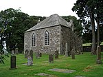
House of MonymuskMonymusk
57° 13′ 43,6″ N, 2° 31′ 1,4″ W
Herrenhaus15967
House of Monymusk
(c) Greg Stringham, CC BY-SA 2.0
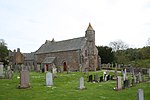
Monymusk Parish ChurchMonymusk
57° 13′ 36,8″ N, 2° 31′ 24,8″ W
Kirche15987
Monymusk Parish Church
(c) Richard Slessor, CC BY-SA 2.0
Marktkreuz von Old RayneOld Rayne
57° 20′ 38,9″ N, 2° 32′ 31,9″ W
Marktkreuz16019
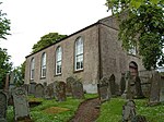
Aberdeenshire Farming MuseumOld Deer
57° 31′ 18,4″ N, 2° 1′ 58,1″ W
Museum16096
Aberdeenshire Farming Museum
(c) Colin Smith, CC BY-SA 2.0
Straloch Housenahe Newmachar
57° 16′ 47,7″ N, 2° 13′ 58″ W
Herrenhaus16125
Harthill Castlenahe Insch
57° 18′ 57,9″ N, 2° 31′ 19,1″ W
Tower House16132
Harthill Castle
(c) Ann Harrison, CC BY-SA 2.0
Westhall Housenahe Old Rayne
57° 19′ 45,2″ N, 2° 32′ 38,3″ W
Herrenhaus16134
Westhall House
(c) Ulrich Hartmann, CC BY-SA 2.0
Cairnbulg Castlenahe Fraserburgh
57° 39′ 56,2″ N, 1° 58′ 25″ W
Burg16143
Cairnbulg Castle
(c) Astrid Horn, CC BY-SA 2.0
House of Memsienahe Fraserburgh
57° 38′ 28″ N, 2° 2′ 48,8″ W
Herrenhaus16146House of Memsie
Skellater Housenahe Bellabeg
57° 10′ 57″ N, 3° 8′ 7,4″ W
Herrenhaus16173
Bellabeg HouseBellabeg
57° 12′ 13,5″ N, 3° 4′ 6,8″ W
Herrenhaus16188
Montgarrie MillMontgarrie
57° 14′ 53,3″ N, 2° 42′ 23″ W
Mühle16207
Tor von Meldrum HouseOldmeldrum
57° 21′ 6,7″ N, 2° 18′ 50,1″ W
Tor16225Tor von Meldrum House
Lickleyhead Castlenahe Insch
57° 18′ 7,5″ N, 2° 37′ 13,8″ W
Tower House16234
Lickleyhead Castle
(c) Stanley Howe, CC BY-SA 2.0
Midmar Castlenahe Echt
57° 8′ 13,8″ N, 2° 29′ 23,6″ W
Burg16262
Midmar Castle
(c) Colin Smith, CC BY-SA 2.0
Sonnenuhr von Midmar Castlenahe Echt
57° 8′ 13,6″ N, 2° 29′ 24,1″ W
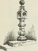
Sonnenuhr16263Sonnenuhr von Midmar Castle
Gärten von Midmar Castlenahe Echt
57° 8′ 13,7″ N, 2° 29′ 20,6″ W
Gärten16264
Linton Housenahe Sauchen
57° 10′ 47,8″ N, 2° 29′ 22,5″ W
Herrenhaus16274
Balmanno Housenahe Marykirk
56° 47′ 21,2″ N, 2° 30′ 25,3″ W
Herrenhaus16278
Taubenhaus von Inglismaldie Castlenahe Marykirk
56° 47′ 21,6″ N, 2° 35′ 14″ W
Taubenhaus16289
Taubenhaus von Inglismaldie Castle
(c) Andrew Wood, CC BY-SA 2.0
Forebank Housenahe Marykirk
56° 46′ 23,1″ N, 2° 29′ 27″ W
Villa16328
Forebank House
(c) Anne Burgess, CC BY-SA 2.0
Lower North Water Bridgenahe St Cyrus
56° 45′ 1,5″ N, 2° 27′ 7,1″ W
Brücke16330
Lower North Water Bridge
(c) Alan Morrison, CC BY-SA 2.0
Buchan Ness LighthouseBoddam
57° 28′ 13,5″ N, 1° 46′ 27,7″ W
Leuchtturm16367
Buchan Ness Lighthouse
(c) Richard Slessor, CC BY-SA 2.0
Towie Barclay Castlenahe Turriff
57° 29′ 5,6″ N, 2° 25′ 41″ W
Tower House16405Towie Barclay Castle
Delgatie Castlenahe Turriff
57° 32′ 39,4″ N, 2° 24′ 42,6″ W
Tower House16421
Delgatie Castle
(c) Bill Harrison, CC BY-SA 2.0
Hatton Castlenahe Turriff
57° 30′ 44,3″ N, 2° 24′ 25,1″ W
Herrenhaus16431
Hatton Castle
(c) Des Colhoun, CC BY-SA 2.0
St John’s Episcopal ChurchNew Pitsligo
57° 35′ 35,1″ N, 2° 11′ 50,7″ W
Kirche16440St John’s Episcopal Church
Haddo Housenahe Ellon
57° 24′ 10,9″ N, 2° 13′ 13,3″ W
Herrenhaus16470
Haddo House
(c) JThomas, CC BY-SA 2.0
Lodges von Dunecht Housenahe Dunecht
57° 9′ 46,8″ N, 2° 21′ 23,1″ W
Lodge16505
Lodges von Dunecht House
(c) Stanley Howe, CC BY-SA 2.0
Garlogie Village HallGarlogie
57° 8′ 23,2″ N, 2° 21′ 41,1″ W
Industriebauwerk16506
Garlogie Village Hall
(c) Stanley Howe, CC BY-SA 2.0
Skene HouseSkene
57° 10′ 40,3″ N, 2° 23′ 8,3″ W
Herrenhaus16530
Skene House
(c) Andrew Tryon, CC BY-SA 2.0
Rathaus von StrichenStrichen
57° 35′ 11,3″ N, 2° 5′ 26,7″ W
Rathaus16551Rathaus von Strichen
New Chapelnahe Milltimber
57° 5′ 56,5″ N, 2° 11′ 39″ W
Kirche19227
New Chapel
(c) Lizzie, CC BY-SA 2.0
Castle of Parknahe Cornhill
57° 36′ 8,7″ N, 2° 41′ 21,9″ W
Herrenhaus19597
Castle of Park
(c) Stephen Bowden, CC BY-SA 2.0
Crombie Castlenahe Aberchirder
57° 33′ 30,5″ N, 2° 41′ 6,4″ W
Tower House19602
Crombie Castle
(c) Greg Stringham, CC BY-SA 2.0
Kinnairdy Castlenahe Aberchirder
57° 32′ 12,1″ N, 2° 39′ 17,1″ W
Tower House19606
Kinnairdy Castle
(c) Ann Harrison, CC BY-SA 2.0
Friedhof von Marnochnahe Aberchirder
57° 32′ 16,7″ N, 2° 40′ 40,8″ W
Friedhof19610
Friedhof von Marnoch
(c) Anne Burgess, CC BY-SA 2.0
11 Boyndie StreetBanff
57° 39′ 53,9″ N, 2° 31′ 26,6″ W
Clubhaus21885
Bridge of BanffBanff
57° 39′ 46,3″ N, 2° 30′ 47,9″ W
Brücke21893
Bridge of Banff
(c) Anne Burgess, CC BY-SA 2.0
Banff Town HallBanff
57° 40′ 0″ N, 2° 31′ 26″ W
Halle21941
Banff CastleBanff
57° 39′ 59,8″ N, 2° 31′ 20,7″ W
Villa21957
Banff Castle
(c) Alisdair Mclean, CC BY-SA 2.0
Duff HouseBanff
57° 39′ 31,3″ N, 2° 31′ 12,2″ W
Schloss21985
Duff House
(c) JThomas, CC BY-SA 2.0
Mausoleum von Duff HouseBanff
57° 39′ 15,1″ N, 2° 32′ 13,7″ W
Mausoleum21988
Mausoleum von Duff House
(c) Anne Burgess, CC BY-SA 2.0
1 High ShoreBanff
57° 39′ 53,6″ N, 2° 31′ 15,8″ W
Wohngebäude22004
1 High Shore
(c) Jo Turner, CC BY-SA 2.0
Banff Primary SchoolBanff
57° 39′ 45,6″ N, 2° 31′ 27,4″ W
Schule22035
8–16 Low StreetBanff
57° 39′ 48,2″ N, 2° 31′ 17″ W
Wohn- und Geschäftsgebäude22056
8–16 Low Street
(c) Anne Burgess, CC BY-SA 2.0
Tolbooth SteepleBanff
57° 39′ 51,7″ N, 2° 31′ 17,2″ W
Rathaus22062
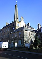
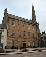
Tolbooth Steeple
(c) Alisdair Mclean, CC BY-SA 2.0
Rathaus von BanffBanff
57° 39′ 52″ N, 2° 31′ 17,4″ W
Rathaus22063
Rathaus von Banff
(c) Anne Burgess, CC BY-SA 2.0
Banff HarbourBanff
57° 40′ 13,1″ N, 2° 31′ 21,3″ W
Hafen22077
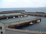
Banff Harbour
(c) Bob Jones, CC BY-SA 2.0
St Catherine’sBanff
57° 40′ 3,7″ N, 2° 31′ 26,3″ W
Villa22098
Ingleneuk HouseBanff
57° 39′ 55,1″ N, 2° 31′ 17,2″ W
Wohngebäude22111
Sonnenuhr von Ellon CastleEllon
57° 21′ 59,2″ N, 2° 4′ 5,4″ W
Sonnenuhr31108Sonnenuhr von Ellon Castle
Old Bridge of EllonEllon
57° 21′ 48,3″ N, 2° 4′ 23,1″ W
Brücke31110
Old Bridge of Ellon
(c) Colin Smith, CC BY-SA 2.0
St Mary on the Rock Episcopal ChurchEllon
57° 21′ 42,2″ N, 2° 4′ 17,9″ W
Kirche31111St Mary on the Rock Episcopal Church
Marktkreuz von FraserburghFraserburgh
57° 41′ 37,2″ N, 2° 0′ 18,6″ W
Marktkreuz31867Marktkreuz von Fraserburgh
Altes Zollhaus von FraserburghFraserburgh
57° 41′ 32″ N, 2° 0′ 18,4″ W
Geschäftsgebäude31873Altes Zollhaus von Fraserburgh
Kinnaird Head LighthouseFraserburgh
57° 41′ 51,5″ N, 2° 0′ 14,2″ W
Leuchtturm31888Kinnaird Head Lighthouse
The Gordon SchoolsHuntly
57° 27′ 2″ N, 2° 47′ 0,2″ W
Schule34943
The Gordon Schools
(c) Colin Smith, CC BY-SA 2.0
St Margaret’s ChurchHuntly
57° 26′ 57,7″ N, 2° 47′ 15″ W
Kirche34945
St Margaret’s Church
(c) Stanley Howe, CC BY-SA 2.0
Alexander Scott’s HospitalHuntly
57° 26′ 41,7″ N, 2° 46′ 51,6″ W
Pflegeheim34962
Alexander Scott’s Hospital
(c) Stanley Howe, CC BY-SA 2.0
Old Bervie BridgeInverbervie
56° 50′ 50,2″ N, 2° 16′ 40,3″ W
Brücke35070
Old Bervie Bridge
(c) jamesnicoll, CC BY-SA 2.0
Rathaus von KintoreKintore
57° 14′ 13,3″ N, 2° 20′ 44,6″ W
Rathaus36312
Rathaus von Kintore
(c) Colin Smith, CC BY-SA 2.0
Peterhead Old Parish ChurchPeterhead
57° 30′ 17,9″ N, 1° 46′ 58,1″ W
Kirche39671Peterhead Old Parish Church
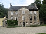
23–27 North High StreetPortsoy
57° 41′ 2,3″ N, 2° 41′ 29″ W
Wohngebäude40262
23–27 North High Street
(c) Anne Burgess, CC BY-SA 2.0
16–20 North High StreetPortsoy
57° 41′ 2,4″ N, 2° 41′ 28,2″ W
Wohngebäude40268
10 ShoreheadPortsoy
57° 41′ 5″ N, 2° 41′ 30,5″ W
Wohngebäude4029210 Shorehead
Corf WarehousePortsoy
57° 41′ 5,8″ N, 2° 41′ 30″ W
Speicher40293
Corf Warehouse
(c) Stanley Howe, CC BY-SA 2.0
Alter Hafen von PortsoyPortsoy
57° 41′ 6,1″ N, 2° 41′ 27,9″ W
Hafen40296
Alter Hafen von Portsoy
(c) Ann Harrison, CC BY-SA 2.0
St James the Great Episcopal ChurchStonehaven
56° 57′ 44,8″ N, 2° 12′ 36,4″ W
Kirche41552
St James the Great Episcopal Church
(c) Stanley Howe, CC BY-SA 2.0
Fetteresso Parish ChurchStonehaven
56° 58′ 6,5″ N, 2° 13′ 1,2″ W
Kirche41576
Fetteresso Parish Church
(c) Stanley Howe, CC BY-SA 2.0
CarronbankStonehaven
56° 57′ 45″ N, 2° 13′ 10″ W
Villa41593
6 Keith PlaceStonehaven
56° 57′ 40″ N, 2° 12′ 12,7″ W
Wohngebäude41638
Tolbooth von StonehavenStonehaven
56° 57′ 38,7″ N, 2° 12′ 7,8″ W
Rathaus41655
Tolbooth von Stonehaven
(c) Stanley Howe, CC BY-SA 2.0
Old Parish Church of St ConganTurriff
57° 32′ 15,9″ N, 2° 27′ 56,1″ W
Kirchenruine42163
Old Parish Church of St Congan
(c) stephen samson, CC BY-SA 2.0
St Thomas’s Episcopal ChurchAboyne
57° 4′ 31,8″ N, 2° 47′ 35,3″ W
Kirche47053
St Thomas’s Episcopal Church
(c) Jonathan Thacker, CC BY-SA 2.0
Souter’s ShopBallogie
57° 3′ 19,3″ N, 2° 41′ 57″ W
Wohn- und Geschäftsgebäude47119
Auchtavan Cottagenahe Crathie
57° 2′ 38″ N, 3° 18′ 51,8″ W
Wohngebäude50074
Auchtavan Cottage
(c) Nigel Corby, CC BY-SA 2.0
Tarlair Swimming PoolMacduff
57° 40′ 14,8″ N, 2° 28′ 15,7″ W
Schwimmbad50788
Tarlair Swimming Pool
(c) Anne Burgess, CC BY-SA 2.0
Balmoral Castlenahe Crathie
57° 2′ 26,1″ N, 3° 13′ 49″ W
Schloss51460
Balmoral Castle
(c) JThomas, CC BY-SA 2.0
Dairy Cottagesnahe Crathie
57° 2′ 8,9″ N, 3° 13′ 12,6″ W
Wohngebäude51468
Werkstätten von Balmoral Castlenahe Crathie
57° 2′ 26,9″ N, 3° 13′ 39,2″ W
Werkstätten51479
Stallungen von Balmoral Castlenahe Crathie
57° 2′ 8″ N, 3° 13′ 14,1″ W
Stallungen51491
John-Brown-Statuenahe Crathie
57° 2′ 3,2″ N, 3° 13′ 14,7″ W
Statue51493
Prince-Albert-Statuenahe Crathie
57° 2′ 14,4″ N, 3° 13′ 6,5″ W
Statue51494
Queen-Victoria-Statuenahe Crathie
57° 2′ 18,6″ N, 3° 13′ 10,5″ W
Statue51495
Venison Lardernahe Crathie
57° 2′ 25,7″ N, 3° 13′ 31,8″ W
Statue51497
Garbh Allt Falls Bridgenahe Crathie
57° 2′ 25,7″ N, 3° 13′ 31,8″ W
Brücke51513
Tomintoul Croftnahe Braemar
56° 59′ 51,7″ N, 3° 24′ 37,6″ W
Wohngebäude51797

Weblinks

Commons: Kategorie-A-Bauwerke in Aberdeenshire – Sammlung von Bildern, Videos und Audiodateien

Auf dieser Seite verwendete Medien

Barra Castle - geograph.org.uk - 938771.jpg
(c) Andrew Wood, CC BY-SA 2.0
Barra Castle Lying between Oldmeldrum and Inverurie and overlooked by Barra Hill, Barra Castle is now a sublet flatted property but no less imposing.
St Mary's church , Blairs College - geograph.org.uk - 11778.jpg
(c) Lizzie, CC BY-SA 2.0
St Mary's church , Blairs College. St Mary's R Church at Blairs College on South Deeside.
Church of Turriff - geograph.org.uk - 843131.jpg
(c) stephen samson, CC BY-SA 2.0
Church of Turriff Remains of the medieval church of Turriff. In December 1861 portions of the choir were taken away, and on removing the stones from a window in the south wall, there appeared on the splay of one of the sides a human figure painted on the plaster in bright colours. Another painting was found on the other splay but was unfortunately never recorded and it was broken up and destroyed!
Rhu na Haven - geograph.org.uk - 35329.jpg
(c) paddy heron, CC BY-SA 2.0
Rhu na Haven. Part of the policies of Rhu na Haven, designed by Lorimer.
Kinnaird's Head Castle Lighthouse 01.jpg
Autor/Urheber: Sagaciousphil, Lizenz: CC BY-SA 3.0
Dieses Foto zeigt das geschützte Denkmal in Schottland mit der Nummer
Church of St John the Evangelist, New Pitsligo 06.jpg
Autor/Urheber: Sagaciousphil, Lizenz: CC BY-SA 3.0
Dieses Foto zeigt das geschützte Denkmal in Schottland mit der Nummer
Duff House Mausoleum - geograph.org.uk - 1761770.jpg
(c) Anne Burgess, CC BY-SA 2.0
Duff House Mausoleum This elaborate building was erected by James Duff in 1790, when he was raised to the rank of 2nd Earl of Fife. He moved the remains of his forebears here, including those of his father the first earl, who built Duff House. For full details see http://hsewsf.sedsh.gov.uk/hslive/hsstart?P_HBNUM=21988 and http://canmore.rcahms.gov.uk/en/site/18468/details/duff+house+mausoleum+and+st+mary+s+well/ Generally speaking, I am in favour of trees, but there are cases where the removal of a few would be beneficial, and this is one of them. It is all but impossible to get a proper view of the mausoleum, and the trees are so close that there must be a risk of them damaging the building.
Cluny Castle.jpg
Autor/Urheber: Cosmolinzeegordon, Lizenz: CC BY-SA 3.0
Face view of Cluny Castle showing the West Wing
Custom House, Fraserburgh 02.JPG
Autor/Urheber: Sagaciousphil, Lizenz: CC BY-SA 3.0
Dieses Foto zeigt das geschützte Denkmal in Schottland mit der Nummer
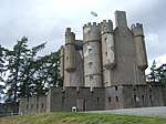
Castle Fraser - geograph.org.uk - 96559.jpg
(c) Richard Slessor, CC BY-SA 2.0
Castle Fraser. National Trust for Scotland property dating from 1676.
Invercauld House - geograph.org.uk - 423852.jpg
(c) Alan Findlay, CC BY-SA 2.0
Invercauld House The House dates from the 13th century, and is the seat of Capt. A. Farquharson, chief of the Farquharson clan, of which my family name is a sept. The House lies next to the river Dee, near Braemar Castle and Balmoral Castle. The snow covered mountain in the background is Ben-a-Bhuird, taken from a loch near the House.
Westhall near Oyne - geograph.org.uk - 1076173.jpg
(c) Ulrich Hartmann, CC BY-SA 2.0
Westhall near Oyne. Nearly nothing has to be added to the comment on494946, except that it has been on the market at Savill's in 2007 but obviously nothing has changed according to http://www.buildingsatrisk.org.uk
Southwest tower of Drumtochty Castle - geograph.org.uk - 894777.jpg
(c) C Michael Hogan, CC BY-SA 2.0
Southwest tower of Drumtochty Castle
Drum Castle, Drumoak, Banchory, Aberdeenshire.jpg
Autor/Urheber: Rosser1954, Lizenz: CC BY-SA 4.0
Drum Castle, Drumoak, Banchory, Aberdeenshire. View from car park
Delgatie Castle - geograph.org.uk - 1497365.jpg
(c) Bill Harrison, CC BY-SA 2.0
Delgatie Castle For the official website: http://www.delgatiecastle.com/
Keith Hall 1909.jpg
Colorized photograph of Keith Hall (Caskieben) near Inverurie, Scotland. Postcard dated June 30th, 1909.
The Gordon Schools.jpg
(c) Colin Smith, CC BY-SA 2.0
The Gordon Schools, Huntly
Gateway to Old Parish Church, Longside 01.JPG
Autor/Urheber: Sagaciousphil, Lizenz: CC BY-SA 3.0
Dieses Foto zeigt das geschützte Denkmal in Schottland mit der Nummer
Muchallscastle.jpg
Muchalls Castle.
The Old Brig, Ellon - geograph.org.uk - 398760.jpg
(c) Colin Smith, CC BY-SA 2.0
The Old Brig, Ellon Ancient three-arched bridge across the Ythan, now superseded by a modern road bridge.
Peterhead Old Parish Church 03.JPG
Autor/Urheber: Sagaciousphil, Lizenz: CC BY-SA 3.0
Dieses Foto zeigt das geschützte Denkmal in Schottland mit der Nummer
Crathes Castle - geograph.org.uk - 477241.jpg
(c) Bill Harrison, CC BY-SA 2.0
Crathes Castle Crathes Castle and its magnificent gardens are maintained by the National Trust for Scotland
Kemnay House (geograph 1836648).jpg
(c) Peter Robinson, CC BY-SA 2.0
Kemnay House
Terpersie Castle - geograph.org.uk - 494943.jpg
(c) Richard Paxman, CC BY-SA 2.0
Terpersie Castle Terpersie is a very attractive small Z-plan castle, hidden away behind a farm in a side glen on the south side of the Correen Hills. It was restored from an almost complete ruin within the last 20 years or so. The last Gordon of Terpersie was "out" during the rebellion of 1745, and he hid in the Correen Hills above his house after the defeat at Culloden until eventually he was caught by the searching government troops. They did not at first realise who they had caught, thinking him just a vagrant, until he was brought down to Terpersie where his children on seeing him ran towards him with cries of "Daddy Daddy"!! He was taken to Carlisle and hung!
Licklyhead Castle, Auchleven - geograph.org.uk - 254419.jpg
(c) Stanley Howe, CC BY-SA 2.0
Licklyhead Castle, Auchleven A chateau-maison designed by James Bell c.1626 for the Leslies. See more history at http://ads.ahds.ac.uk/catalogue/adsdata/PSAS_2002/pdf/vol_106/106_161_171.pdf
The Doocot - geograph.org.uk - 959121.jpg
(c) Andrew Wood, CC BY-SA 2.0
The Doocot Lying in a field this dovecot gives name to both a nearby farm and camping site.
Park House - geograph.org.uk - 1442684.jpg
(c) Alan Findlay, CC BY-SA 2.0
Drumoak (civil parish), Aberdeenshire, Park House
Beldorney Castle - geograph.org.uk - 1235692.jpg
(c) Anne Burgess, CC BY-SA 2.0
Beldorney Castle Best seen in winter when the leafless trees allow a view from the public road, Beldorney Castle is a Z-plan castle dating from the 16th century. In the 15th century Beldorney was granted to Sir James Ogilvy of Deskford, and in the 16th century it passed, possibly through marriage, to George Gordon, 1st of Beldorney. in the late 18th century it was sold to Sir William Grant, whose family retained it until 1919. There is a detailed article about Beldorney Castle at http://ads.ahds.ac.uk/catalogue/adsdata/PSAS_2002/pdf/vol_105/105_262_280.pdf
Udny Castle 05.jpg
Autor/Urheber: Sagaciousphil, Lizenz: CC BY-SA 3.0
Dieses Foto zeigt das geschützte Denkmal in Schottland mit der Nummer
Strichen Town House 04.jpg
Autor/Urheber: Sagaciousphil, Lizenz: CC BY-SA 3.0
Dieses Foto zeigt das geschützte Denkmal in Schottland mit der Nummer
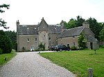
Pittodries Yate (Gate), Chapel of Garioch (geograph 4647329).jpg
(c) Bill Harrison, CC BY-SA 2.0
Pittodrie's Yate (Gate), Chapel of Garioch
Inchdrewer Castle - geograph.org.uk - 494951.jpg
(c) Richard Paxman, CC BY-SA 2.0
Inchdrewer Castle Inchdrewer Castle stands on high ground looking out over Banff to the North Sea. It is a fine house, now fallen on sad days. Like most Scottish castles, it has seen its share of incidents! Lord Banff was murdered here by his own servants (probably having earned it!), who in an attempt to hide their crime, torched the castle. It remained a ruin for a long time but has undergone some half-hearted restoration.
Garlogie Mill Power House.jpg
(c) Stanley Howe, CC BY-SA 2.0
Garlogie Mill Power House, now a museum containing a rare beam engine, Garlogie, Aberdeenshire
Scottish-Castle-Symbol.svg
Autor/Urheber: Majo statt Senf, Lizenz: CC BY-SA 4.0
Schlosssymbol Schottland
Alexander Scotts Hospital (geograph 3083423).jpg
(c) Stanley Howe, CC BY-SA 2.0
Alexander Scott's Hospital
Bourtie House, front.JPG
Autor/Urheber: Sagaciousphil, Lizenz: CC BY-SA 3.0
Dieses Foto zeigt das geschützte Denkmal in Schottland mit der Nummer
The cottage at Auchtavan - geograph.org.uk - 1440008.jpg
(c) Nigel Corby, CC BY-SA 2.0
The cottage at Auchtavan. The cottage was recently the subject of a major restoration project. http://www.auchtavan.com

The cottage is of particular historical significance because it is considered to provide nationally important surviving evidence of the early traditional Scottish small house and it has of a number of rare architectural features. These include a cruckframed roof structure, with heather and thatch roofing under corrugated iron; rubble dry stone walls with some lime mortar, and a largely intact hanging lum (chimney) of vertical timber boarding over an open hearth. The cottage would originally have been divided into two; the left side was for the animals and the right side with the hanging lum was for the family. See also 1466978 1466981

1466987
Tarlair Swimming Pool - geograph.org.uk - 435018.jpg
(c) Anne Burgess, CC BY-SA 2.0
Tarlair Swimming Pool In its heyday a popular attraction, the pool now lies forlorn and abandoned.
Scottish Episcopal Church of St Palladius - geograph.org.uk - 1387528.jpg
(c) Stanley Howe, CC BY-SA 2.0
Scottish Episcopal Church of St Palladius
Market Cross, Fraserburgh 02.jpg
Autor/Urheber: Sagaciousphil, Lizenz: CC BY-SA 3.0
Dieses Foto zeigt das geschützte Denkmal in Schottland mit der Nummer
Aden Country Park, Museum.jpg
(c) Colin Smith, CC BY-SA 2.0
Farming museum at Aden Country Park, Aberdeenshire
Fyvie Castle, Geograph.jpg
(c) Mike and Kirsty Grundy, CC BY-SA 2.0
Fyvie Castle in the village of Fyvie, near Turriff in Aberdeenshire, Scotland.
North Gatehouse - geograph.org.uk - 514519.jpg
(c) Stanley Howe, CC BY-SA 2.0
North Gatehouse East Lodge, Dunecht.
Cairness House, lodge 01.JPG
Autor/Urheber: Sagaciousphil, Lizenz: CC BY-SA 3.0
Dieses Foto zeigt das geschützte Denkmal in Schottland mit der Nummer
House of Monymusk.jpg
(c) Greg Stringham, CC BY-SA 2.0
House of Monymusk, Monymusk, Aberdeenshire
Meldrum House stable and coachhouse.JPG
Autor/Urheber: Sagaciousphil, Lizenz: CC BY-SA 3.0
Dieses Foto zeigt das geschützte Denkmal in Schottland mit der Nummer
23-27 North High Street (geograph 4020174).jpg
(c) Anne Burgess, CC BY-SA 2.0
23-27 North High Street
Nether Ardgrain, Farmhouse, front.JPG
Autor/Urheber: Sagaciousphil, Lizenz: CC BY-SA 3.0
Dieses Foto zeigt das geschützte Denkmal in Schottland mit der Nummer
Fetteresso Parish Church - geograph.org.uk - 299456.jpg
(c) Stanley Howe, CC BY-SA 2.0
Fetteresso Parish Church Church of Scotland. Replacement (built 1810-12) for the old St Cieran's Church at Fetteresso, with a frontage modelled on Fetteresso Castle.
ScotlandAberdeenshire.png
Autor/Urheber: unknown, Lizenz: CC-BY-SA-3.0
House of Memsie 01.JPG
Autor/Urheber: Sagaciousphil, Lizenz: CC BY-SA 3.0
Dieses Foto zeigt das geschützte Denkmal in Schottland mit der Nummer
Echt church.jpg
(c) Stanley Howe, CC BY-SA 2.0
Echt church, Aberdeenshire, built 1804
Hatton Castle on the morning of a shoot - geograph.org.uk - 650119.jpg
(c) Des Colhoun, CC BY-SA 2.0
Hatton Castle on the morning of a shoot
Former Laird's House, Raemoir - geograph.org.uk - 400790.jpg
(c) Colin Smith, CC BY-SA 2.0
Former Laird's House, Raemoir A grand late 17th Century Hall House, architecture is now starting to avoid fortified features.
St Marnoch's Church Benholm - geograph.org.uk - 299271.jpg
(c) C Page, CC BY-SA 2.0
St Marnoch's Church Benholm This church was closed to regular worship in 2003, and is now in the care of 'Scottish Redundant Churches Trust'. See http://www.srct.org.uk/benholm.html
Marnoch Cemetery - geograph.org.uk - 706316.jpg
(c) Anne Burgess, CC BY-SA 2.0
Marnoch Cemetery The cemetery lies close to River Deveron, on the original site of the Kirkton of Marnoch.
Tilquhillie Castle - geograph.org.uk - 134776.jpg
(c) Peter Ward, CC BY-SA 2.0
Tilquhillie Castle. Z-plan castle built in 1576 for John Douglas. After passing through many owners it became semi derelict, but has since been restored and occupied.
St. Thomas Scottish Episcopal Church, Aboyne (geograph 3773408).jpg
(c) Jonathan Thacker, CC BY-SA 2.0
St. Thomas' Scottish Episcopal Church, Aboyne
The Old North Water Bridge - geograph.org.uk - 1219170.jpg
(c) Karen Vernon, CC BY-SA 2.0
The Old North Water Bridge The old road bridge here is now only open to pedestrians allowing access to houses across the river. Although on the map the border between Angus and Aberdeenshire is down the centre of the river, it seems to be Aberdeenshire council who carry out maintenance on the bridge.
The castellated and domestic architecture of Scotland, from the twelfth to the eighteenth century (1887) (14782477005).jpg
Autor/Urheber: Internet Archive Book Images, Lizenz: No restrictions

Identifier: castellateddomes05macg (find matches)
Title: The castellated and domestic architecture of Scotland, from the twelfth to the eighteenth century
Year: 1887 (1880s)
Authors: MacGibbon, David, d. 1902 Ross, Thomas, 1839-1930
Subjects: Architecture Architecture, Domestic Castles
Publisher: Edinburgh : D. Douglas
Contributing Library: University of California Libraries
Digitizing Sponsor: Internet Archive

View Book Page: Book Viewer
About This Book: Catalog Entry
View All Images: All Images From Book
Click here to view book online to see this illustration in context in a browseable online version of this book.

Text Appearing Before Image:
Fig. 1C38.—Aberdeen. absorbed in the Duthie Park, a public pleasure ground presented toAberdeen by the late Miss Duthie of Ruthrieston. The dial-faces andthe ball on the top are painted a light blue colour, and the lines andfigures are gilt; there are shields on each of the four sides of the support- SUNDIALS 465 — SUNDIALS ing baluster beai^ng respectively the initials C.G., G.B., the date 1707,and a representation of a mortar and pestle. This dial bears a consider-able resemblance ^ the one at Midmar (Fig. 1639); and, omitting allabove the square block with the cup-sinkings, it is not unlike the Gadderdial. Midmar, Aberdeenshire (see Vol. ii. p. 372).—This dial stands (Fig.1639) in front of the grand old castle of Midmar. It is of quaint design,and contains nine dials. Its age is uncertain, but it is believed to have
Text Appearing After Image:
Fig. 1639.—Midmar. been made a little over a hundred years ago. The drawing was madefrom a photograph kindly sent us by Miss Gordon, Midmar. The heightof the dial above the steps is not quite 6 feet.V. 2 G SUNDIALS 466 — SUNDIALS Meadoivhanh, New Gallotvay, Kirkcud-brightshire.—We are indebted to the lateMr. Hamilton, Ardendee, for the sketchesof this dial (Fig. 1640) which stands infront of Meadowbank House. It is an olddial-stone in the shape of a cube, with acircular hollow on top and square sinkingson the sides. A portion of the stone is leftstanding in the hollow on the top to act asa gnomon, and there is a gnomon of steelon one side, and a stone gnomon on anothe

Note About Images

Please note that these images are extracted from scanned page images that may have been digitally enhanced for readability - coloration and appearance of these illustrations may not perfectly resemble the original work.
Balbegno Dovecot - geograph.org.uk - 967233.jpg
(c) Andrew Wood, CC BY-SA 2.0
Balbegno Dovecot Between Balgeno Farm and Castle lies the dovecot just visible from the road.
Castle of Allardice.jpg
(c) Alan Thomson, CC BY-SA 2.0
Castle of Allardice (aka Allardice Castle), near Inverurie, Aberdeenshire
Banff Bridge - geograph.org.uk - 1762738.jpg
(c) Anne Burgess, CC BY-SA 2.0
Banff Bridge The elegant seven-arched bridge over the River Deveron is a Category 'A' listed building. It was designed by John Smeaton to replace an earlier bridge washed away in 1768. Originally built in 1779, it was widened in 1881 by engineer John Willett. It carries the main A98 and is always busy with traffic, as shown in this view.
Apse of St James the Great, Stonehaven (geograph 2662845).jpg
(c) Stanley Howe, CC BY-SA 2.0
Apse of St James the Great, Stonehaven
Portsoy-old-harbour-buildings-.jpg
Autor/Urheber: Lee.Klement, Lizenz: CC BY-SA 4.0
Dieses Foto zeigt das geschützte Denkmal in Schottland mit der Nummer
Mains of Pittendrum House 04.JPG
Autor/Urheber: Sagaciousphil, Lizenz: CC BY-SA 3.0
Dieses Foto zeigt das geschützte Denkmal in Schottland mit der Nummer
Kirk of St Ternan (geograph 2529696).jpg
(c) Andrew Wood, CC BY-SA 2.0
Kirk of St Ternan
Old bridge of Dye - geograph.org.uk - 258336.jpg
(c) Stanley Howe, CC BY-SA 2.0
Old bridge of Dye As seen from the new bridge.
Potarch Bridge - geograph.org.uk - 1014799.jpg
(c) Stanley Howe, CC BY-SA 2.0
Potarch Bridge Over the River Dee.
Norman Church at Monymusk - geograph.org.uk - 288324.jpg
(c) Richard Slessor, CC BY-SA 2.0
Norman Church at Monymusk
Fraser Mausoleum, Cluny kirkyard. - geograph.org.uk - 458465.jpg
(c) Stanley Howe, CC BY-SA 2.0
Fraser Mausoleum, Cluny kirkyard. The inscription beneath the dome reads 'ELYZA FRASER OF CASTLE FRASER MDCCCVIII'. The escutcheon above the door bears the Fraser Coat of Arms with the motto 'Je suis prest' (I am ready). There are four mortsafes close to the door to the mausoleum. See link at http://www.undiscoveredscotland.co.uk/monymusk/clunykirkyard/index.html
Walled garden at Castle Fraser - geograph.org.uk - 537924.jpg
(c) Bob Jones, CC BY-SA 2.0
Walled garden at Castle Fraser The pathways in the 18th century walled garden have been recently reinstated to resemble its original layout. New lawns have been laid around island borders containing unusual as well as more traditional herbaceous plants.
Craigston Castle.jpg
(c) Anne Burgess, CC BY-SA 2.0
Craigston Castle
Bridge of Alvah - geograph.org.uk - 1761855.jpg
(c) Anne Burgess, CC BY-SA 2.0
Bridge of Alvah Because of the curve in the river, it is difficult to get a good view of the bridge from the right bank. It was built in 1771-3 for the Duke of Fife and incorporates a room for the toll collector within the structure. See http://canmore.rcahms.gov.uk/en/site/110833/details/bridge+of+alvah/ and http://hsewsf.sedsh.gov.uk/hslive/hsstart?P_HBNUM=2883 which are not entirely consistent with one another! The broken railings in the foreground are part of a walkway along the bank. I am not sure whether they have been in that state for a while, or whether they were damaged by this year's spate.
Skene House, Aberdeenshire (geograph 5100613).jpg
(c) Andrew Tryon, CC BY-SA 2.0
Skene House, Aberdeenshire
Braemar Castle from the east - geograph.org.uk - 1435908.jpg
(c) Stanley Howe, CC BY-SA 2.0
Braemar Castle from the east With its star-shaped curtain wall.
Duff House Fishing Temple - geograph.org.uk - 1762712.jpg
(c) Anne Burgess, CC BY-SA 2.0
Duff House Fishing Temple This small round building on an island in the River Deveron is a Category 'A' listed building. It was designed by William Adam and features in a painting of Jean Grant, Lady Braco, and her son Lewis by William Mosman, dated 1741. It seems a shame that it should have become so overgrown.
Pitmedden Gardens 01.JPG
Autor/Urheber: Sagaciousphil, Lizenz: CC BY-SA 3.0
Dieses Foto zeigt das geschützte Denkmal in Schottland mit der Nummer
St Margaret's Church, Huntly - geograph.org.uk - 746693.jpg
(c) Stanley Howe, CC BY-SA 2.0
St Margaret's Church, Huntly Opened in 1834AD, and named for Queen Margaret of Scotland whose 900th centenary was celebrated in 1993.
Forglen House 05.JPG
Autor/Urheber: Sagaciousphil, Lizenz: CC BY-SA 3.0
Listed building
Parish Church of Crimond 11.JPG
Autor/Urheber: Sagaciousphil, Lizenz: CC BY-SA 3.0
Dieses Foto zeigt das geschützte Denkmal in Schottland mit der Nummer
Kirkton of Culsalmond church - geograph.org.uk - 392054.jpg
(c) Martyn Gorman, CC BY-SA 2.0
Kirkton of Culsalmond church The old church of Culsalmond was built in 1791 and abandoned in 1938. The fine bell tower dates from the 17th century. In the kirkyard there is an old mort house and a watch house designed to protect the newly dead from the body snatchers who supplied the anatomy schools in Aberdeen.
Old Kirk of Glenbuchat - geograph.org.uk - 446158.jpg
(c) Stanley Howe, CC BY-SA 2.0
Old Kirk of Glenbuchat South side.
Benholm Mill - geograph.org.uk - 142851.jpg
(c) Peter Ward, CC BY-SA 2.0
Benholm Mill. Restored Meal Mill
Arbuthnott House - geograph.org.uk - 258001.jpg
(c) Stanley Howe, CC BY-SA 2.0
Arbuthnott House Lawn and sundial
TowieBarclayCastle1.JPG
Autor/Urheber: TravisNygard, Lizenz: CC BY-SA 3.0
This is a photograph of Towie Barclay Castle in Aberdeenshire, Scotland.
Birkenbog,near Cullen - geograph.org.uk - 121661.jpg
(c) Christopher Gillan, CC BY-SA 2.0
Birkenbog,near Cullen. Birkenbog House and derelict steading,near Cullen
Balmoral Castle - geograph.org.uk - 1275694.jpg
(c) JThomas, CC BY-SA 2.0
Balmoral Castle A Victorian baronial style castle, built on the site of an earlier castle. Still a popular summer residence for the queen.
Frendraught House - geograph.org.uk - 287805.jpg
(c) James Allan, CC BY-SA 2.0
Frendraught House Secluded country house in private estate.
Balfluig Castle - geograph.org.uk - 550712.jpg
(c) Anne Burgess, CC BY-SA 2.0
Balfluig Castle Built in the late 16th century, this was the seat of a branch of the Forbes clan which was the pricipal clan in the Howe of Alford, but was sold to a Farquharson in 1753. Local tradition apparently relates that at one time there was another castle near enough for the respective lairds to shoot at one another from their windows, until one laird killed the other, regretting the deed for the rest of his life.
The Old Bucket Mill - geograph.org.uk - 6946.jpg
(c) phil smith, CC BY-SA 2.0
The Old Bucket Mill. On the River Feugh near Finzean and the Forest of Birse
Gateway to Old Parish Church, Longside 04.jpg
Autor/Urheber: Sagaciousphil, Lizenz: CC BY-SA 3.0
Dieses Foto zeigt das geschützte Denkmal in Schottland mit der Nummer
Gairnshiel Bridge - geograph.org.uk - 284991.jpg
(c) Lyn Mcleod, CC BY-SA 2.0
Gairnshiel Bridge Deceptive to the eye, this bridge seems very steep to drive over because you cannot see over the brow.
Kildrummy Church - geograph.org.uk - 253042.jpg
(c) Stanley Howe, CC BY-SA 2.0
Kildrummy Church Built on the cemetery hill incorporating stone salvaged from the original St Bride's Chapel that once stood near. Indeed the charnel house may be the remains of the latter's porch, which served as a burial aisle for the lairds of Elphinstone.
Aul Fife Arms Pend (geograph 3922890).jpg
(c) Anne Burgess, CC BY-SA 2.0
Aul' Fife Arms Pend
Cairness House - geograph.org.uk - 1210268.jpg
(c) JThomas, CC BY-SA 2.0
Cairness House Much restored in recent years and now open to the public.
Fordyce Castle - geograph.org.uk - 404843.jpg
(c) Dominic Moore, CC BY-SA 2.0
Fordyce Castle A close up of the castle at Fordyce
Arbuthnott House estate - geograph.org.uk - 257995.jpg
(c) Stanley Howe, CC BY-SA 2.0
Arbuthnott House estate Ornamental bridge
Mercat Cross, Fettercairn - geograph.org.uk - 870097.jpg
(c) Trish Steel, CC BY-SA 2.0
Mercat Cross, Fettercairn The mercat cross was erected on its present site in 1670 and is a schedule monument.
St Mary on the Rock Church, Ellon 02.JPG
Autor/Urheber: Sagaciousphil, Lizenz: CC BY-SA 3.0
Dieses Foto zeigt das geschützte Denkmal in Schottland mit der Nummer
View of Lower North Water Bridge - geograph.org.uk - 1106598.jpg
(c) Alan Morrison, CC BY-SA 2.0
View of Lower North Water Bridge This bridge spans the River North Esk
The Town House, Kintore - geograph.org.uk - 108982.jpg
(c) Colin Smith, CC BY-SA 2.0
The Town House, Kintore. Note the unusual double staircase leading to the first floor entrance. Kintore is now a dormitory town for Aberdeen and is now by-passed by the A96.
South Colleonard (geograph 2282645).jpg
(c) Anne Burgess, CC BY-SA 2.0
South Colleonard
An autumn view - geograph.org.uk - 600277.jpg
(c) Stanley Howe, CC BY-SA 2.0
An autumn view Across a field, towards Balbegno Castle. The castle is an L-plan fortified house dating from the 15th century, with later appendages now being used as a farmhouse.
Midmar Castle - geograph.org.uk - 97346.jpg
(c) Colin Smith, CC BY-SA 2.0
Midmar Castle. Midmar Castle, taken from the west. Midmar is one of the famous castles of Mar, superb examples of Scottish castle building, with many examples of corbelling, crow-stepped gables, round towers, etc. It is now in private hands but may be glimpsed by walkers heading to and from the Hill o'Fare.
Mortsafes in Cluny kirkyard - geograph.org.uk - 174646.jpg
(c) Martyn Gorman, CC BY-SA 2.0
Mortsafes in Cluny kirkyard. Mort-safes were devices designed to physically prevent anatomists and body snatchers from obtaining the corpse. These at Cluny date to the early 1800s and consist of a large granite slab with an iron cage. This was lowered over the coffin until the corpse rotted and was then removed for further use.
Sun dial, Ellon Castle.jpg
Line drawing from c. 1900 of sun dial in (old) Ellon Castle garden. Sun dial is Category A listed. Illustration from a book (1900) "Seven gardens and a palace"
Banff Harbour - geograph.org.uk - 19037.jpg
(c) Bob Jones, CC BY-SA 2.0
Banff Harbour. A former fishing and cargo port, it is now used as a recreational harbour.
Estate bridge over the River Dee at Easter Balmoral (geograph 1861610).jpg
(c) John Ferguson, CC BY-SA 2.0
Estate bridge over the River Dee at Easter Balmoral
Buchan Ness Lighthouse, Boddam - geograph.org.uk - 159596.jpg
(c) Richard Slessor, CC BY-SA 2.0
Buchan Ness Lighthouse, Boddam This lighthouse was built by Robert Stevenson in 1827. The area is prone to fog and mist so the lighthouse acquired the red stripes in 1907 to help improve its visibility. It has been electrified since 1978 and fully automated since 1988.
Fasque House.jpg
(c) Richard Slessor, CC BY-SA 2.0
Fasque House, Aberdeenshire, Scotland
Hallhead House (geograph 3054775).jpg
(c) Stanley Howe, CC BY-SA 2.0
Hallhead House
Crombie Castle seen from Brae of Crombie - geograph.org.uk - 27500 (cropped).jpg
(c) Greg Stringham, CC BY-SA 2.0
Crombie Castle seen from Brae of Crombie.
Stonehaven Tolbooth (museum and restaurant) - geograph.org.uk - 1371995.jpg
(c) Stanley Howe, CC BY-SA 2.0
Stonehaven Tolbooth (museum & restaurant) With a sundial at the head of the steps from the harbour beach.
The old and the older Bervie Bridges (geograph 1880484).jpg
(c) jamesnicoll, CC BY-SA 2.0
The old and the older Bervie Bridges
Hill Kirk 03.JPG
Autor/Urheber: Sagaciousphil, Lizenz: CC BY-SA 3.0
Dieses Foto zeigt das geschützte Denkmal in Schottland mit der Nummer
Auchmacoy Dovecot 08.JPG
Autor/Urheber: Sagaciousphil, Lizenz: CC BY-SA 3.0
Dieses Foto zeigt das geschützte Denkmal in Schottland mit der Nummer
Findlater Doocot - geograph.org.uk - 1249111.jpg
(c) JThomas, CC BY-SA 2.0
Findlater Doocot Old doocot or dovecote used to house birds to provide food for the table.
Geograph-5388-Stephen Bowden-Castle of Park (12th century).jpg
(c) Stephen Bowden, CC BY-SA 2.0
The Castle of Park, Cornhill, Aberdeenshire, Scotland.
Haddo House - geograph.org.uk - 1690854.jpg
(c) JThomas, CC BY-SA 2.0
Haddo House Haddo House is one of the most beautiful stately homes open to the public in Scotland.
Orrok or Orrock House.JPG
Autor/Urheber: Sagaciousphil, Lizenz: CC BY-SA 3.0
Dieses Foto zeigt das geschützte Denkmal in Schottland mit der Nummer
Cairnbulg Castle.jpg
(c) Astrid Horn, CC BY-SA 2.0
Cairnbulg Castle
Crimonmogate House 01.JPG
Autor/Urheber: Sagaciousphil, Lizenz: CC BY-SA 3.0
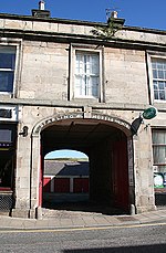
Dieses Foto zeigt das geschützte Denkmal in Schottland mit der Nummer