Liste der Einträge im National Register of Historic Places im Richmond County (New York)
Die Liste der Denkmäler im National Register of Historic Places im Richmond County umfasst alle im New Yorker Stadtbezirk Staten Island und somit im Richmond County in das National Register of Historic Places aufgenommene Bauwerke. Unter den 51 Einträgen sind vier National Historic Landmarks und ein National Historic Landmark District. Unter den übrigen Einträgen befinden sich vier weitere historische Distrikte.
Liste der Denkmäler
| Bezeichnung | Bild | Datum der Eintragung | Lage | Stadtviertel | Beschreibung | |
|---|---|---|---|---|---|---|
| 1 | Elizabeth Alice Austen House |  | 28. Juli 1970 | 2 Hylan Blvd. 40° 36′ 54″ N, 74° 3′ 49″ W | Rosebank | |
| 2 | Battery Weed |  | 20. Jan. 1972 | Fort Wadsworth Reservation 40° 36′ 19″ N, 74° 3′ 17″ W | Fort Wadsworth | |
| 3 | Billou-Stillwell-Perine House |  | 1. Jan. 1976 | 1476 Richmond Rd. 40° 35′ 34″ N, 74° 6′ 3″ W | Dongan Hills | |
| 4 | Brighton Heights Reformed Church | 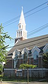 | 3. Juni 1982 | 320 St. Mark 40° 38′ 29″ N, 74° 4′ 43″ W | Brighton Heights | |
| 5 | Calvary Presbyterian Church |  | 21. Nov. 2002 | 909 Castleton Ave. 40° 38′ 6″ N, 74° 6′ 47″ W | West New Brighton | |
| 6 | Christ Church New Brighton (Episcopal) |  | 27. Mai 2004 | 76 Franklin Ave. 40° 38′ 36″ N, 74° 5′ 36″ W | New Brighton | |
| 7 | St. Andrew’s Church |  | 6. Okt. 2000 | Arthur Kill und Old Mill Rd. 40° 34′ 22″ N, 74° 8′ 51″ W | Staten Island | |
| 8 | Conference House | (c) I, Dmadeo, CC-BY-SA-3.0 | 15. Okt. 1966 | Hylan Blvd. 40° 30′ 10″ N, 74° 15′ 14″ W | Tottenville | |
| 9 | Edgewater Village Hall and Tappen Park |  | 19. Mai 1980 | begrenzt von Wright, Water, Bay and Canal St. 40° 37′ 36″ N, 74° 4′ 40″ W | Stapleton | |
| 10 | Dr. Samuel MacKenzie Elliott House |  | 28. März 1980 | 69 Delafield Pl. 40° 38′ 38″ N, 74° 6′ 37″ W | West New Brighton | |
| 11 | Fire Fighter |  | 30. Juni 1989 | Staten Island | Staten Island | |
| 12 | Fort Tompkins Quadrangle |  | 30. Juli 1974 | Building 137, Fort Wadsworth 40° 36′ 0″ N, 74° 3′ 40″ W | Fort Wadsworth | |
| 13 | Gardiner-Tyler House |  | 23. Nov. 1984 | 27 Tyler St. 40° 37′ 24″ N, 74° 6′ 48″ W | West New Brighton | |
| 14 | Garibaldi Memorial |  | 17. Apr. 1980 | 420 Tompkins Ave. 40° 36′ 54″ N, 74° 4′ 27″ W | Rosebank | |
| 15 | Hamilton Park Community Houses |  | 26. Sep. 1983 | 105 Franklin Ave., 66 Harvard Ave. und 32 Park Pl. 40° 38′ 30″ N, 74° 5′ 27″ W | New Brighton | |
| 16 | House at 5910 Amboy Road |  | 16. Dez. 1982 | 5910 Amboy Rd. 40° 31′ 32″ N, 74° 12′ 17″ W | Prince’s Bay | |
| 17 | Peter Houseman House |  | 29. Okt. 1982 | 308 St. John Ave. 40° 36′ 57″ N, 74° 8′ 12″ W | Westerleigh | |
| 18 | Houses at 364 and 390 Van Duzer Street | 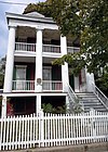 | 14. Nov. 1982 | 364 and 390 Van Duzer St. 40° 37′ 45″ N, 74° 4′ 47″ W | Stapleton | |
| 19 | Jacques Marchais Center of Tibetan Art |  | 29. Mai 2009 | 338 Lighthouse Ave. 40° 34′ 34,8″ N, 74° 8′ 18,5″ W | Staten Island | |
| 20 | Kreischer House |  | 29. Okt. 1982 | 4500 Arthur Kill Rd. 40° 31′ 57″ N, 74° 14′ 18″ W | Charleston | erbaut um 1885 |
| 21 | Kreuzer-Pelton House |  | 29. Jan. 1973 | 1262 Richmond Ter. 40° 38′ 37″ N, 74° 6′ 43″ W | West New Brighton | |
| 22 | LaTourette House |  | 5. März 1982 | Richmond Hill 40° 34′ 34″ N, 74° 8′ 50″ W | New Springville | 1836 errichtetes Backsteingebäude im Federal Style, das nun das Vereinshaus eines im städtischen Besitz stehenden Golfplatzes ist |
| 23 | McFarlane-Bredt House |  | 8. Sep. 1983 | 30 Hylan Blvd. 40° 36′ 51″ N, 74° 3′ 51″ W | Rosebank | |
| 24 | Miller Army Air Field Historic District | 11. Apr. 1980 | New Dorp Lane 40° 33′ 51″ N, 74° 5′ 44″ W | New Dorp Beach | ||
| 25 | Moore-McMillen House |  | 23. Apr. 1980 | 3531 Richmond Rd. 40° 34′ 21″ N, 74° 8′ 21″ W | Egbertville | |
| 26 | Neville House |  | 28. Juli 1977 | 806 Richmond Terrace 40° 38′ 40″ N, 74° 5′ 57″ W | New Brighton | |
| 27 | New Brighton Village Hall | 15. Dez. 1978 | 66 Lafayette Ave. 40° 38′ 35″ N, 74° 5′ 46″ W | New Brighton | ||
| 28 | New Dorp Light |  | 28. Aug. 1973 | Altamont Ave., Staten Island 40° 34′ 50,9″ N, 74° 7′ 12,7″ W | New Dorp | |
| 29 | Office Building and U.S. Light-House Depot Complex |  | 15. Sep. 1983 | 1 Bay St. 40° 38′ 28″ N, 74° 4′ 30″ W | St. George | |
| 30 | Old Orchard Shoal Light Station | 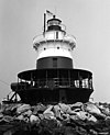 | 20. Sep. 2006 | in der Lower New York Bay, südlich vom New Dorp Beach 40° 30′ 44″ N, 74° 5′ 56″ W | Lower New York Bay | |
| 31 | Our Lady of Mount Carmel Grotto |  | 2. Nov. 2000 | 36 Amity St. 40° 36′ 44″ N, 74° 4′ 31″ W | Rosebank | |
| 32 | Poillon-Seguine-Britton House | 2. Feb. 1984 | 360 Great Kills Rd. 40° 32′ 44″ N, 74° 8′ 25″ W | Great Kills | ||
| 33 | Reformed Church on Staten Island | 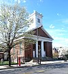 | 20. Jan. 2005 | 54 Port Richmond Ave. 40° 38′ 23″ N, 74° 7′ 58″ W | Port Richmond | |
| 34 | Sailors’ Snug Harbor National Register District |  | 16. März 1972 | Richmond Ter. 40° 38′ 33″ N, 74° 6′ 10″ W | Livingston | |
| 35 | Sandy Ground Historic Archeological District | 23. Sep. 1982 | Adresse Verschlußsache | Staten Island | ||
| 36 | Scott-Edwards House |  | 11. Feb. 1983 | 752 Delafiel Ave. 40° 37′ 43″ N, 74° 7′ 26″ W | West New Brighton | |
| 37 | Seaview Hospital |  | 7. Sep. 2005 | 460 Brielle Ave. 40° 35′ 30″ N, 74° 7′ 58″ W | Willowbrook | |
| 38 | Seguine House |  | 6. Mai 1980 | 440 Seguine Ave. 40° 31′ 0″ N, 74° 11′ 52″ W | am Lemon Creek | |
| 39 | St. Alban’s Episcopal Church |  | 29. Okt. 1982 | 76 St. Alban’s Place 40° 32′ 37″ N, 74° 9′ 40″ W | Eltingville | |
| 40 | St. Paul’s Memorial Church and Rectory |  | 21. Nov. 1980 | 225 St. Pauls Ave. 40° 37′ 55″ N, 74° 4′ 46″ W | Stapleton | |
| 41 | Standard Oil Company No. 16 (harbor tug) | 29. Nov. 2001 | 3001 Richmond Terrace 40° 38′ 18″ N, 74° 9′ 35″ W | Mariners Harbor | ||
| 42 | Staten Island Borough Hall and Richmond County Courthouse |  | 6. Okt. 1983 | Richmond Terr. 40° 38′ 33″ N, 74° 4′ 35″ W | St. George | |
| 43 | Staten Island Light | 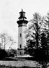 | 30. Nov. 2005 | Südseite der Edinboro Rd., zwischen 402 and 426 Rd. 40° 34′ 33,6″ N, 74° 8′ 28,5″ W | Staten Island | |
| 44 | Louis A. and Laura Stirn House |  | 12. Nov. 2010 | 79 Howard Ave. 40° 37′ 43″ N, 74° 5′ 18″ W | Staten Island | Neuer Eintrag; Ref.-Nummer 10000899 |
| 45 | Temple Emanu-El |  | 2. Aug. 2007 | 984 Post Ave. 40° 37′ 56″ N, 74° 8′ 3″ W | Port Richmond | |
| 46 | Voorlezer’s House |  | 15. Okt. 1966 | Arthur Kill Rd. gegenüber Center St. 40° 34′ 18″ N, 74° 8′ 52″ W | Richmondtown | |
| 47 | Caleb T. Ward Mansion |  | 26. Juli 1982 | 141 Nixon Ave. 40° 38′ 3″ N, 74° 4′ 53″ W | Ward Hill | |
| 48 | Ward’s Point Conservation Area | 29. Sep. 1982 | Adresse Verschlußsache | Tottenville | ||
| 49 | Wards Point Archeological Site |  | 19. Apr. 1993 | Adresse Verschlußsache | Tottenville | |
| 50 | West Bank Light Station |  | 9. Jan. 2007 | Leuchtturm in der New York Bay, östlich des New Dorp Beach 40° 32′ 17″ N, 74° 2′ 35″ W | New Dorp Beach | |
| 51 | Woodrow Methodist Church |  | 29. Okt. 1982 | 1109 Woodrow Rd. 40° 32′ 35″ N, 74° 12′ 6″ W | Woodrow |
Siehe auch
- Bundesstaat: National Register of Historic Places in New York
- Stadtbezirke: Manhattan, Queens, Brooklyn, Bronx
- Liste der New York City Designated Landmarks in Staten Island
Auf dieser Seite verwendete Medien
Autor/Urheber: Jim.henderson, Lizenz: CC0
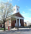
Looking east from St Pauls Avenue at St Paul's Church on a cloudy late morning.
West Bank Light - Front Range for Ambrose Channel
Autor/Urheber: JERRYE & ROY KLOTZ, M.D., Lizenz: CC BY-SA 4.0
1840 GREEK REVIVAL HOUSE; NO OTHER INFORMATION AV AVAILABLE
Autor/Urheber: thomas tiernan from roslyn hts, united States, Lizenz: CC BY 2.0
seaview childrens hospital
Looking northeast at en:Battery Weed and its lighthouse and Brooklyn on a clear, sunny midday. ZIP 10305
Autor/Urheber: Jim.henderson, Lizenz: CC0
Looking north across Port Richmond Avenue at en:Reformed Church on Staten Island on a sunny midday.
Staten Island Rear Range Lighthouse
Autor/Urheber: Jim.henderson, Lizenz: CC0
Looking north at former Edgewater Village Hall and Tappen Park in Stapleton on a cloudy midday.
Autor/Urheber: JERRYE & ROY KLOTZ, M.D., Lizenz: CC BY-SA 4.0
BUILT IN THE 1730s IN DUTCH COLONIAL STYLE AND WAS THE HOME OF JUDGE OGDEN EDWARDS, A DESCENDENT OF JONATHAN EDWARDS AND A COUSIN OF AARON BURR.
Alice Austen House on Staten Island, New York City, New York
Autor/Urheber: JERRYE & ROY KLOTZ, M.D., Lizenz: CC BY-SA 4.0
BUILT IN 1730 AND ADDED TO IN 1760. PETER HOUSEMAN, A MILLWRIGHT, BOUGHT THIS HOUSE FROM THOMAS DONGAN, GREAT-NEPHEW OF THE COLONIAL NEW YORK GOVERNOR OF THE SAME NAME, AND EXPANDED THE STRUCTURE. HOUSEMAN WOULD LATER BE KILLED BY ROBBERS THERE IN 1784, AND HIS SON JOHN, A RICHMOND COUNTY SUPERVISOR AND ASSEMBLYMAN, WOULD TAKE OVER THE ESTATE
Autor/Urheber: Wisnit01, Lizenz: CC BY-SA 3.0
This is a picture (in winter) of my house which is in the Register of Historical Places. You have an entry on this house: http://en.wikipedia.org/wiki/Caleb_T._Ward_Mansion There is no picture; hence I am providing a picture to use.
Autor/Urheber: JERRYE & ROY KLOTZ, M.D., Lizenz: CC BY-SA 4.0
BUILT IN 1818 AS THE RECTORY FOR THE CHURCH OF ST. ANDREW
Autor/Urheber: JERRYE & ROY KLOTZ MD, Lizenz: CC BY-SA 3.0
EPISCOPAL CHURCH DATING FROM 1872 ON THE SITE OF A 1712 COLONIAL STRUCTURE
Autor/Urheber: Dmadeo, Lizenz: CC BY-SA 3.0
Vicinity of Wards Point Archeological site, Tottenville, Staten Island
Autor/Urheber: Jim.henderson, Lizenz: CC0
Looking west from Post Avenue at Temple Emanu-El on a sunny midday. ZIP 10302.
Autor/Urheber: Dmadeo, Lizenz: CC BY-SA 4.0
Voorlezer's House, Staten Island, NY
Autor/Urheber: Dmadeo, Lizenz: CC BY-SA 3.0
St Albans church, Staten Island
Autor/Urheber: Jim.henderson, Lizenz: CC0
Looking southeast at Christ Church Episcopal on a cloudy afternoon. Henry M Congdon, architect.
Autor/Urheber: Dmadeo, Lizenz: CC BY-SA 3.0
Seguine Mansion — on Staten Island, NY.
- Housing the Seguine-Burke Mansion Museum.
(c) I, Dmadeo, CC BY-SA 3.0
Conference House, Staten Island, New York City
Looking southeast at Brighton Heights Reformed Church on a sunny late afternoon.
Autor/Urheber: Jim.henderson, Lizenz: CC0
Looking southeast at Jacques Marchais Museum of Tibetan Art on a rainy midday before opening time.
Autor/Urheber: Daniel Case, Lizenz: CC BY-SA 3.0
LaTourette House, in the Staten Island Greenbelt, Staten Island, NY, USA
Autor/Urheber: Jim.henderson, Lizenz: CC0
Looking northeast at 4500 Arthur Kill Road on a sunny afternoon. Must eventually make a cropped version.
Autor/Urheber: Robert Haber, Lizenz: CC BY-SA 3.0
Gardiner-Tyler House
Autor/Urheber: Rolfmueller, Lizenz: CC BY-SA 3.0
Looking southwest at the front of the Garibaldi-Meucci House, 420 Tompkins Avenue, Staten Island, New York. NYCLPC designation 1965.
Autor/Urheber: Robert Haber, Lizenz: CC BY-SA 3.0
Neville House — on Staten Island, NYC.
Autor/Urheber: JERRYE & ROY KLOTZ, M.D., Lizenz: CC BY-SA 4.0
FORT TOMPKINS QUADRANGLE IS A FORT WITHIN THE CONFINES OF A LARGER FORT WADSWORTH COMPLEX. THE FORT WAS BUILT BETWEEN 1859 AND 1870 AND WAS DESIGNED TO PROTECT BATTERY WEED BELOW AT WATER LEVEL. IT HOUSED ONLY ONE GUN AND WAS MAINLY USED AS A PARADE GROUND AND SOLDIERS’ QUARTERS.
kreuzer-pelton house
Looking southwest and up at Staten Island Boro Hall from the street, in en:Saint George, Staten Island#The Heyday on a cloudy early afternoon, late June 2008.
Looking north from Woodrow Road at Woodrow United Methodist Church in en:Woodrow, Staten Island on a cloudy afternoon.
Autor/Urheber: Dmadeo, Lizenz: CC BY-SA 4.0
Looking west along the fronts of the five northern buildings of Sailors Snug Harbor, Staten Island, NY.
Autor/Urheber: Robert Haber, Lizenz: CC BY-SA 3.0
Houses at 364 and 390 Van Duzer Street
This is a locator map showing Richmond County in New York. For more information, see Commons:United States county locator maps.
Autor/Urheber: JERRYE & ROY KLOTZ, M.D., Lizenz: CC BY-SA 4.0
AKA CASA BELVEDERE; BUILT IN 1908 IN ITALIAN RENAISSNCE STYLE. IN 2008 IT WAS PURCHASED BY GINA BIANCARDI AND LUCIANO RAMMAIRONI WHO TURNED IT INTO A CULTURAL CENTER FOR ITALIAN WORKS
Lighthouse at Old Orchard Shoal
Autor/Urheber: Peter Greenberg, Lizenz: CC BY-SA 3.0
Office building of the U.S. Light-House Depot Complex in St. George, Staten Island, New York City. Built 1869. Architect was Alfred B. Mullett, who designed many other Federal buildings nationwide. On National Register of Historic Places (Office Building and U.S. Light-House Depot Complex, NRHP Reference # 83001785, Sept. 15, 1983). Also designated New York City Landmark (Old Administration Building (Third District U.S. Lighthouse Depot) U.S. Coast Guard Station, LP-1112, Nov. 25, 1980).
New Dorp Lighthouse on Staten Island


