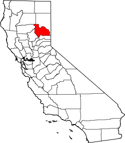
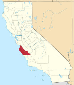
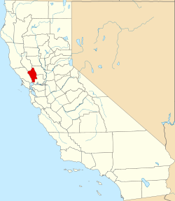
Liste der Countys in Kalifornien
Der US-Bundesstaat Kalifornien ist heute in 58 Countys aufgeteilt. Diese sind für alle Wahlen, Vermögenssteuern, öffentliche Beurkundungen und die lokale Rechtsprechung zuständig. Zudem setzt es den Sheriff als Polizeiorgan ein, der außerhalb der selbständigen Städte für die Durchsetzung des Gesetzes zuständig ist. In San Francisco sind Stadt- und Countyverwaltung zusammengelegt. Der Countysheriff ist vorwiegend noch für die Verwaltung des Gefängnisses zuständig.
Kaliforniens Kurzzeichen ist CA und der FIPS-Code ist 06.
Einrichtung der ersten Countys von Kalifornien
Am 4. Januar 1850 schlug die Verfassungskommission von Kalifornien die Schaffung von 18 Countys vor. Diese ersten Countys waren Benicia, Butte, Fremont, Los Angeles, Mariposa, Monterey, Mount Diablo, Oro, Redding, Sacramento, San Diego, San Francisco, San Joaquin, San Jose, San Luis Obispo, Santa Barbara, Sonoma und Sutter. Am 22. April kamen Branciforte, Calaveras, Coloma, Colusi, Marin, Mendocino, Napa, Trinity und Yuba hinzu, und Benicia wurde umbenannt in Solano, Coloma in El Dorado, Fremont in Yolo, Mt. Diablo in Contra Costa, San Jose in Santa Clara, Oro in Tuolumne und Redding in Shasta. Zu den Aktionen der ersten Legislative Kaliforniens gehörte dann die weitere Umbenennung von Branciforte County in Santa Cruz, Colusi in Colusa und Yola in Yolo.
Das jüngste County Kaliforniens ist das Imperial County, das 1907 eingerichtet wurde.
Tabelle
| County | FIPS Code [1] | County Seat [2] | Gegründet [2] | Ursprung | Namensherkunft | Bevölkerung [3] | Fläche [2] | Karte |
|---|---|---|---|---|---|---|---|---|
| Alameda County | 001 | Oakland | 1853 | Teile von Contra Costa County und Santa Clara County. | Ein spanisches Wort für eine Kerbe in einer Pappelart | 1.474.368 | 1.911 km² (738 sq mi) |  |
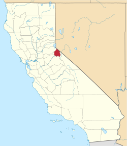
| Alpine County | 003 | Markleeville | 1864 | Amador County, El Dorado County, Calaveras County, Mono County, Tuolumne County. | Alpen | 1.061 | 1.914 km² (739 sq mi) |  |
| Amador County | 005 | Jackson | 1854 | Calaveras County. | Jose Maria Amador (1794–1883), Soldat, Rancher und Bergmann. Das Wort bedeutet Liebender auf Spanisch | 38.238 | 1.536 km² (593 sq mi) | 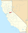 |
| Butte County | 007 | Oroville | 1850 | Eines der 27 ursprünglich errichteten Countys. | Gebirgszug Sutter Buttes, von dem irrtümlich angenommen wurde, er liege innerhalb dieses Countys | 220.337 | 4.248 km² (1.640 sq mi) |  |
| Calaveras County | 009 | San Andreas | 1850 | Eines der 27 ursprünglich errichteten Countys. | Calaveras River, dessen Name auf Spanisch Schädel bedeutet | 46.843 | 2.642 km² (1.020 sq mi) |  |
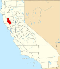
| Colusa County | 011 | Colusa | 1850 | Eines der 27 ursprünglich errichteten Countys. | Aus zwei Landgaben Mexikos; Coluses (1844) und Colus (1845). | 21.204 | 2.981 km² (1.151 sq mi) |  |
| Contra Costa County | 013 | Martinez | 1850 | Eines der 27 ursprünglich errichteten Countys. | Spanisch für gegenüberliegende Küste, weil Contra Costa dem San Francisco County gegenüberliegt | 1.029.703 | 1.865 km² (720 sq mi) |  |
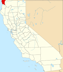
| Del Norte County | 015 | Crescent City | 1857 | Klamath County. | Spanisch für nördlich, weil es das nördlichste County ist | 29.100 | 2.611 km² (1.008 sq mi) | 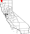 |
| El Dorado County | 017 | Placerville | 1850 | Eines der 27 ursprünglich errichteten Countys. | vom mythischen Eldorado, da das Gebiet eine wesentliche Rolle im Goldrausch in Kalifornien einnahm. | 176.075 | 4.434 km² (1.712 sq mi) |  |
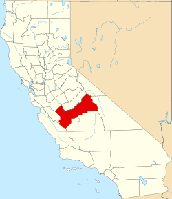
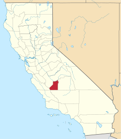
| Fresno County | 019 | Fresno | 1856 | Mariposa County, Merced County und Tulare County. | Fresno Creek, Fresno bedeutet Esche auf Spanisch | 909.153 | 15.444 km² (5.963 sq mi) |  |
| Glenn County | 021 | Willows | 1891 | Colusa County. | Hugh J. Glenn (1824–1883), Kalifornischer Geschäftsmann und Politiker | 28.237 | 3.406 km² (1.315 sq mi) | 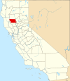 |
| Humboldt County | 023 | Eureka | 1853 | Trinity County. | Humboldt Bay, nach Baron Alexander von Humboldt (1769–1859), Naturalist und Entdecker. | 129.000 | 9.254 km² (3.573 sq mi) |  |
| Imperial County | 025 | El Centro | 1907 | San Diego County | Nach dem Imperial Valley, das seinen Namen von der Imperial Land Company hat | 163.972 | 10.813 km² (4.175 sq mi) |  |
| Inyo County | 027 | Independence | 1866 | Mono County und Tulare County. | Von einem indianischen Wort für wo der große Geist wohnt | 17.136 | 26.397 km² (10.192 sq mi) | 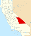 |
| Kern County | 029 | Bakersfield | 1866 | Los Angeles County und Tulare County. | Kern River, nach Edward Kern, Kartograf während der Expedition von General John C. Frémont 1845 | 800.458 | 21.088 km² (8.142 sq mi) | 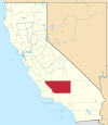 |
| Kings County | 031 | Hanford | 1893 | Tulare County. | Kings River. | 149.518 | 3.600 km² (1.390 sq mi) |  |
| Lake County | 033 | Lakeport | 1861 | Napa County. | Clear Lake (Kalifornien). | 64.866 | 3.258 km² (1.258 sq mi) | 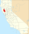 |
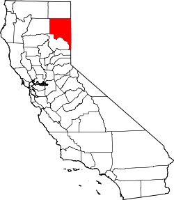
| Lassen County | 035 | Susanville | 1864 | Plumas County und Shasta County und des heute nicht mehr existierenden Lake County in Nevada | Peter Lassen (1800–1859), dänischer Entdecker | 34.574 | 11.805 km² (4.558 sq mi) | 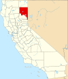 |
| Los Angeles County | 037 | Los Angeles | 1850 | Eines der 27 ursprünglich errichteten Countys. | Spanisch für die Engel; die Spanischen Galleonen dachten, sie würden den Himmel erreichen, wenn sie im Morgennebel die Küste erreichten | 9.862.049 | 10.515 km² (4.060 sq mi) | 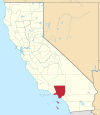 |
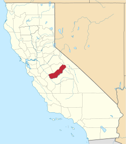
| Madera County | 039 | Madera | 1893 | Fresno County. | Spanisch für Holz oder Balken | 148.333 | 5.537 km² (2.138 sq mi) |  |
| Marin County | 041 | San Rafael | 1850 | Eines der 27 ursprünglich errichteten Countys. | Umstritten (siehe Artikel), vielleicht eine Verstümmelung von Marina, da es an der Bucht von San Francisco liegt. | 248.794 | 1.347 km² (520 sq mi) |  |
| Mariposa County | 043 | Mariposa | 1850 | Eines der 27 ursprünglich errichteten Countys.[4] | Spanisch für Schmetterling | 17.976 | 3.758 km² (1.451 sq mi) |  |
| Mendocino County | 045 | Ukiah | 1850 | Eines der 27 ursprünglich errichteten Countys. | Cape Mendocino, vielleicht nach Antonio von Mendoza oder Lorenzo Suárez von Mendoza, Vizekönige von Neu-Spanien | 86.221 | 9.088 km² (3.509 sq mi) | 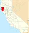 |
| Merced County | 047 | Merced | 1855 | Mariposa County. | Merced River, von Spanisch El Río de Nuestra Señora de la Merced, benannt bei einer Expedition von Gabriel Moraga. | 246.117 | 4.996 km² (1.929 sq mi) |  |
| Modoc County | 049 | Alturas | 1874 | Siskiyou County. | Modoc-Indianer. | 9.184 | 10.215 km² (3.944 sq mi) |  |
| Mono County | 051 | Bridgeport | 1861 | Calaveras County, Fresno County und Mariposa County. | Mono Paiute, ein Indianerstamm | 12.774 | 7.884 km² (3.044 sq mi) |  |
| Monterey County | 053 | Salinas | 1850 | Eines der 27 ursprünglich errichteten Countys. | Monterey Bay. Aus den Spanischen Wörtern für monte (Hügel) und rey (König) | 408.238 | 8.604 km² (3.322 sq mi) |  |
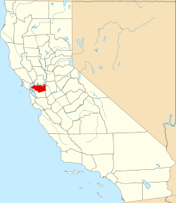
| Napa County | 055 | Napa | 1850 | Eines der 27 ursprünglich errichteten Countys. | Die Napans waren ein Indianerstamm | 133.433 | 1.953 km² (754 sq mi) | 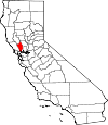 |
| Nevada County | 057 | Nevada City | 1851 | Yuba County. | Schneefall auf Spanisch | 97.118 | 2.481 km² (958 sq mi) |  |
| Orange County | 059 | Santa Ana | 1889 | Los Angeles County. | Von der Zitrusfrucht, die zur Zeit der Gründung hier weiträumig angepflanzt war. | 3.010.759 | 2.046 km² (790 sq mi) |  |
| Placer County | 061 | Auburn | 1851 | Sutter County und Yuba County. | Kleine Goldflocken, die hier während des Goldrauschs gefunden wurden. | 341.945 | 3.893 km² (1.503 sq mi) |  |
| Plumas County | 063 | Quincy | 1854 | Butte County. | Plumas heißt Federn auf Spanisch. | 20.275 | 6.615 km² (2.554 sq mi) |  |
| Riverside County | 065 | Riverside | 1893 | San Bernardino County und San Diego County. | Die Stadt Riverside | 2.100.516 | 18.669 km² (7.208 sq mi) | 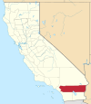 |
| Sacramento County | 067 | Sacramento | 1850 | Eines der 27 ursprünglich errichteten Countys. | Sacramento River, nach dem spanischen Ausdruck für das Heiligste Sakrament (die Eucharistie) | 1.394.154 | 2.502 km² (966 sq mi) |  |
| San Benito County | 069 | Hollister | 1874 | Monterey County. | Benedikt von Nursia, Benito ist eine Verkleinerungsform von Benedikt | 54.699 | 3.597 km² (1.389 sq mi) |  |
| San Bernardino County | 071 | San Bernardino | 1853 | Los Angeles County. | Bernhardin von Siena. San Bernardino ist das größte County der USA | 2.015.355 | 51.960 km² (20.062 sq mi) |  |
| San Diego County | 073 | San Diego | 1850 | Eines der 27 ursprünglich errichteten Countys. | San Diego Bay, nach San Diego de Alcalá | 3.001.072 | 10.888 km² (4.204 sq mi) |  |
| San Francisco County | 075 | San Francisco | 1850 | Eines der 27 ursprünglich errichteten Countys. | Franz von Assisi, Ordensgründer der Franziskaner | 808.976 | 122 km² (47 sq mi) |  |
| San Joaquin County | 077 | Stockton | 1850 | Eines der 27 ursprünglich errichteten Countys. | Heiliger Joachim, Vater Marias | 672.388 | 3.623 km² (1.399 sq mi) |  |
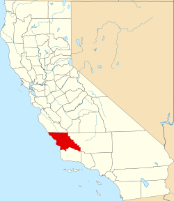
| San Luis Obispo County | 079 | San Luis Obispo | 1850 | Eines der 27 ursprünglich errichteten Countys. | Spanischer Name von Bischof Ludwig von Toulouse | 265.297 | 8.557 km² (3.304 sq mi) |  |
| San Mateo County | 081 | Redwood City | 1856 | San Francisco County. | Spanischer Name des Evangelisten Matthäus | 712.690 | 1.163 km² (449 sq mi) |  |
| Santa Barbara County | 083 | Santa Barbara | 1850 | Eines der 27 ursprünglich errichteten Countys. | Barbara von Nikomedien | 405.396 | 7.091 km² (2.738 sq mi) | 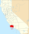 |
| Santa Clara County | 085 | San Jose | 1850 | Eines der 27 ursprünglich errichteten Countys. | Klara von Assisi und die Missionsstation in Santa Clara | 1.764.499 | 3.344 km² (1.291 sq mi) | 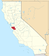 |
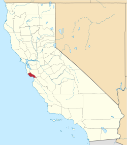
| Santa Cruz County | 087 | Santa Cruz | 1850 | Eines der 27 ursprünglich errichteten Countys. | Die Stadt Santa Cruz | 253.137 | 1.155 km² (446 sq mi) |  |
| Shasta County | 089 | Redding | 1850 | Eines der 27 ursprünglich errichteten Countys. | Nach Mount Shasta, obwohl sich dieser eigentlich nicht darin befindet | 180.214 | 9.806 km² (3.786 sq mi) |  |
| Sierra County | 091 | Downieville | 1852 | Yuba County. | Spanisch für Gebirgszug | 3.263 | 2.468 km² (953 sq mi) | 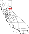 |
| Siskiyou County | 093 | Yreka | 1852 | Shasta County und Klamath County. | Siskiyou Mountain Range; Die Etymologie von Siskiyou ist umstritten | 44.542 | 16.283 km² (6.287 sq mi) |  |
| Solano County | 095 | Fairfield | 1850 | Eines der 27 ursprünglich errichteten Countys. | Die Solanos waren ein Indianerstamm | 407.515 | 2.145 km² (828 sq mi) | 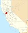 |
| Sonoma County | 097 | Santa Rosa | 1850 | Eines der 27 ursprünglich errichteten Countys. | Nach dem Ort Sonoma | 466.741 | 4.082 km² (1.576 sq mi) |  |
| Stanislaus County | 099 | Modesto | 1854 | Tuolumne County. | Benannt nach Häuptling Stanislaus, der in den 1820ern gegen die Mexikaner kämpfte | 510.694 | 3.872 km² (1.495 sq mi) | 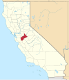 |
| Sutter County | 101 | Yuba City | 1850 | Eines der 27 ursprünglich errichteten Countys. | Johann August Sutter (1803–1880), Schweizer Pionier, seine Ranch hieß ursprünglich Nueva Helvetica, latinisierte Form für die Schweiz | 92.207 | 1.562 km² (603 sq mi) |  |
| Tehama County | 103 | Red Bluff | 1856 | Butte County, Colusa County und Shasta County. | Arabismus im Spanischen, Bedeutung: Heiße Tiefländer | 61.550 | 7.643 km² (2.951 sq mi) |  |
| Trinity County | 105 | Weaverville | 1850 | Klamath County, eines der 27 ursprünglich errichteten Countys. | Trinity River, von Pierson B. Reading so benannt, da er glaubte, dieser würde ins Trinidad Bay fließen. | 14.317 | 8.234 km² (3.179 sq mi) |  |
| Tulare County | 107 | Visalia | 1852 | Mariposa County. | Tulare Lake, ein ausgetrockneter See | 426.276 | 12.494 km² (4.824 sq mi) |  |
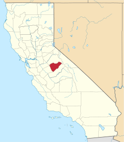
| Tuolumne County | 109 | Sonora | 1850 | Eines der 27 ursprünglich errichteten Countys. | Tuolomnes-Indianer | 55.644 | 5.791 km² (2.236 sq mi) |  |
| Ventura County | 111 | Ventura | 1872 | Santa Barbara County. | Abkürzung von San Buenaventura, dem spanischen Namen von Bonaventura | 797.740 | 4.781 km² (1.846 sq mi) | 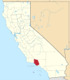 |
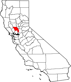
| Yolo County | 113 | Woodland | 1850 | Eines der 27 ursprünglich errichteten Countys. | Yolans-Indianer | 197.658 | 2.621 km² (1.012 sq mi) | 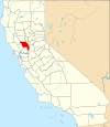 |
| Yuba County | 115 | Marysville | 1850 | Eines der 27 ursprünglich errichteten Countys. | Die Yuba-Familie besaß Ländereien im Sacramento River Valley. | 73.067 | 1.632 km² (630 sq mi) |  |
Ehemalige Countys
- Klamath County wurde 1851 aus einem Teil von Trinity County ausgegliedert, 1874 wurde es in Humboldt County und Siskiyou County aufgeteilt, nachdem bereits 1857 Teile in Del Norte aufgegangen waren.
- Pautah County wurde 1852 aus einem Territorium erstellt, das eigentlich zu Nevada gehörte, da der Staat Kalifornien davon ausging, der Kongress würde das Land entsprechend umgliedern, was aber nicht geschah. Offiziell wurde das County, das nie existierte, 1859 wieder abgeschafft.
Weblinks
Einzelnachweise
- ↑ EPA County FIPS Code Listing. In: EPA.gov. Abgerufen am 23. Februar 2008.
- ↑ a b c National Association of Counties: NACo – Find a county. Archiviert vom Original am 23. September 2012. Info: Der Archivlink wurde automatisch eingesetzt und noch nicht geprüft. Bitte prüfe Original- und Archivlink gemäß Anleitung und entferne dann diesen Hinweis. Abgerufen am 30. April 2008.
- ↑ US Census Bureau: County Population Estimates. Archiviert vom Original am 22. März 2009. Info: Der Archivlink wurde automatisch eingesetzt und noch nicht geprüft. Bitte prüfe Original- und Archivlink gemäß Anleitung und entferne dann diesen Hinweis. Abgerufen am 30. März 2009.
- ↑ Mariposa war ursprünglich das größte County, seine Fläche wurde inzwischen jedoch auf zwölf andere verteilt: Fresno, Inyo, Kern, Kings, Los Angeles, Madera, Merced, Mono, San Benito, San Bernardino, San Luis Obispo und Tulare.
Auf dieser Seite verwendete Medien
This is a locator map showing Colusa County in California. For more information, see Commons:United States county locator maps.
This is a locator map showing Trinity County in California. For more information, see Commons:United States county locator maps.
This is a locator map showing Amador County in California. For more information, see Commons:United States county locator maps.
A locator map showing Orange County — in Southern California.
Locator map showing Sierra County (red) — Northern California.
- Located in the northern Sierra Nevada mountain range.
- The northern reach of the 19th-century California Gold Rush prospecting and mining activity in the Sierra's gold fields.
Locator map showing San Bernardino County in Southern California.
This is a locator map showing Santa Cruz County in California. For more information, see Commons:United States county locator maps.
This is a locator map showing Santa Clara County in California. For more information, see Commons:United States county locator maps.
This is a locator map showing Placer County in California. For more information, see Commons:United States county locator maps.
This is a locator map showing Alameda County in California. For more information, see Commons:United States county locator maps.
This is a locator map showing Stanislaus County in California. For more information, see Commons:United States county locator maps.
This is a locator map showing San Diego County in California. For more information, see Commons:United States county locator maps.
This is a locator map showing Calaveras County in California. For more information, see Commons:United States county locator maps.
This is a locator map showing Fresno County in California. For more information, see Commons:United States county locator maps.
This is a locator map showing Contra Costa County in California. For more information, see Commons:United States county locator maps.
This is a locator map showing San Luis Obispo County in California. For more information, see Commons:United States county locator maps.
This is a locator map showing Madera County in California. For more information, see Commons:United States county locator maps.
Locator Map of California, United States
This is a locator map showing Tuolumne County in California. For more information, see Commons:United States county locator maps.
This is a locator map showing Lake County in California. For more information, see Commons:United States county locator maps.
This is a locator map showing Del Norte County in California. For more information, see Commons:United States county locator maps.
This is a locator map showing Siskiyou County in California. For more information, see Commons:United States county locator maps.
A locator map showing Los Angeles County — in Southern California.
Locator map showing Kern County — in central and southern California.
This is a locator map showing Inyo County in California. For more information, see Commons:United States county locator maps.
This is a locator map showing Yuba County in California. For more information, see Commons:United States county locator maps.
This is a locator map showing San Joaquin County in California. For more information, see Commons:United States county locator maps.
This is a locator map showing Merced County in California. For more information, see Commons:United States county locator maps.
This is a locator map showing Alpine County in California. For more information, see Commons:United States county locator maps.
County locator map showing Kings County — in central California.
This is a locator map showing Lassen County in California. For more information, see Commons:United States county locator maps.
This is a locator map showing San Francisco County in California. For more information, see Commons:United States county locator maps.
This is a locator map showing Humboldt County in California. For more information, see Commons:United States county locator maps.
This is a locator map showing Butte County in California. For more information, see Commons:United States county locator maps.
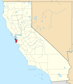
This is a locator map showing San Mateo County in California. For more information, see Commons:United States county locator maps.
This is a locator map showing Sonoma County in California. For more information, see Commons:United States county locator maps.
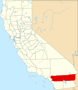
This is a locator map showing Riverside County in California. For more information, see Commons:United States county locator maps.
This is a locator map showing Shasta County in California. For more information, see Commons:United States county locator maps.
This is a locator map showing Glenn County in California. For more information, see Commons:United States county locator maps.
This is a locator map showing Nevada County in California. For more information, see Commons:United States county locator maps.
This is a locator map showing Tulare County in California. For more information, see Commons:United States county locator maps.
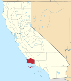
This is a locator map showing Santa Barbara County in Southern California.
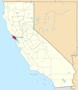
This is a locator map showing Marin County in California. For more information, see Commons:United States county locator maps.
This is a locator map showing Plumas County in California. For more information, see Commons:United States county locator maps.
This is a locator map showing Sutter County in California. For more information, see Commons:United States county locator maps.
This is a locator map showing San Benito County in California. For more information, see Commons:United States county locator maps.
This is a locator map showing El Dorado County in California. For more information, see Commons:United States county locator maps.
This is a locator map showing Napa County in California. For more information, see Commons:United States county locator maps.


